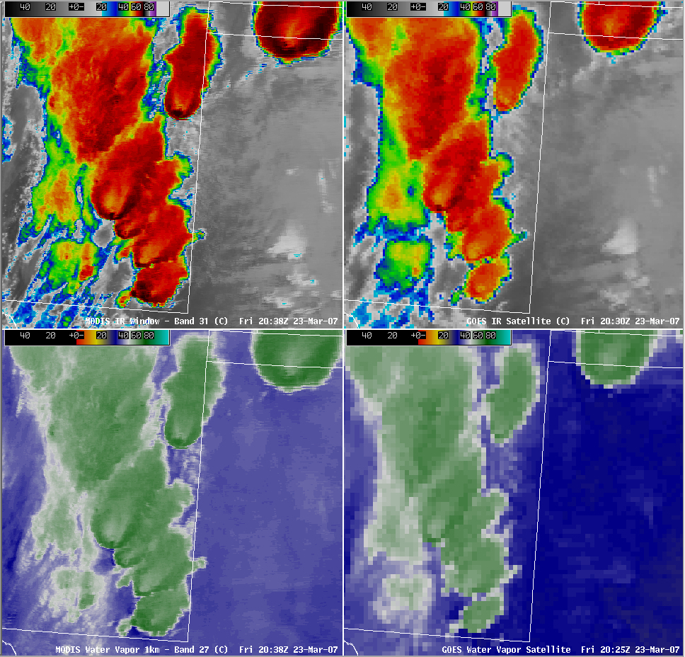
Multiple “enhanced-v” signatures in New Mexico and Texas/Oklahoma
Widespread severe convection developed during the day on 23 March 2007 over parts of New Mexico, Texas, Oklahoma, Kansas, and Colorado. AWIPS imagery of the MODIS and GOES InfraRed (IR) and water vapor channels (above) indicates that six of these storms located over eastern New Mexico and the Texas/Oklahoma panhandle region exhibited “enhanced-v” signatures around 20:30-20:38 UTC (the enhanced-v signatures were better defined on the 1-km resolution MODIS images, compared to the 4-km resolution GOES images). This particular satellite signature is an indicator that thunderstorms are producing (or are about to produce) hail, tornadoes, or damaging winds. According to the SPC storm reports, the storms were indeed producing hail up to 1.75 inches in diameter in New Mexico around the time of the images above; hail up to 2 inches in diameter and several tornadoes were then reported within 1-4 hours of the image time.
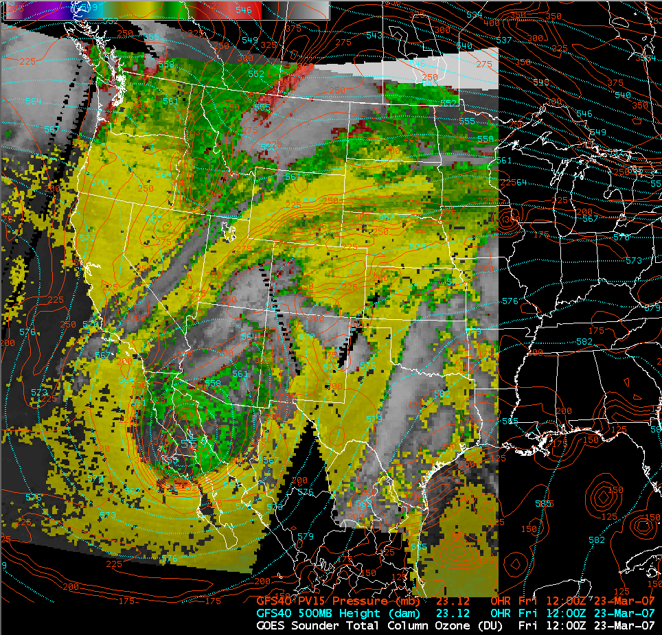
A vigorous upper-level cutoff low was located over the Baja California region at 12 UTC that day. AWIPS imagery of the GOES sounder total column ozone product (below) depicted elevated ozone levels (green enhancement) within a broad tropopause anomaly in the vicinity of the upper low — the height of the 1.5 Potential Vorticity Unit (PVU) surface (which defines the dynamical tropopause) was as low 475 hPa . Dynamic forcing associated with this low began to increase over the southwestern US as the cutoff low moved northeastward during the day.


