Valley Fog in the Ohio River Valley
The long nights of November allow ample cooling in clear airmasses, and fog is a frequent occurrence over rivers that are still relatively warm compared to the surrounding land. In these near-water locations, cooling to the dewpoint, and resultant saturation, allows fog to form in and along River valleys as shown in the above visible image from GOES-12. The Ohio River and its many tributaries in Pennsylvania, West Virginia and Kentucky are plainly visible.
Detection of fog at night occurs by comparing observed brightness temperatures at about 11 microns and about 3.9 microns. Small water droplets in fog are not effective emitters of radiation at 3.7 or 3.9 microns — that is, they do not emit like blackbodies — but the water droplets are effective emitters of radiation at 11 microns. Thus, the temperature inferred by the satellite (that assumes all bodies are emitting like blackbodies) is cooler for the 3.9-channel than for the 11-micron channel. A difference between the two temperatures, then, can be used to highlight fog.
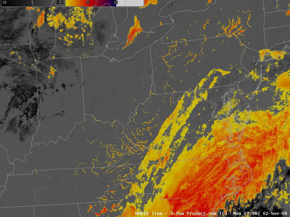
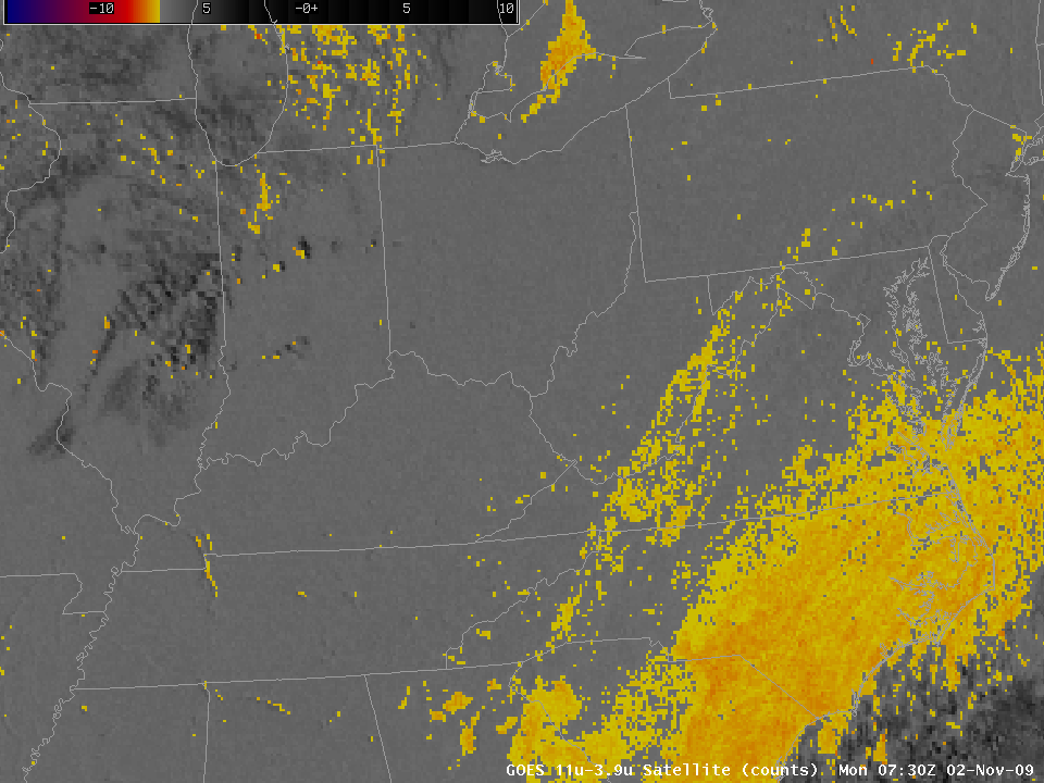
The MODIS Fog product image, above, from AWIPS, shows the channel difference at 0736 UTC on 2 November, and it suggests ongoing fog in river valleys from New York State southwestward to Kentucky. The nearly simultaneous GOES image (from 0730 UTC) is below. The degraded resolution of the GOES infrared sensor over the Ohio Valley (about 5-km pixels, vs. 1-km pixels for MODIS) means that developing fog, by its nature at very small horizontal scales, is not initially detected. The finer-resolution detector on the MODIS instrument provides earlier warning of developing fog.
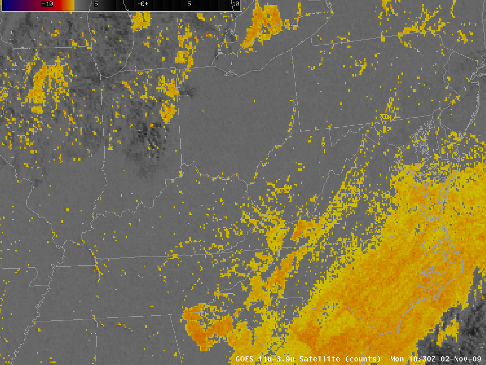
Fog in the river valleys is more obvious in the GOES Fog Product image from 1030 UTC, three hours later. However, the pixel footprint of GOES IR sensor means a less defined horizontal mapping of the true fog locations. The higher resolution MODIS instrument gives earlier detection and better horizontal delineation of fog events.


