Rapidly intensifying storm in the North Pacific Ocean
![GOES-17 Mid-level (6.9 µm) and Air Mass RGB images [click to play animation | MP4]](https://cimss.ssec.wisc.edu/satellite-blog/images/2020/03/ak_wv-20200304_150032.png)
GOES-17 Mid-level Water Vapor (6.9 µm) and Air Mass RGB images [click to play animation | MP4]
![GOES-17 Mid-level (6.9 µm) and Air Mass RGB images, with NAM40 PV1.5 pressure [click to enlarge]](https://cimss.ssec.wisc.edu/satellite-blog/images/2020/03/200304_1200utc_goes17_waterVapor_airMassRGB_modelPV1.5_Gulf_of_Alaska_anim.gif)
GOES-17 Mid-level Water Vapor (6.9 µm) and Air Mass RGB images, with NAM40 PV1.5 pressure [click to enlarge]
![GOES-17 "Red" Visible (0.64 µm) images [click to play animation | MP4]](https://cimss.ssec.wisc.edu/satellite-blog/images/2020/03/ak_vis-20200304_210059.png)
GOES-17 “Red” Visible (0.64 µm) images [click to play animation | MP4]
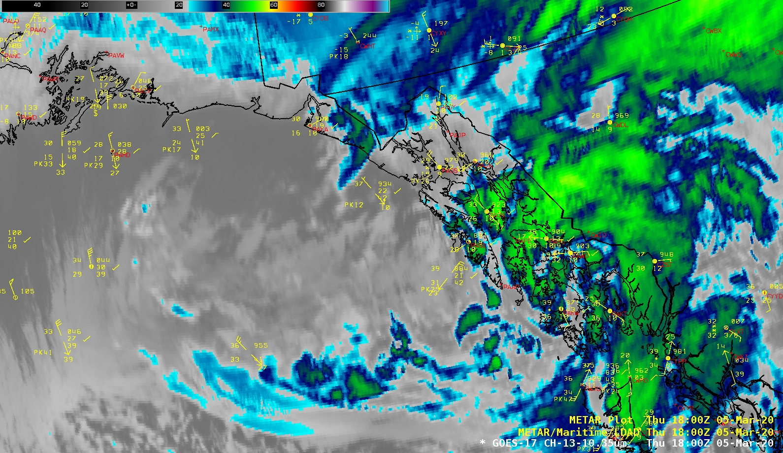
===== 05 March Update =====

GOES-17 “Clean” Infrared Window (10.35 µm) mages [click to play animation | MP4]
Strong arctic outflow event ongoing across the N Panhandle. Gale and storm force winds + freezing spray in many of the northern marine areas. Blizzard warning for Klondike Highway, and High wind warning for downtown Juneau and Douglas. #akwx pic.twitter.com/rEPlhPeKBc
— NWS Juneau (@NWSJuneau) March 5, 2020
GOES-17 True Color Red-Green-Blue (RGB) images created using Geo2Grid (below) revealed several plumes of airborne glacial silt drifting over the Gulf of Alaska, lofted by a strong offshore gap winds. A ship near Prince William Sound reported blowing dust at 18 UTC. Also seen in the images was the northwestward drift of ice into Cook Inlet and Turnagain Arm as high tide approached.
![GOES-17 True Color RGB images [click to play animation | MP4]](https://cimss.ssec.wisc.edu/satellite-blog/images/2020/03/GOES-17_ABI_RadF_true_color_2020065_185032Z.png)
GOES-17 True Color RGB images [click to play animation | MP4]

