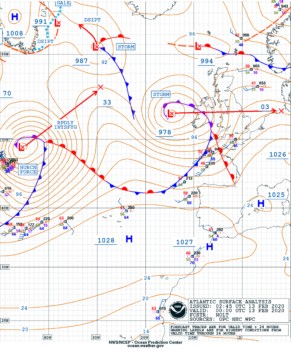
Hurricane Force lows in the North Atlantic Ocean
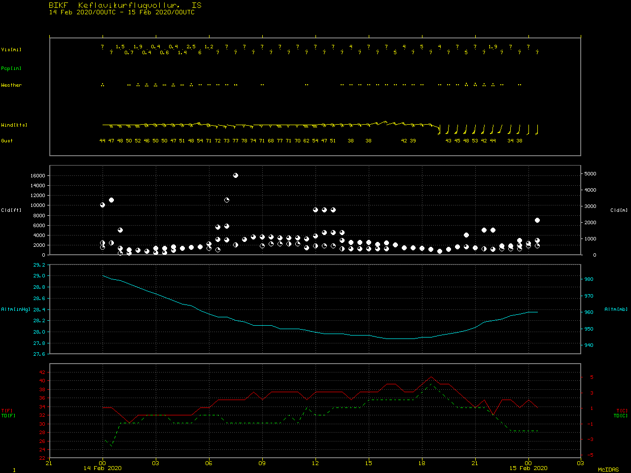
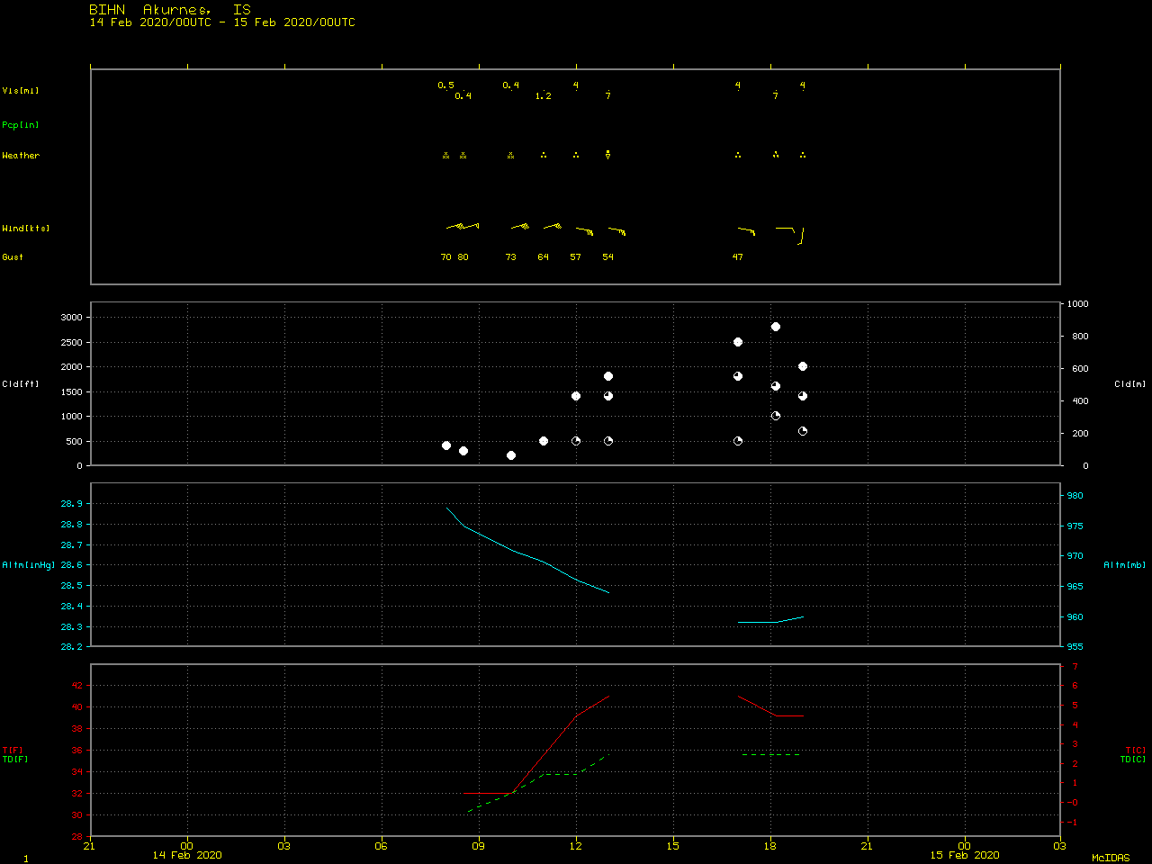
![GOES-16 Mid-level Water Vapor (6.9 µm) images, with plots of hourly surface wind barbs and gusts (in knots) [click to play animation | MP4]](https://cimss.ssec.wisc.edu/satellite-blog/images/2020/02/200213_200215_goes16_waterVapor_surfaceWinds_North_Atlantic_anim.gif)
GOES-16 Mid-level Water Vapor (6.9 µm) images, with plots of hourly surface wind barbs and gusts (in knots) [click to play animation | MP4]
Sequences of VIIRS Infrared Window (11.45 µm) and True Color RGB images from NOAA-20 and Suomi NPP during those same days as viewed using RealEarth are shown below.
![Sequences of VIIRS Infrared Window (11.45 µm) images from NOAA-20 and Suomi NPP [click to play animation]](https://cimss.ssec.wisc.edu/satellite-blog/images/2020/02/200214_200216_noaa20_suomiNPP_viirs_infrared_North_Atlantic_anim.gif)
Sequence of VIIRS Infrared Window (11.45 µm) images from NOAA-20 and Suomi NPP [click to play animation]
![Sequence of VIIRS True Color RGB images from NOAA-20 and Suomi NPP [click to play animation]](https://cimss.ssec.wisc.edu/satellite-blog/images/2020/02/200214_200216_noaa20_suomiNPP_viirs_trueColorRGB_North_Atlantic_anim.gif)
Sequence of VIIRS True Color RGB images from NOAA-20 and Suomi NPP [click to play animation]
![Meteosat-11 Water Vapor (6.25 µm) images, with hourly wind barbs and gusts (in knots) [click to play animation | MP4]](https://cimss.ssec.wisc.edu/satellite-blog/images/2020/02/200214_200216_meteosat11_waterVapor_surfaceWinds_Storm_Dennis_anim.gif)
Meteosat-11 Water Vapor (6.25 µm) images, with hourly wind barbs and gusts (in knots) [click to play animation | MP4]