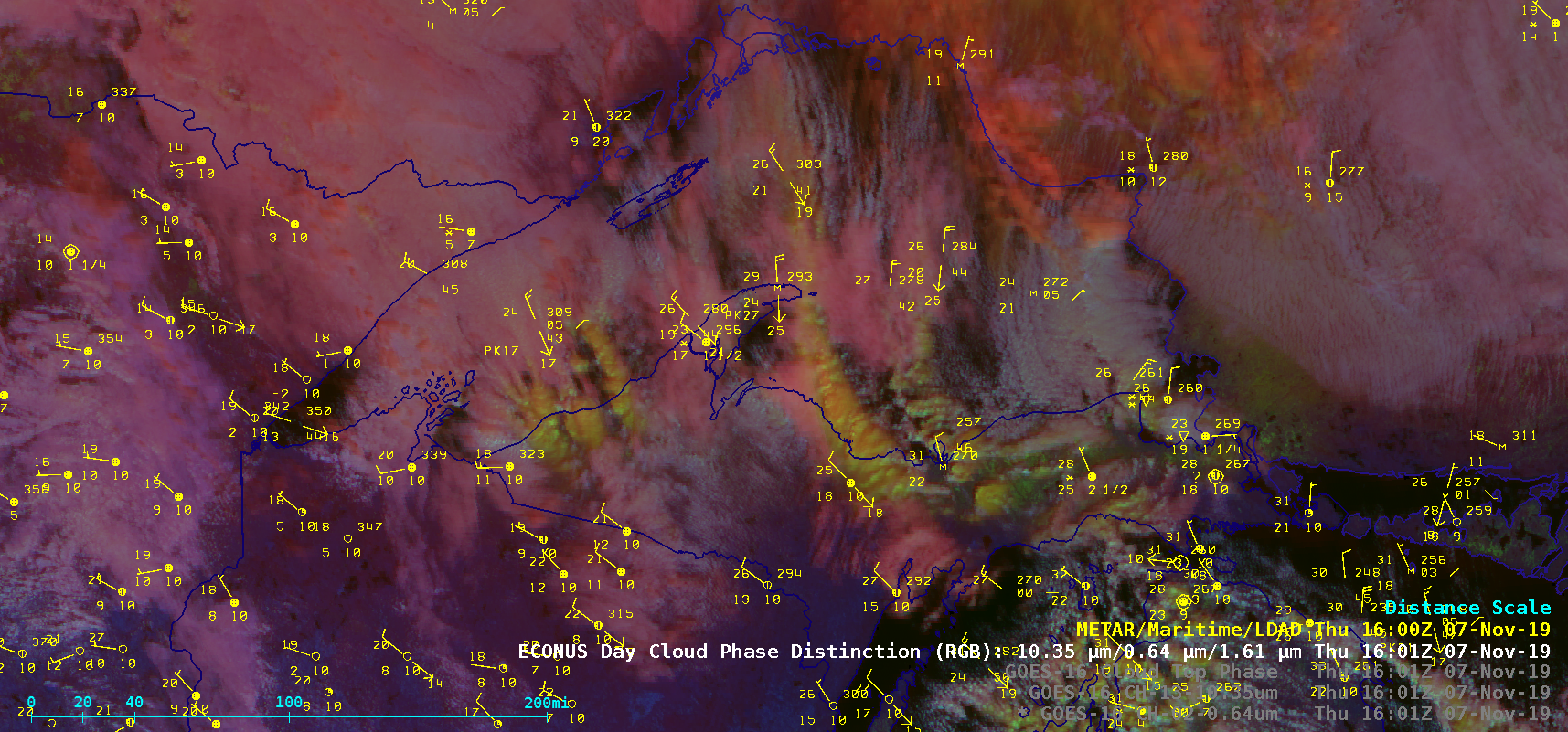
Lake-effect, river-effect and bay-effect cloud bands producing snowfall

GOES-16 “Red” Visible (0.64 µm), “Clean” Infrared Window (10.35 µm) and Day Cloud Phase Distinction RGB images on 07 November [click to play animation | MP4]
On 11 November, GOES-16 Nighttime Microphysics RGB images (below) displayed lake-effect clouds originating from the still-unfrozen waters of Fort Peck Lake in northeastern Montana — these clouds did produce a brief period of light snowfall downstream at Glendive (KGDV). On this particular morning, the lowest temperature in the US occurred in north-central Montana, with -30ºF reported north of Rudyard.
![GOES-16 Nighttime Cloud Phase Distinction RGB images on 11 November [click to play animation | MP4]](https://cimss.ssec.wisc.edu/satellite-blog/wp-content/uploads/sites/5/2019/11/mt_ntmp-20191111_120122.png)
GOES-16 Nighttime Microphysics RGB images on 11 November [click to play animation | MP4]
![GOES-16 Nighttime Microphysics RGB and "Red" Visible (0.64 µm) images on 12 November [click to play animation | MP4]](https://cimss.ssec.wisc.edu/satellite-blog/wp-content/uploads/sites/5/2019/11/mem_vis-20191112_133622.png)
GOES-16 Nighttime Microphysics RGB and “Red” Visible (0.64 µm) images on 12 November [click to play animation | MP4]
![MODIS Sea Surface Temperature product at 1848 UTC on 12 November; rivers are plotted in red [click to enlarge]](https://cimss.ssec.wisc.edu/satellite-blog/wp-content/uploads/sites/5/2019/11/mem_modis_sst-20191112_184800.png)
Aqua MODIS Sea Surface Temperature product at 1848 UTC on 12 November; rivers are plotted in red [click to enlarge]
@memphisweather1 @NWSMemphis Snow showers downtown! Sticking to roads that are ice-less! Unusual sight downtown. #memsnow pic.twitter.com/2t9FVFlRNl
— Andrew (@AndrewAvery_2) November 12, 2019
GOES-16 “Clean” Infrared Window (10.35 µm) images on 12 November [click to play animation | MP4]


![Terra MODIS Sea Surface Temperature product and Visible (0.65 µm) image at 1613 UTC [click to enlarge]](https://cimss.ssec.wisc.edu/satellite-blog/wp-content/uploads/sites/5/2019/11/191113_1613utc_terra_modis_seaSurfaceTemperature_visible_Chesapeake_Bay_Delaware_Bay_anim.gif)