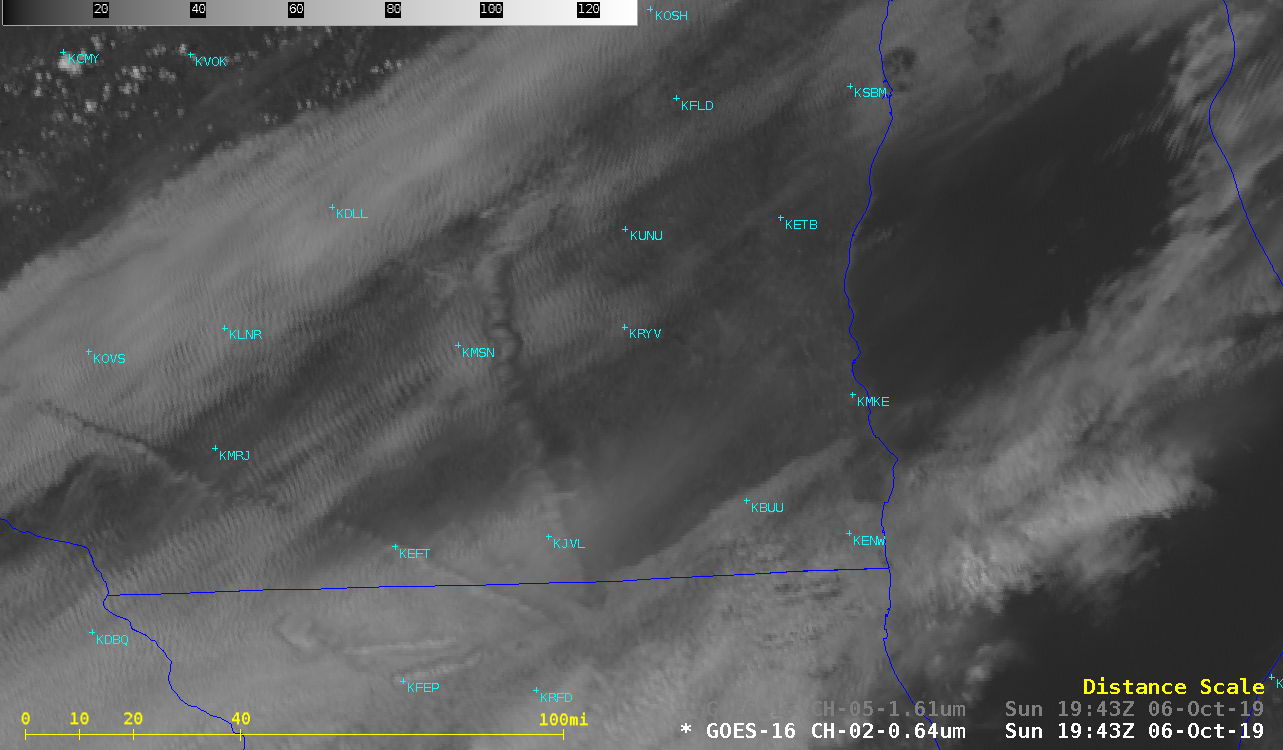
Aircraft dissipation trails over southern Wisconsin and northern Illinois

GOES-16 “Red” Visible (0.64 µm) and Near-Infrared “Snow/Ice” (1.61 µm) images [click to play animation | MP4]
A comparison of Suomi NPP VIIRS Visible (0.64 µm), Near-Infrared (1.61 µm), Shortwave Infrared (3.74 µm) and Infrared Window (11.45 µm) images (below) helped to confirm the presence of ice crystals within the aircraft dissipation trails: a darker appearance in the 1.61 µm image (since ice is a strong absorber of radiation at that wavelength), and a colder (brighter white) signature in the 3.74 µm image. In the enhancement applied to the 3.74 µm and 11.45 µm images, colors are applied to infrared brightness temperatures of -30ºC and colder — and the shades of yellow represent cloud-top brightness temperatures in the -30 to -39ºC range.
![Suomi NPP VIIRS Visible (0.64 µm), Near-Infrared (1.61 µm), Shortwave Infrared (3.74 µm) and Infrared Window (11.45 µm) images [click to enlarge]](https://cimss.ssec.wisc.edu/satellite-blog/wp-content/uploads/sites/5/2019/10/191006_1918utc_suomiNPP_visible_nearInfrared_shortwaveInfrared_infraredWindow_WI_IL_aircraft_dissipation_trails_anim.gif)
Suomi NPP VIIRS Visible (0.64 µm), Near-Infrared (1.61 µm), Shortwave Infrared (3.74 µm) and Infrared Window (11.45 µm) images [click to enlarge]


![Time lapse of west-facing AOSS rooftop camera images [click to play YouTube video]](https://cimss.ssec.wisc.edu/satellite-blog/wp-content/uploads/sites/5/2019/10/191006_west_camera.png)
![Time lapse of east-facing AOSS rooftop camera images [click to play YouTube video]](https://cimss.ssec.wisc.edu/satellite-blog/wp-content/uploads/sites/5/2019/10/191006_east_camera.png)