Hurricane Lorenzo reaches Category 5 intensity
![GOES-16 "Clean" Infrared Window (10.35 µm) images [click to play animation | MP4]](https://cimss.ssec.wisc.edu/satellite-blog/wp-content/uploads/sites/5/2019/09/190928_goes16_infrared_Lorenzo_anim.gif)
GOES-16 “Clean” Infrared Window (10.35 µm) images [click to play animation | MP4]
![Plot of the CIMSS Advanced Dvorak Technique (ADT) for Hurricane Lorenzo [click to enlarge]](https://cimss.ssec.wisc.edu/satellite-blog/wp-content/uploads/sites/5/2019/09/190929_adt_Lorenzo.GIF)
Plot of the CIMSS Advanced Dvorak Technique (ADT) for Hurricane Lorenzo [click to enlarge]
#Lorenzo has strengthened into a Category 5 hurricane at 45°W – the farthest east Category 5 #hurricane in the Atlantic on record. Previous record was Hurricane Hugo in 1989 at 54.6°W. pic.twitter.com/FXGgKFPc3m
— Philip Klotzbach (@philklotzbach) September 29, 2019
A toggle between NOAA-20 VIIRS Day/Night Band (0.7 µm) and Infrared Window (11.45 µm) images at 0425 UTC is shown below.
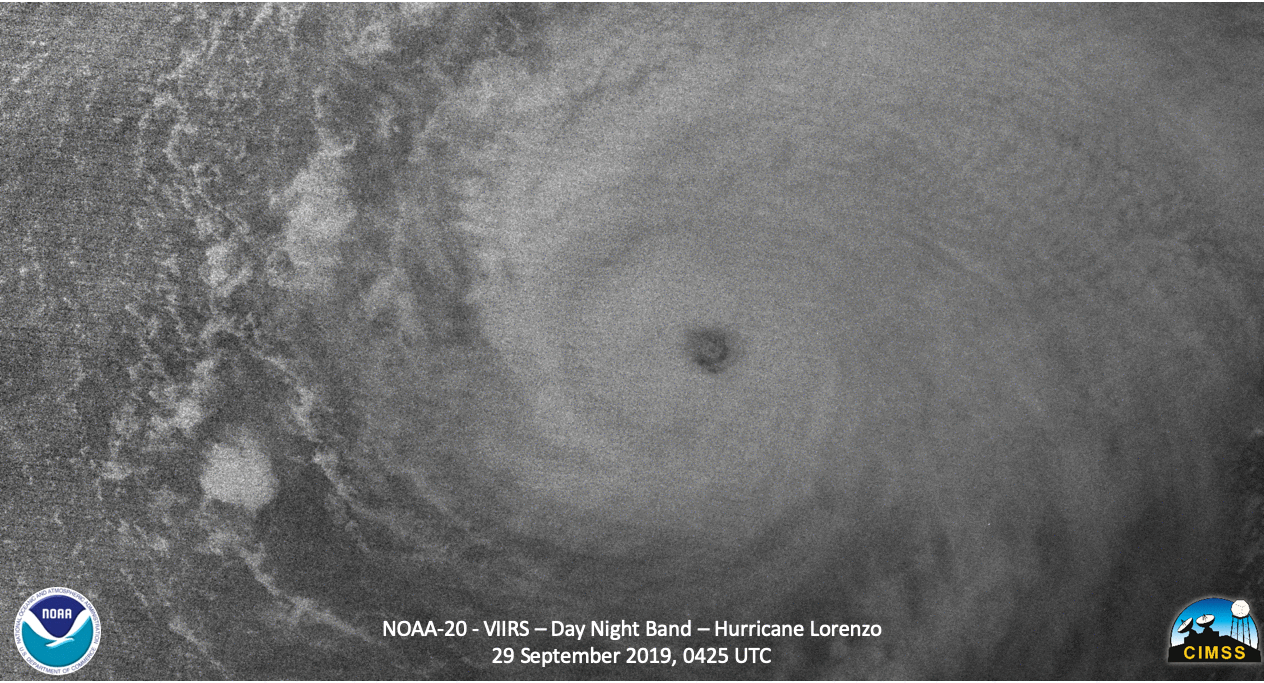
NOAA-20 VIIRS Day/Night Band (0.7 µm) and Infrared Window (11.45 µm) images (courtesy of William Straka, CIMSS) [click to enlarge]
![GOES-16 Water Vapor images, with contours and streamlines of deep-layer wind shear [click to play animation]](https://cimss.ssec.wisc.edu/satellite-blog/wp-content/uploads/sites/5/2019/09/190927_190929_goes16_waterVapor_deepLayerShear_anim.gif)
GOES-16 Water Vapor (6.9 µm) images, with contours and streamlines of deep-layer wind shear [click to play animation]
![Sea Surface Temperature and Ocean Heat Content on 29 September, with a plot of the track/intensity of Lorenzo [click to enlarge]](https://cimss.ssec.wisc.edu/satellite-blog/wp-content/uploads/sites/5/2019/09/190929_seaSurfaceTemperature_oceanHeatContent_Lorenzo_anim.gif)
Sea Surface Temperature and Ocean Heat Content on 29 September, with a plot of the track/intensity of Lorenzo [click to enlarge]