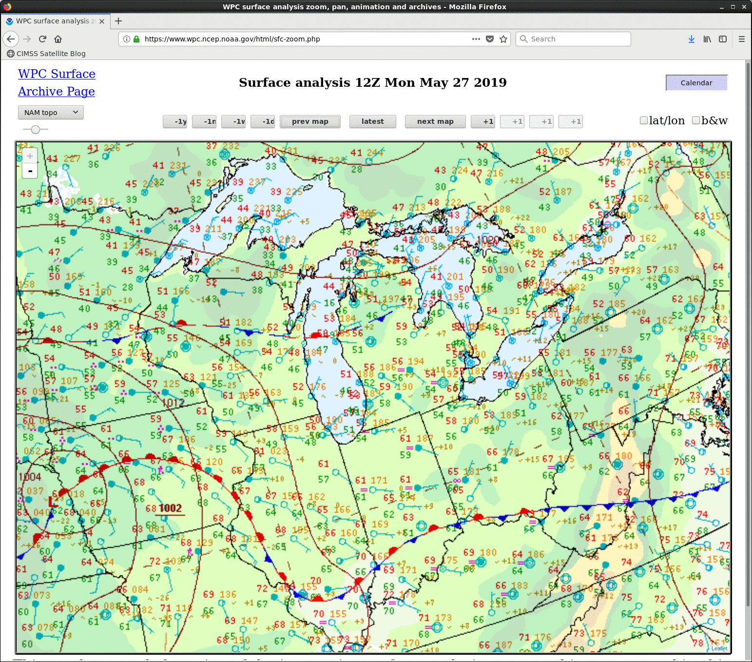
Severe thunderstorms in Indiana and Ohio
![GOES-16 “Red” Visible (0.64 µm) images, with SPC Storm Reports plotted in red [click to play animation | MP4]](https://cimss.ssec.wisc.edu/satellite-blog/wp-content/uploads/sites/5/2019/05/190527_goes16_visible_spcStormReports_IN_anim.gif)
GOES-16 “Red” Visible (0.64 µm) images, with SPC Storm Reports plotted in red [click to play animation | MP4]
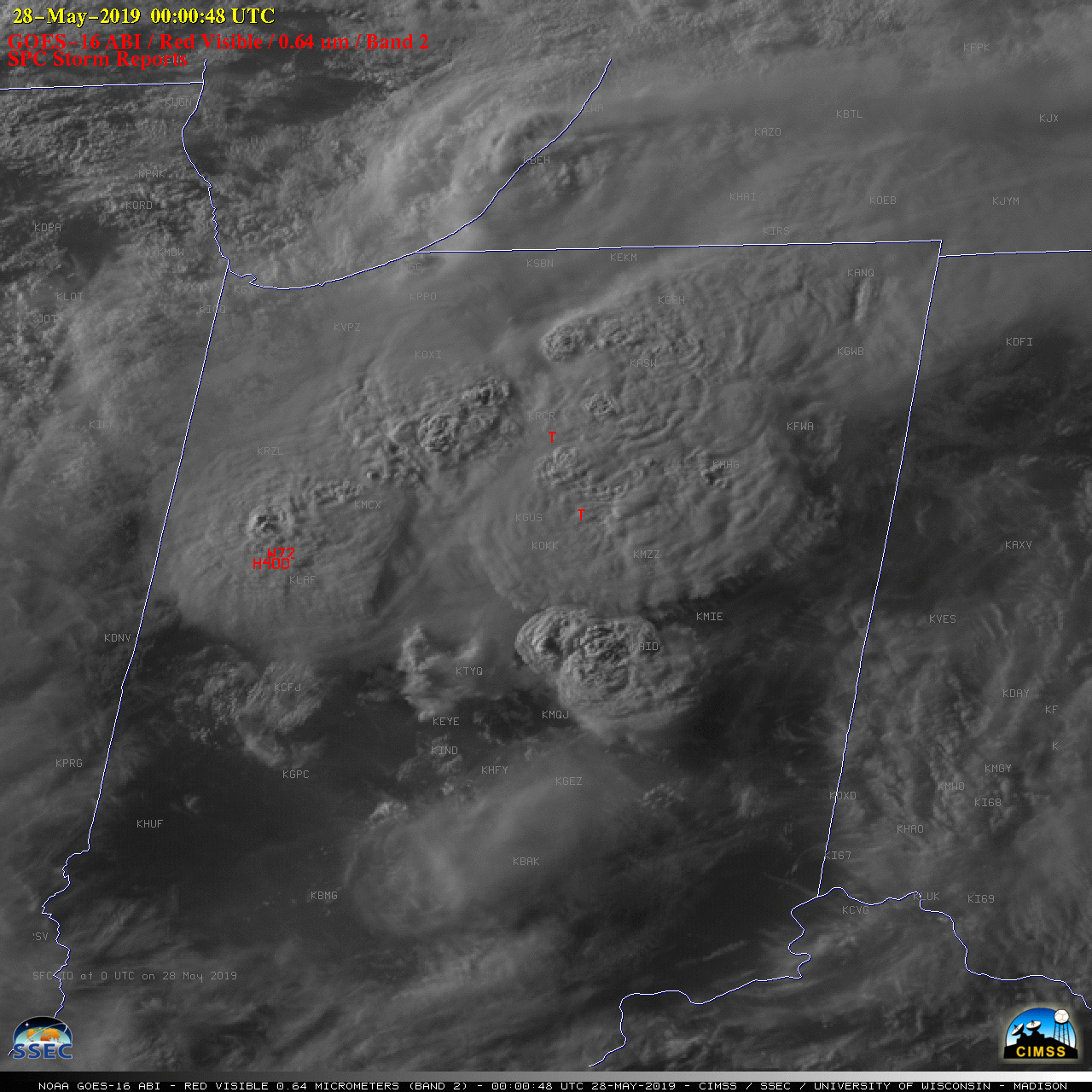
Many of these storms exhibited well-defined overshooting tops; the largest hail was 4.0 inches in diameter at 0000 UTC. A comparison of SPC Storm Reports at the time of this large hail (and a nearby wind gust to 72 mph) — plotting the reports at the actual ground location vs a “parallax-corrected” location which shifted them northwestward — showed that the severe report locations closely corresponded to the overshooting top (below).
![GOES-16 “Red” Visible (0.64 µm) images, with SPC Storm Reports plotted in red [click to enlarge]](https://cimss.ssec.wisc.edu/satellite-blog/wp-content/uploads/sites/5/2019/05/190528_0000utc_goes16_visible_spcStormReports_parallax_IN_anim.gif)
GOES-16 “Red” Visible (0.64 µm) image at 0000 UTC, with SPC Storm Reports plotted in red [click to enlarge]
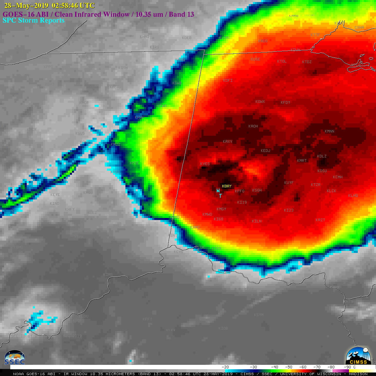
![GOES-16 “Clean” Infrared Window (10.35 µm) images, with SPC Storm Reports plotted in cyan [click to play animation | MP4]](https://cimss.ssec.wisc.edu/satellite-blog/wp-content/uploads/sites/5/2019/05/190527_goes16_infrared_spcStormReports_IN_anim.gif)
GOES-16 “Clean” Infrared Window (10.35 µm) images, with SPC Storm Reports plotted in cyan [click to play animation | MP4]
![GOES-16 “Clean” Infrared Window (10.35 µm) images, with SPC Storm Reports plotted in cyan [click to play animation | MP4]](https://cimss.ssec.wisc.edu/satellite-blog/wp-content/uploads/sites/5/2019/05/190527_goes16_infrared_spcStormReports_OH_anim.gif)
GOES-16 “Clean” Infrared Window (10.35 µm) images, with SPC Storm Reports plotted in cyan [click to play animation | MP4]
![Terra MODIS Infrared Window (11.0 µm) image with plots of SPC Storm Reports within +/- 45 minutes of the image time [click to enlarge]](https://cimss.ssec.wisc.edu/satellite-blog/wp-content/uploads/sites/5/2019/05/190526_0243utc_terra_modis_infrared_spcStormReports_OH_anim.gif)
Terra MODIS Infrared Window (11.0 µm) image with plots of SPC Storm Reports within +/- 45 minutes of the image time [click to enlarge]