Standing wave clouds over Virginia and North Carolina
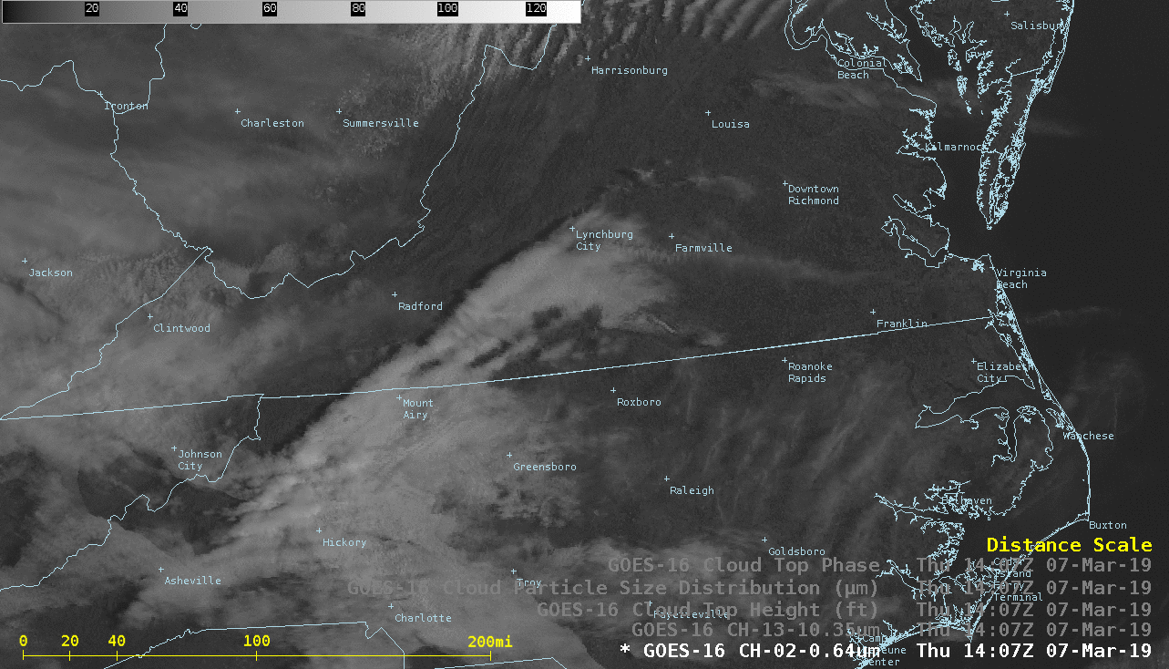
GOES-16 “Red” Visible (0.64 µm), “Clean” Infrared Window (10.3 µm), Cloud Top Height, Cloud Particle Size Distribution, and Cloud Phase [click to play animation | MP4]
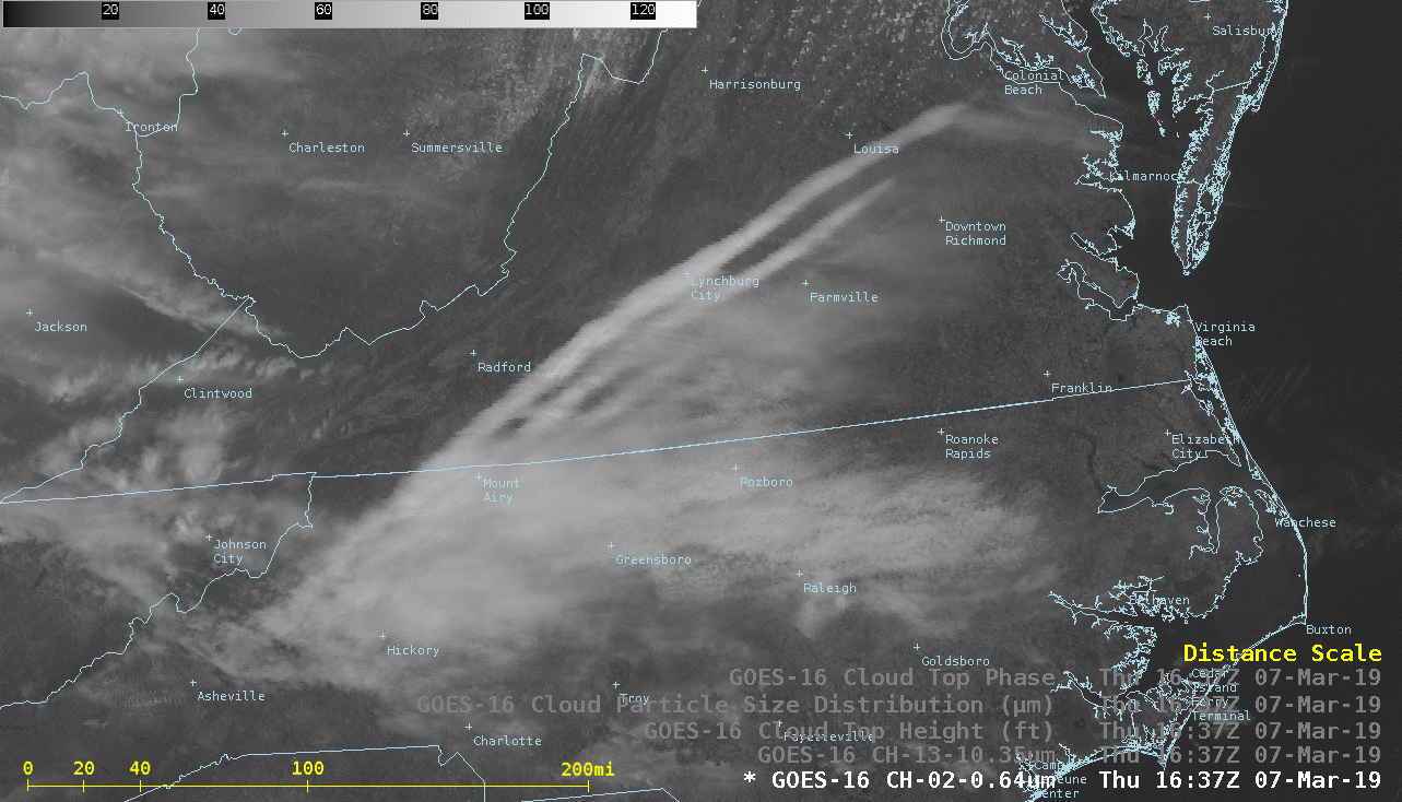
GOES-16 Day Cloud Phase Distinction Red-Green-Blue (RGB) images from the AOS site (below) also identified the rotor clouds as supercooled water droplet features (brighter shades of white), with the banner clouds being identified as high-level ice (shades of pink) or glaciating (shades of green) features. An unrelated phenomena was the brief brightening of the bare ground across much of the Southeast US midway through the animation — a result of transient solar reflectance that is seen around the Spring and Autumn equinox.
![GOES-16 Day Cloud Phase Distinction RGB images [click to play animation | MP4]](https://cimss.ssec.wisc.edu/satellite-blog/wp-content/uploads/sites/5/2019/03/190307_goes16_dayCloudPhaseDistinctionRGB_VA_NC_standing_wave_anim.gif)
GOES-16 Day Cloud Phase Distinction RGB images [click to play animation | MP4]
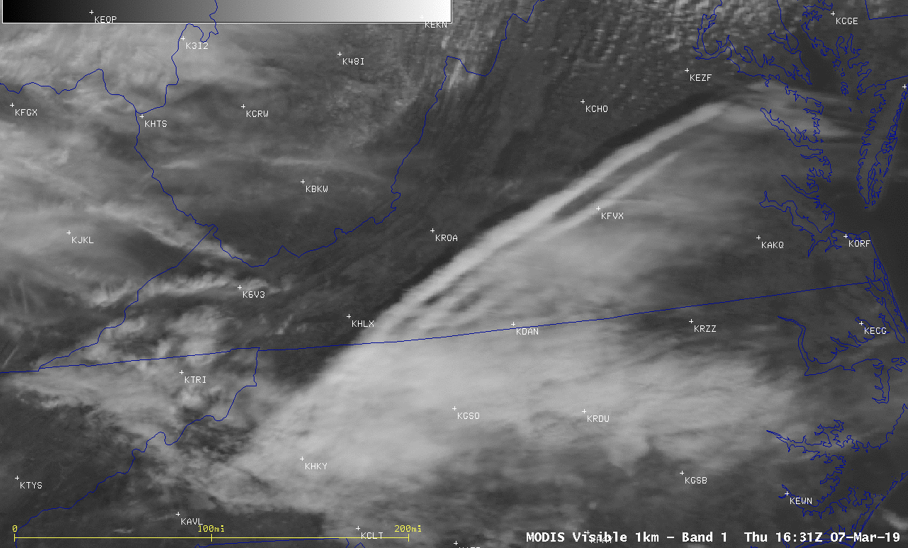
Terra MODIS Visible (0.65 µm), Near-Infrared “Cirrus” (1.37 µm), Shortwave Infrared (3.7 µm) and Infrared Window (11.0 µm) images [click to enlarge]
![Terra MODIS Visible (0.65 µm) image, with pilot reports of turbulence [click to enlarge]](https://cimss.ssec.wisc.edu/satellite-blog/wp-content/uploads/sites/5/2019/03/Pirep_Turb_260-500_20190307_1400.png)
Terra MODIS Visible (0.65 µm) image, with pilot reports of turbulence [click to enlarge]