Moisture Streaming towards Southern California
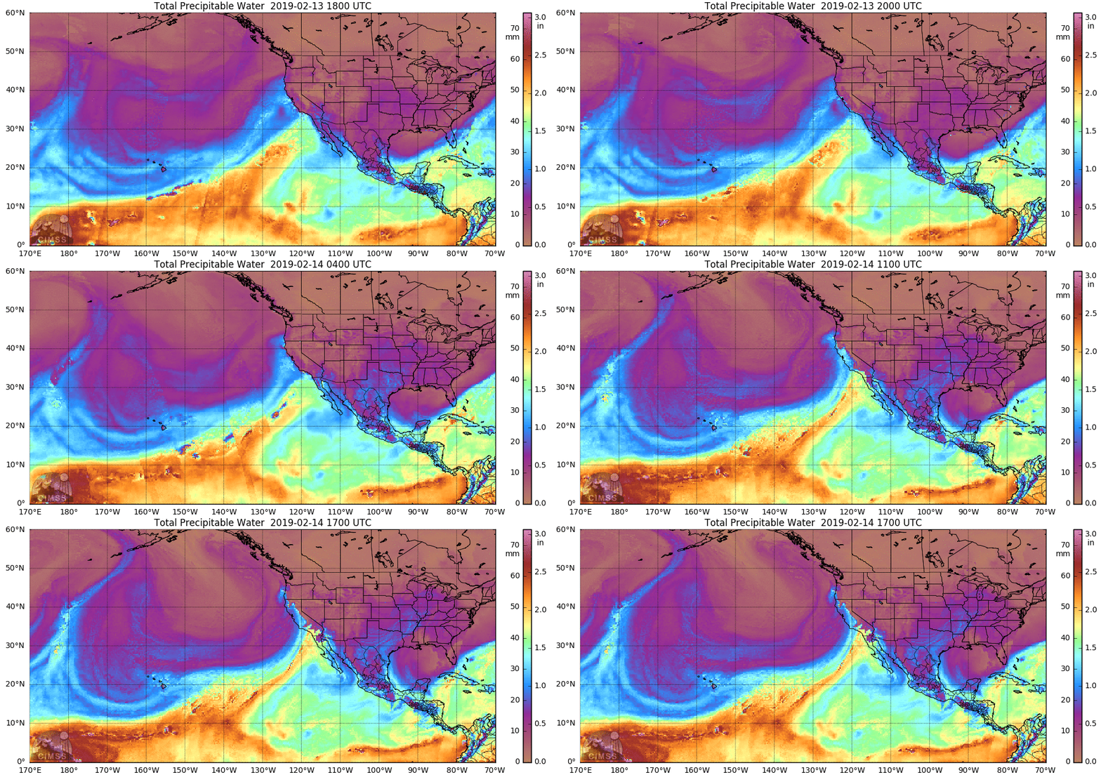
Morphed Microwave Total Precipitable Water, 1800 UTC 13 February to 1700 UTC 14 February 2019 (Click to enlarge)
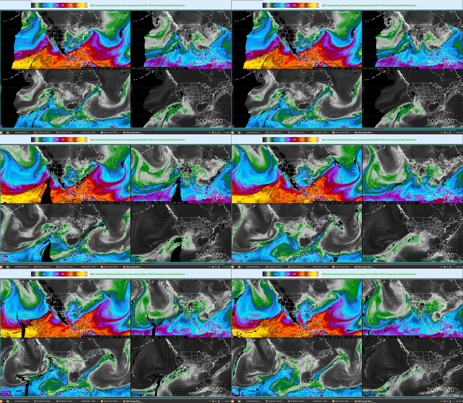
A potent Atmospheric River is affecting the California Coast on 14 February 2019. The morphed microwave imagery, above (from this site), shows rich moisture from deep in the tropics moving onto the southern California and northwest Mexican coasts. The animation below shows the Layered Precipitable water — also a product derived from microwave imagery — for the same time period, but at 3-hour time steps (from this site). An interesting feature is that the 850-700 hPa moisture layer is not as continuous back to the tropics as the other 3 layers.
You can also infer a large influx of moisture from the low-level water vapor imagery, as shown in the short animation below from GOES-17, from 1617 UTC (just as Loop Heat Pipe issues that cause missing data were ramping down) to 1857 UTC. One might also infer a long-duration event from this animation!
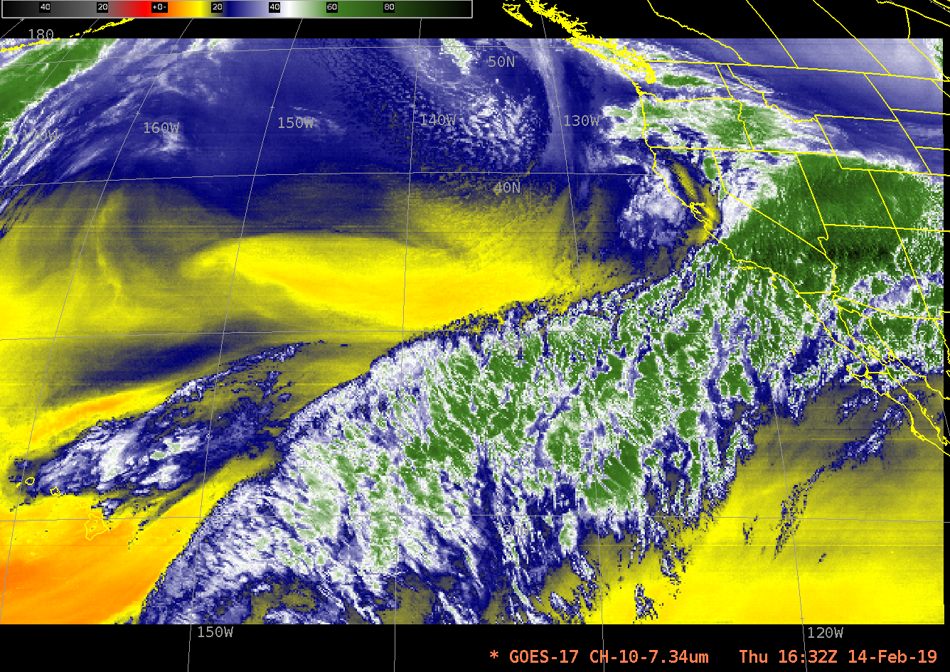
GOES-17 ABI Band 10 Infrared 7.3 µm Imagery (Low-Level Water Vapor Band) from 1617 UTC to 1857 UTC on 14 February 2019 (Click to animate)
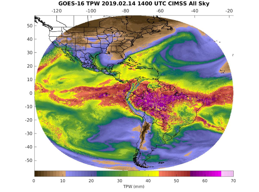
The GOES-R All-Sky Total Precipitable Water product (from this site) is as yet produced only from GOES-16 data (The Loop Heat Pipe problems have a strong impact on all Baseline products, including Legacy Profiles that are used to create Total Precipitable Water, which impact is still under investigation). The western Pacific is on the limb of this product, but it does capture the deep moisture moving towards southern California.
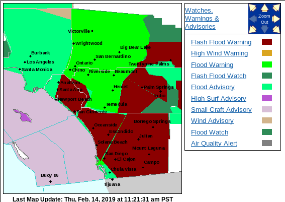
Much of the San Diego National Weather Service Forecast Office County Warning Area is under Flood and/or Wind Warnings! See the Screen Capture below from 1121 AM Pacific Standard Time.


