Stereoscopic views of a small storm over the North Pacific Ocean
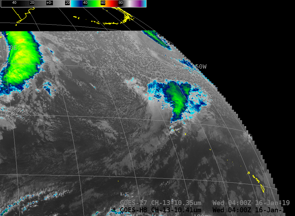
Himawari-8 AHI and GOES-17 ABI Band 13 (10.41 µm and 10.35 µm, respectively) at 0400 UTC on 16 January 2019 (Click to enlarge)
GOES-17 Data in this post are preliminary and non-operational.
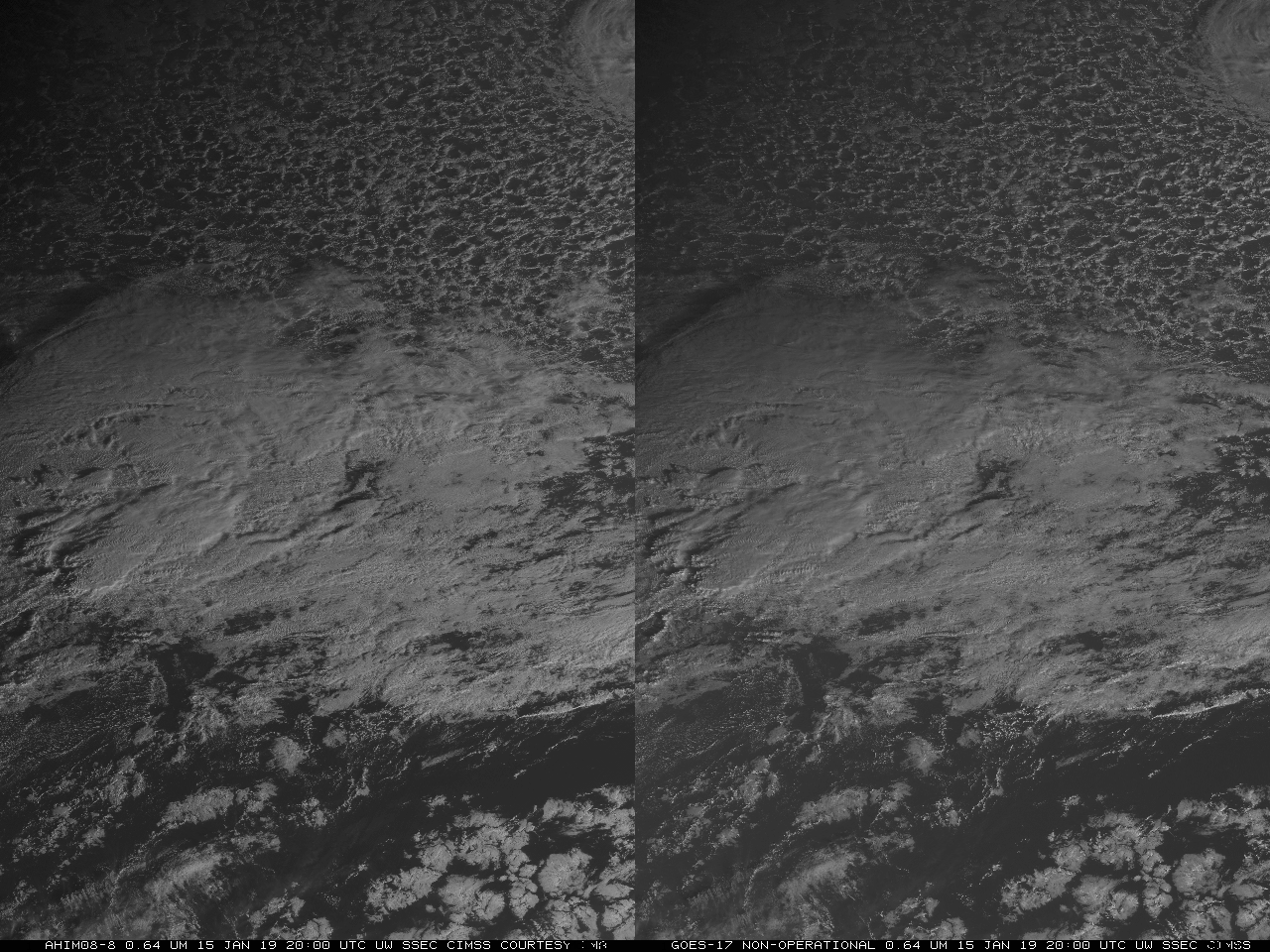
The toggle above shows clean window imagery from the Advanced Himawari Imager (Band 13, 10.41 µm) on Himawari-8 (data courtesy JMA) and clean window imagery from the Advanced Baseline Imager (ABI, Band 13, 10.3 µm) on GOES-17 (GOES-17 data are non-operational). There is a small developing storm between the Hawai’ian Islands and Alaska that is resolved by both satellites. The storm is in between the two satellites and therefore ideal for stereoscopic views created from Visible 0.64 µm imagery (Band 3 for AHI, Band 2 for GOES-17). That is shown below. Thirty-minute timesteps are used because GOES-17 scans a full disk every 15 minutes (in Mode 3 that is currently operational; Mode 6, if used, scans a Full Disk every 10 minutes; and Mode 4, continuous Full Disk, the highest data rate for the GOES-R series, scans a Full Disk every 5 minutes). Himawari scans a Full Disk every 10 minutes. The three-dimensional representation facilitates the identification of warm conveyor belts associated with this developing storm. (This link shows the same animation but with the imagery flipped so it can be viewed in Google Daydream).
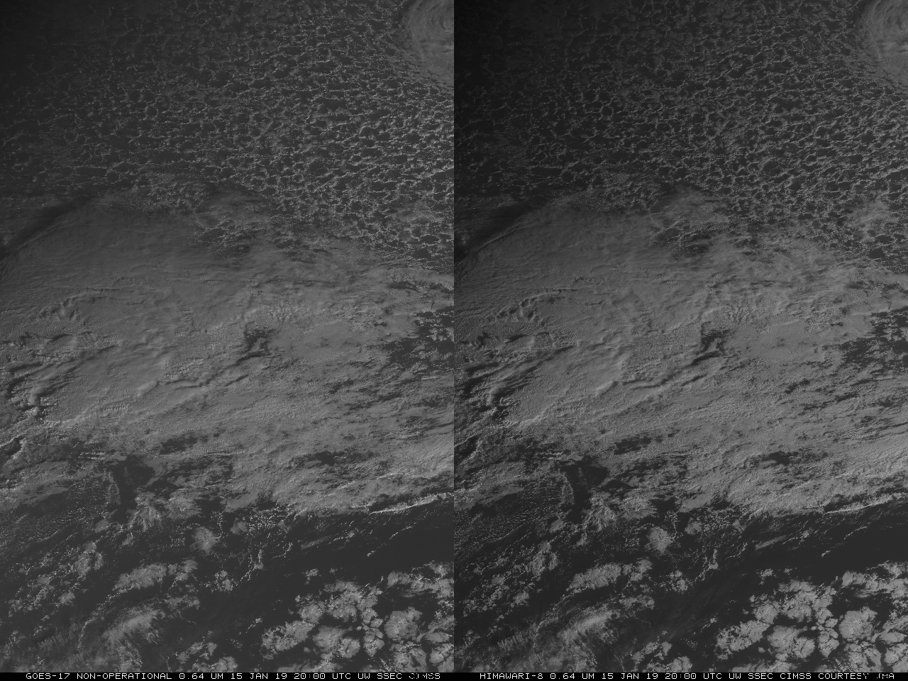
GOES-17 non-operational Visible (0.64 µm) imagery (left) and Himawari-8 Visible (0.64 µm) imagery (right), every half-hour from 2000 UTC on 15 January to 0400 UTC on 16 January (Click to animate)
Thanks to Mary Ellen Craddock, Northrop-Grumman, for the reminder that stereo imagery is possible with GOES-17 and Himawari. (It should be even better with Himawari-8 and South Korea’s GEOKOMPSAT-2A!)