Subtle signature of temperature advection seen in GOES-16 infrared imagery
![Topography background with surface pressure analyses at 03, 06 and 09 UTC [click to enlarge]](https://cimss.ssec.wisc.edu/satellite-blog/wp-content/uploads/sites/5/2018/10/181018_topo_surface_pressure_anim.gif)
Topography background with surface pressure analyses at 03, 06 and 09 UTC [click to enlarge]
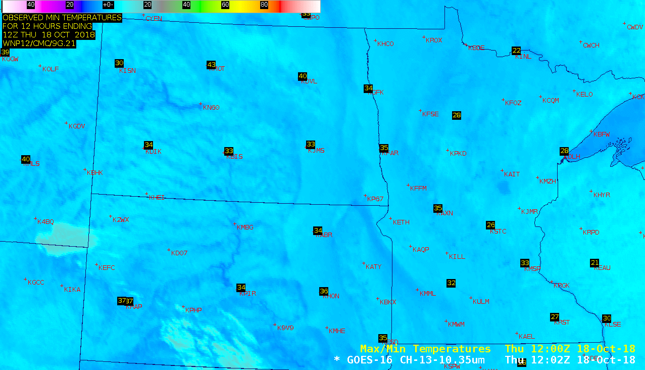
An animation of 5-minute GOES-16 (GOES-East) “Clean” Infrared Window (10.3 µm) images (below) suggested a lack of clouds across most of the region, except for some patchy mid/high-level clouds drifting slowly northward from Nebraska/Wyoming across western South Dakota and far southeastern Montana. However, a close inspection of the imagery revealed the subtle appearance of “motion” across northern/eastern North Dakota into eastern South Dakota and far western Minnesota. This was noted by Carl Jones (NWS Grand Forks), who further pointed out “strong winds just above the surface (45 kt at 900ft per KMVX VWP) mixing down a huge warm tongue at 900mb along with downslope influences”. A comparison of the GOES-16 Infrared images with topography showed the slightly higher elevation of the Coteau du Missouri (elevation around 2000 feet) across southwestern North Dakota and western South Dakota along with the more narrow Coteau des Prairies in northeastern South Dakota and southwestern Minnesota — and a subtle “downslope warming” effect could be seen on the Infrared images (warmer temperatures are darker shades of blue with the applied enhancement).
5-minute GOES-16 “Clean” Infrared Window (10.3 µm) images + topography, with hourly plots of surface reports [click to play animation | MP4]
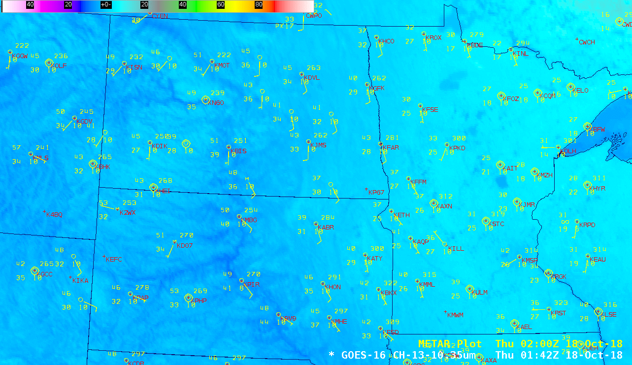
![GOES-16 Land Surface Temperature product + topography, with hourly plots of surface reports [click to play animation | MP4]](https://cimss.ssec.wisc.edu/satellite-blog/wp-content/uploads/sites/5/2018/10/181018_goes16_landSurfaceTemperature_Upper_Midwest_anim.gif)
Hourly GOES-16 Land Surface Temperature product + topography, with plots of surface reports [click to play animation | MP4]
![Infrared Window images from Terra/Aqua MODIS (11.0 µm) and NOAA-20/Suomi NPP VIIRS (11.45 µm), with topography and plots of surface reports [click to enlarge]](https://cimss.ssec.wisc.edu/satellite-blog/wp-content/uploads/sites/5/2018/10/181018_modis_viirs_infrared_topo_Upper_Midwest_anim.gif)
Infrared Window images from Terra/Aqua MODIS (11.0 µm) and NOAA-20/Suomi NPP VIIRS (11.45 µm) + topography, with plots of surface reports [click to enlarge]
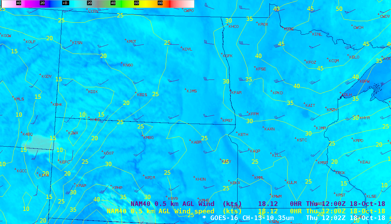
GOES-16 “Clean” Infrared Window (10.3 µm) image + topography, with NAM40 winds/isotachs at 0.5 km above ground level [click to enlarge]
![Plot of 12 UTC rawinsonde data from Bismarck, North Dakota [click to enlarge]](https://cimss.ssec.wisc.edu/satellite-blog/wp-content/uploads/sites/5/2018/10/181018_12utc_kbis_raob.png)
Plot of 12 UTC rawinsonde data from Bismarck, North Dakota [click to enlarge]
![Plot of 12 UTC rawinsonde data from Aberdeen, South Dakota [click to enlarge]](https://cimss.ssec.wisc.edu/satellite-blog/wp-content/uploads/sites/5/2018/10/181018_12utc_kabr_raob.png)
Plot of 12 UTC rawinsonde data from Aberdeen, South Dakota [click to enlarge]