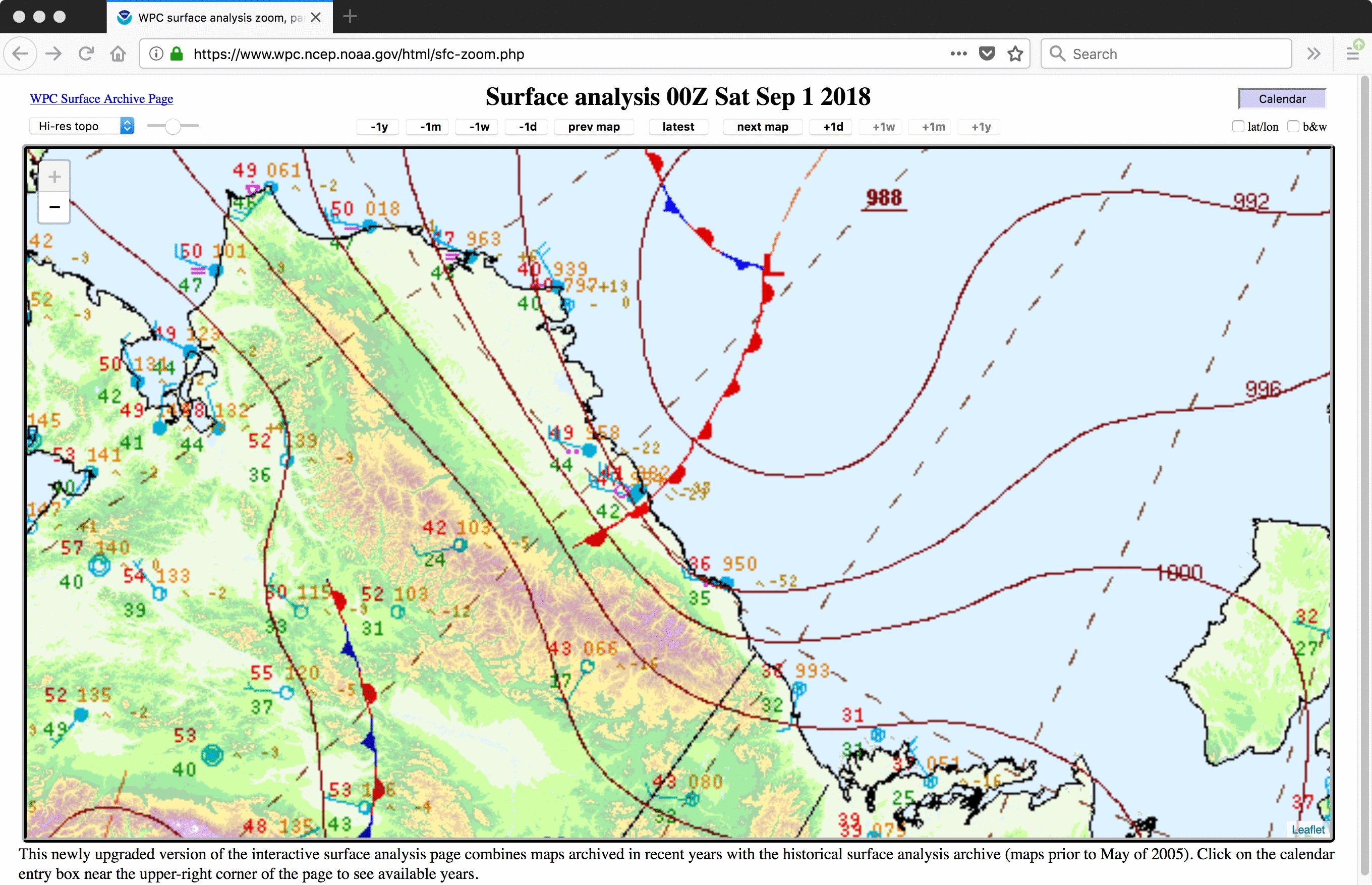
Snow cover in the Brooks Range and North Slope of Alaska
![Suomi NPP VIIRS Infrared Window (11.45 µm) images on 01 and 02 September [click to enlarge]](https://cimss.ssec.wisc.edu/satellite-blog/wp-content/uploads/sites/5/2018/09/180901_180902_suomi_npp_viirs_InfraredWindow_AK_anim.gif)
Suomi NPP VIIRS Infrared Window (11.45 µm) images on 01 and 02 September [click to enlarge]
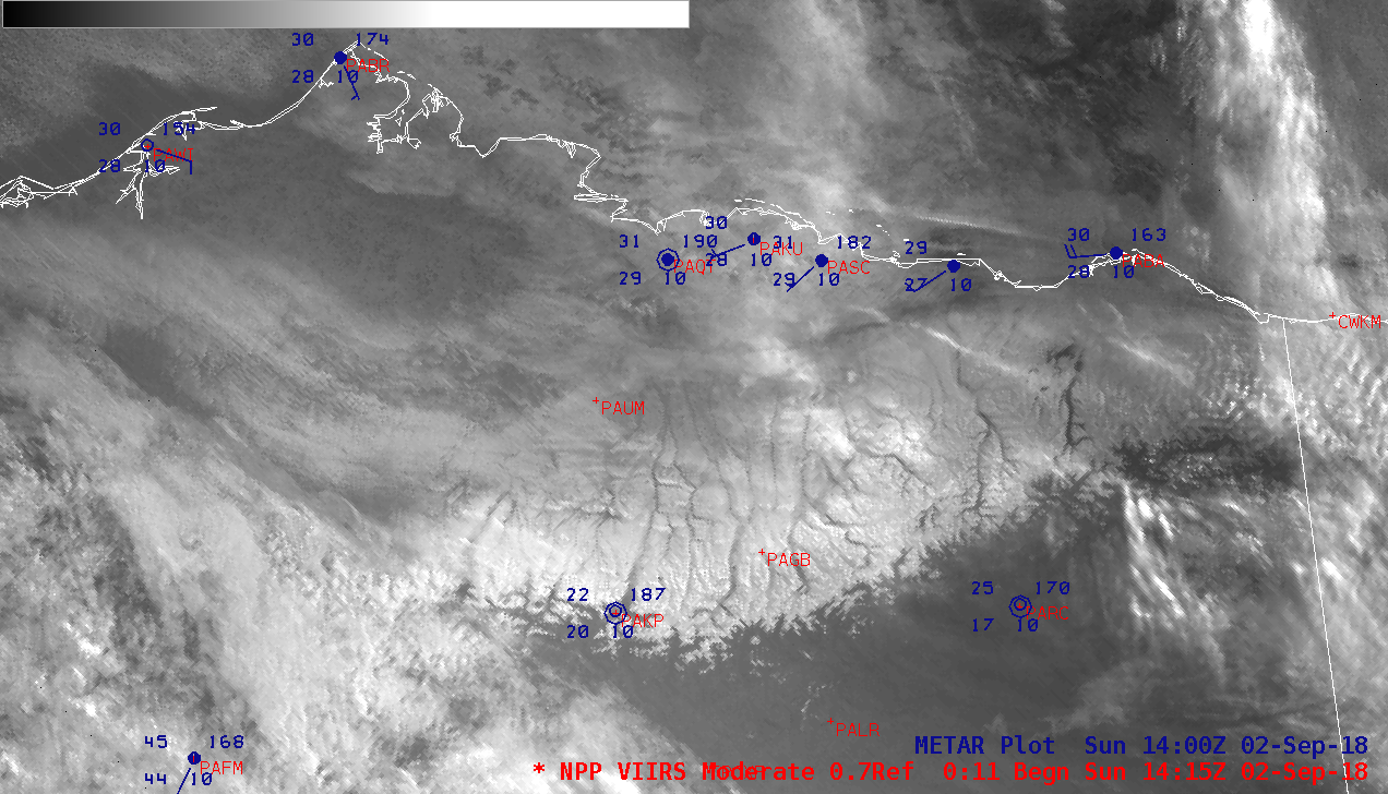
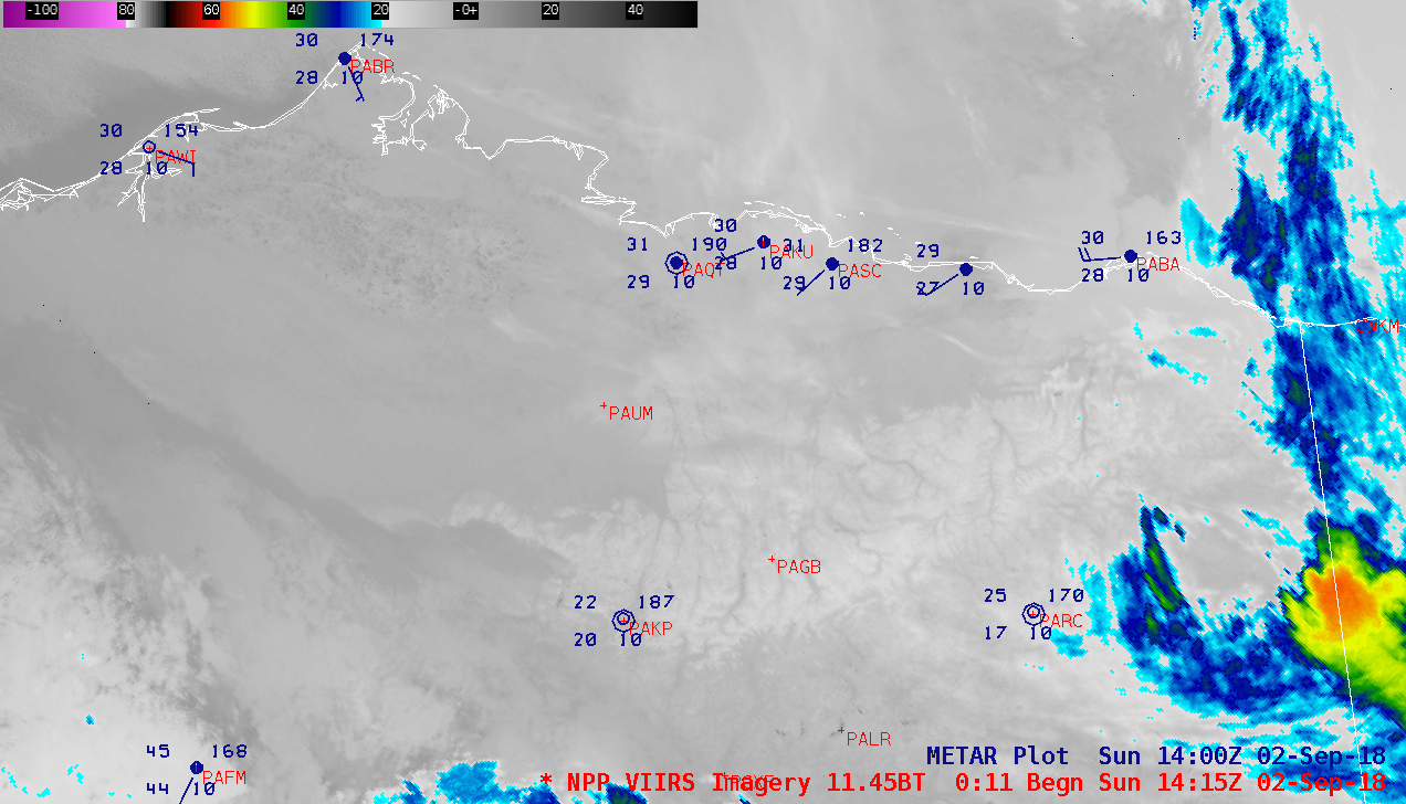
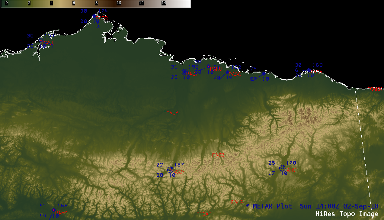
The upslope flow of cold air helped to generate accumulating snowfall across that region — prompting a Winter Storm Warning to be issued for the eastern Brooks Range, where 4-8 inches was expected at higher elevations — and some of the resulting snow cover was seen on a Suomi NPP VIIRS Day/Night Band (0.7 µm) image at 1415 UTC or 6:15 am local time on 02 September (below). A comparison with the corresponding VIIRS Infrared Window (11.45 µm) image and Topography is also shown. The darker shades of brown on the topography image correspond to elevations of 6000-8000 feet in the Brooks Range.
![Suomi NPP VIIRS Day/Night Band (0.7 µm), Infrared Window (11.45 µm) and Topography images [click to enlarge]](https://cimss.ssec.wisc.edu/satellite-blog/wp-content/uploads/sites/5/2018/09/180902_1415utc_suomi_npp_viirs_DayNightBand_InfraredWindow_topography_AK_anim.gif)
Suomi NPP VIIRS Day/Night Band (0.7 µm), Infrared Window (11.45 µm) and Topography images [click to enlarge]
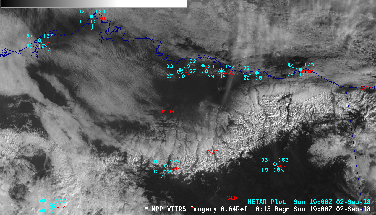
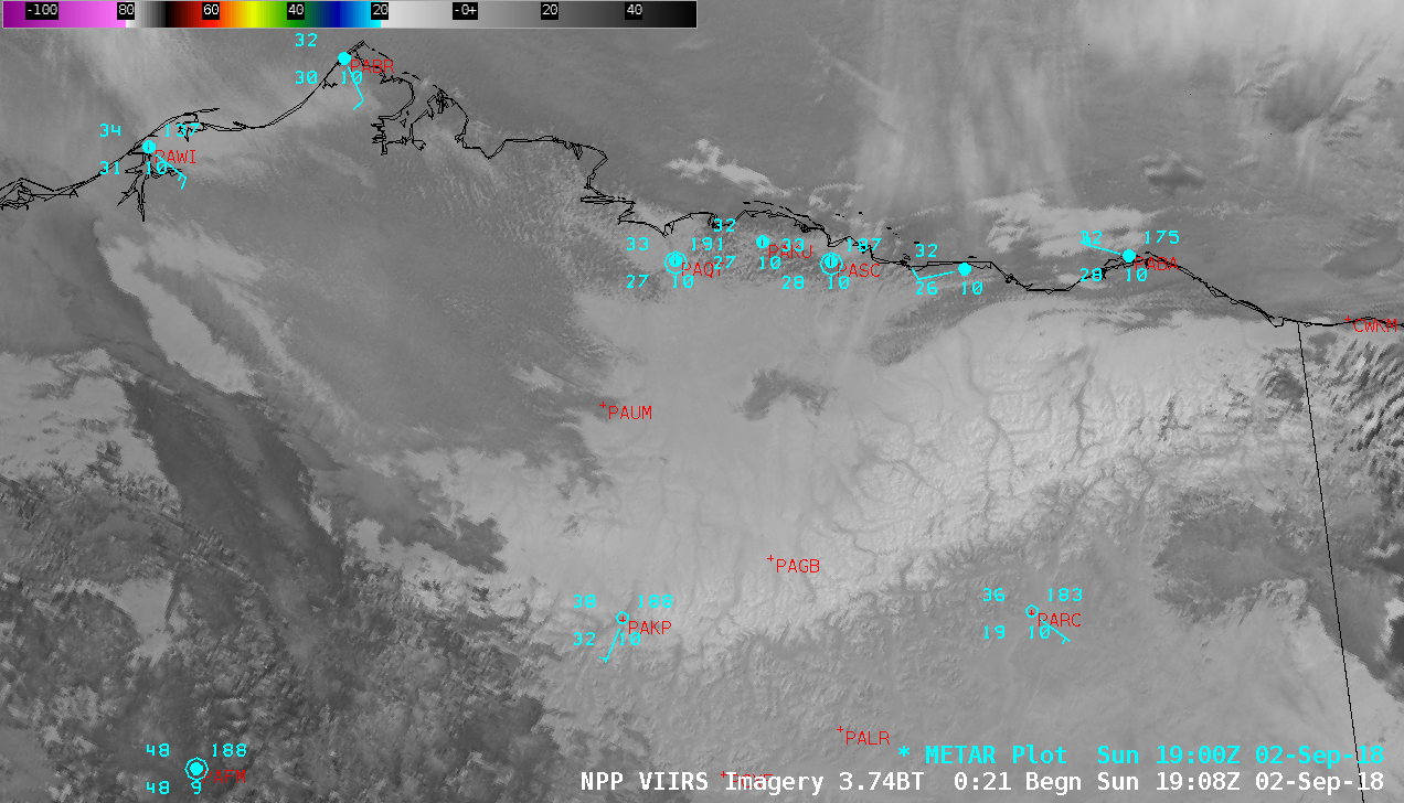
![Suomi NPP VIIRS Visible (0.64 µm), Shortwave Infrared (3.74 µm) and Topography images [click to enlarge]](https://cimss.ssec.wisc.edu/satellite-blog/wp-content/uploads/sites/5/2018/09/180902_1924utc_suomi_npp_viirs_visible_shortwaveInfrared_topography_AK_anim.gif)
Suomi NPP VIIRS Visible (0.64 µm), Shortwave Infrared (3.74 µm) and Topography images [click to enlarge]
![Landsat-8 False Color RGB image [click to enlarge]](https://cimss.ssec.wisc.edu/satellite-blog/wp-content/uploads/sites/5/2018/09/180902_2124utc_landsat8_falsecolor_AK.jpeg)
Landsat-8 False Color RGB image [click to enlarge]
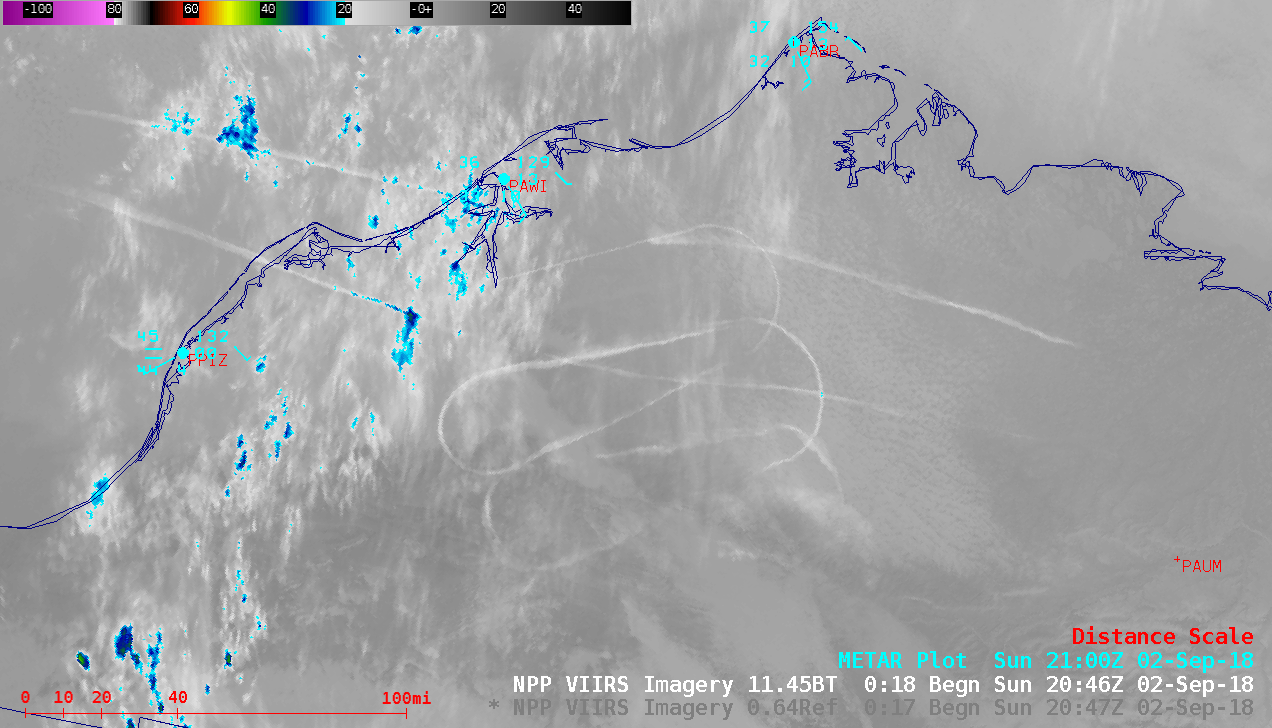
![Suomi NPP VIIRS Visible (0.64 µm) and Infrared Window (11.45 µm) images [click to enlarge]](https://cimss.ssec.wisc.edu/satellite-blog/wp-content/uploads/sites/5/2018/09/180902_suomiNPP_viirs_visible_infrared_contrails_AK_anim.gif)
Suomi NPP VIIRS Visible (0.64 µm) and Infrared Window (11.45 µm) images [click to enlarge]
Webcam from Atqasuk earlier. @AlaskaWx pic.twitter.com/VJbbLaqtJm
— Brian Brettschneider (@Climatologist49) September 3, 2018