Severe thunderstorms in the Southeast US
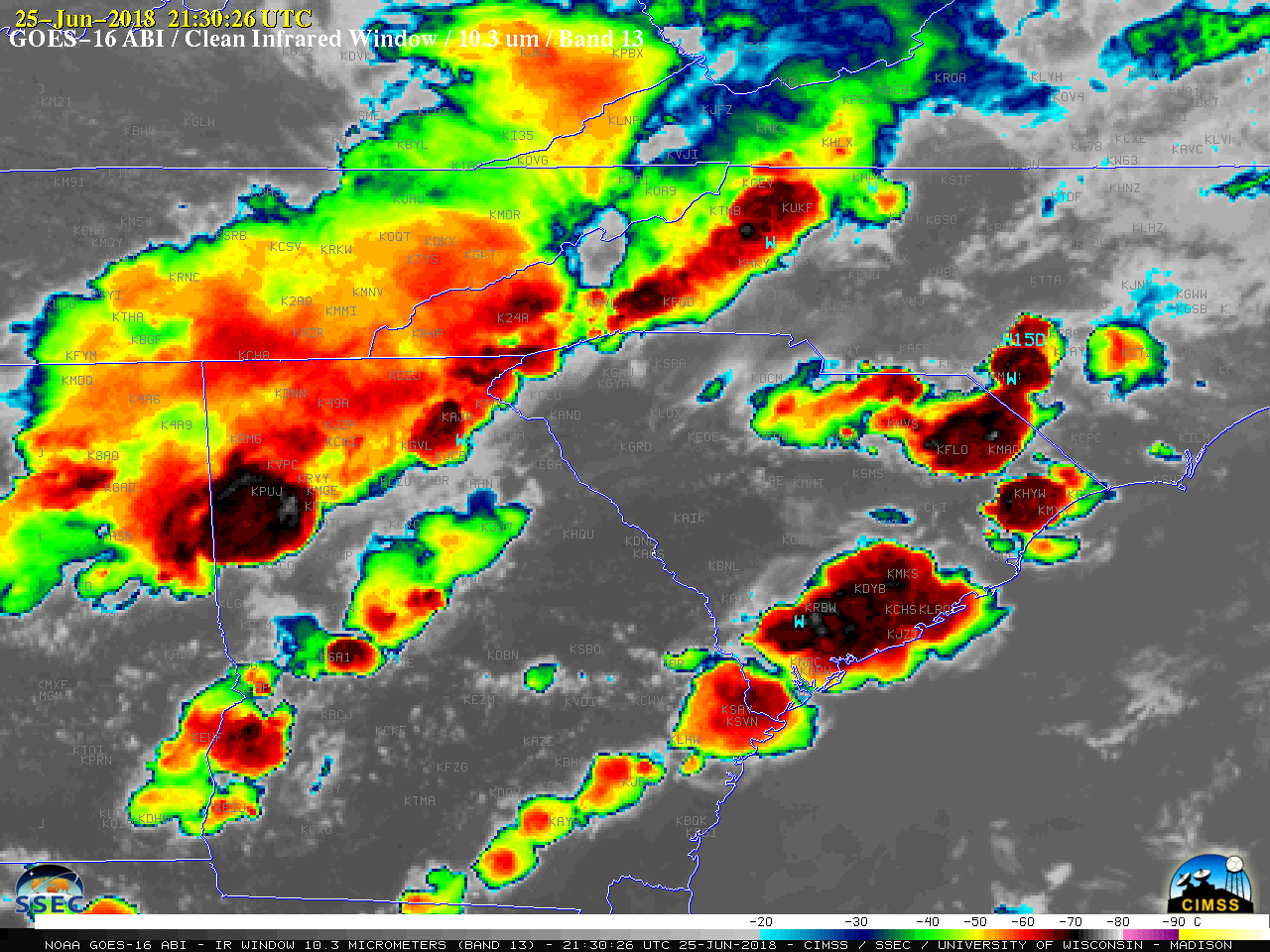
GOES-16 “Clean” Infrared Window (10.3 µm) images, with SPC storm reports plotted in cyan [click to play MP4 animation]
A closer view of the storms was provided by GOES-16 “Red” Visible (0.64 µm) images (below).
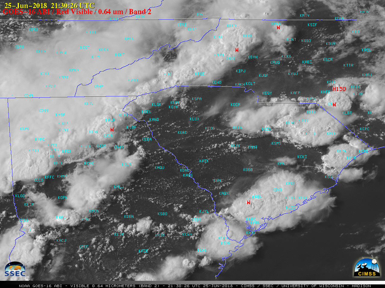
GOES-16 “Red” Visible (0.64 µm) images, with SPC storm reports plotted in red [click to play MP4 animation]
![Aqua MODIS Infrared Window (11.0 µm) image and Total Precipitable Water derived product, with plots of SPC storm reports [click to enlarge]](https://cimss.ssec.wisc.edu/satellite-blog/wp-content/uploads/sites/5/2018/06/180625_1854utc_aqua_modis_InfraredWindow_TotalPrecipitableWater_Southeast_US_severe_anim.gif)
Aqua MODIS Infrared Window (11.0 µm) image and Total Precipitable Water derived product, with plots of SPC storm reports [click to enlarge]
Our #GOESEast Geostationary Lightning Mapper captured the strong storms over #SouthCarolina and #Georgia yesterday – the red areas indicate the most frequent #lightning flashes over a 5 minute period. See more #lightningfromspace here: https://t.co/P1F11zXUHI pic.twitter.com/o39XZT6OuX
— NOAA Satellites (@NOAASatellites) June 26, 2018