PyroCumulonimbus cloud in Colorado
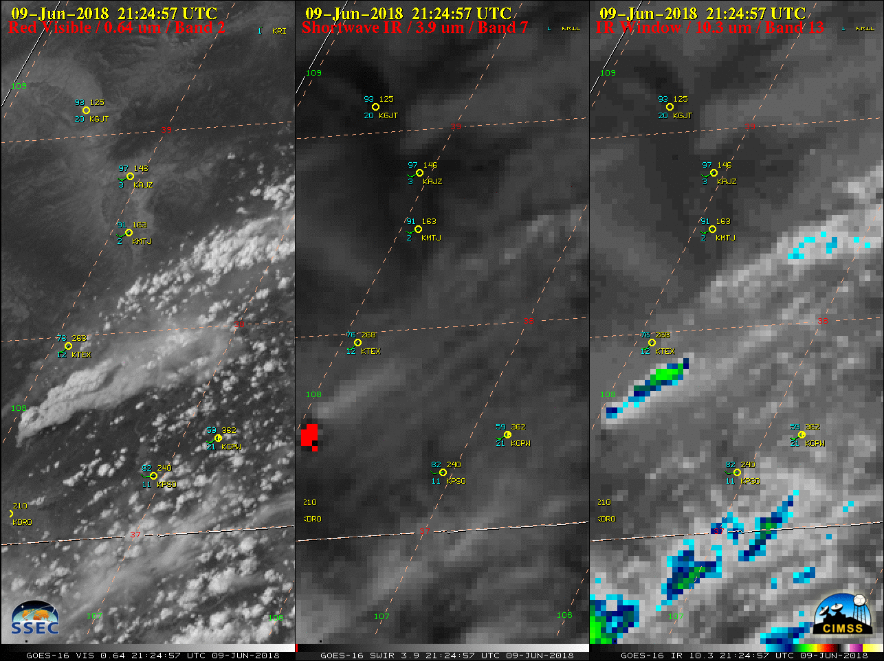
GOES-16 “Red” Visible (0.64 µm, left), Shortwave Infrared (3.9 µm, center) and “Clean” Infrared Window (10.3 µm, right) images, with hourly plots of surface reports [click to play MP4 animation]
On Shortwave Infrared imagery, the thermal anomaly or “hot spot” appeared as a large cluster of red pixels — and the top of the pyroCb cloud took on a darker gray appearance than nearby high-altitude ice crystal clouds (due to enhanced solar reflectance off the smaller ice crystals of the pyroCb anvil). On 10.3 µm imagery, cloud-top infrared brightness temperatures cooled to around -50ºC (bright yellow enhancement) as the pyroCb drifted northeastward.
![NOAA-19 AVHRR Visible (0.63 µm), Shortwave Infrared (3.7 µm) and Infrared Window (10.8 µm) images, with plots of 22 UTC surface reports [click to enlarge]](https://cimss.ssec.wisc.edu/satellite-blog/wp-content/uploads/sites/5/2018/06/180609_2207utc_noaa19_visible_shortwaveIR_IRwindow_anim.gif)
NOAA-19 AVHRR Visible (0.63 µm), Shortwave Infrared (3.7 µm) and Infrared Window (10.8 µm) images, with plots of 22 UTC surface reports [click to enlarge]
![Plots of rawinsonde data from Grand Junction, Colorado [click to enlarge]](https://cimss.ssec.wisc.edu/satellite-blog/wp-content/uploads/sites/5/2018/06/180609_KGJT_RAOBS.GIF)
Plots of rawinsonde data from Grand Junction, Colorado [click to enlarge]
Pretty incredible 100-mile distant view of the #Pyrocumulus over the #416fire in southwest Colorado! Looking south from Matchett Park in Grand Junction. @NWSGJT #COwx pic.twitter.com/7mgHkigcx1
— Michael Charnick (@charnick_wx) June 9, 2018