Heavy snow across southern Minnesota, northern Iowa and southern Wisconsin
![24-hour snowfall ending at 12 UTC on 19 April [click to enlarge]](https://cimss.ssec.wisc.edu/satellite-blog/wp-content/uploads/sites/5/2018/04/180419_snowfall.png)
24-hour snowfall ending at 12 UTC on 19 April [click to enlarge]
Animations of 1-minute Mesoscale Sector GOES-16 (GOES-East) “Red” Visible (0.64 µm), “Clean” Infrared Window (10.3 µm) and “Low-level” Water Vapor (7.3 µm) images (below) showed the formation of convective elements and banding along the southern edge of the colder cloud shield — snowfall rates were enhanced when these convective features moved overhead, and thundersnow was noted at some locations in northern Iowa and southern Wisconsin.
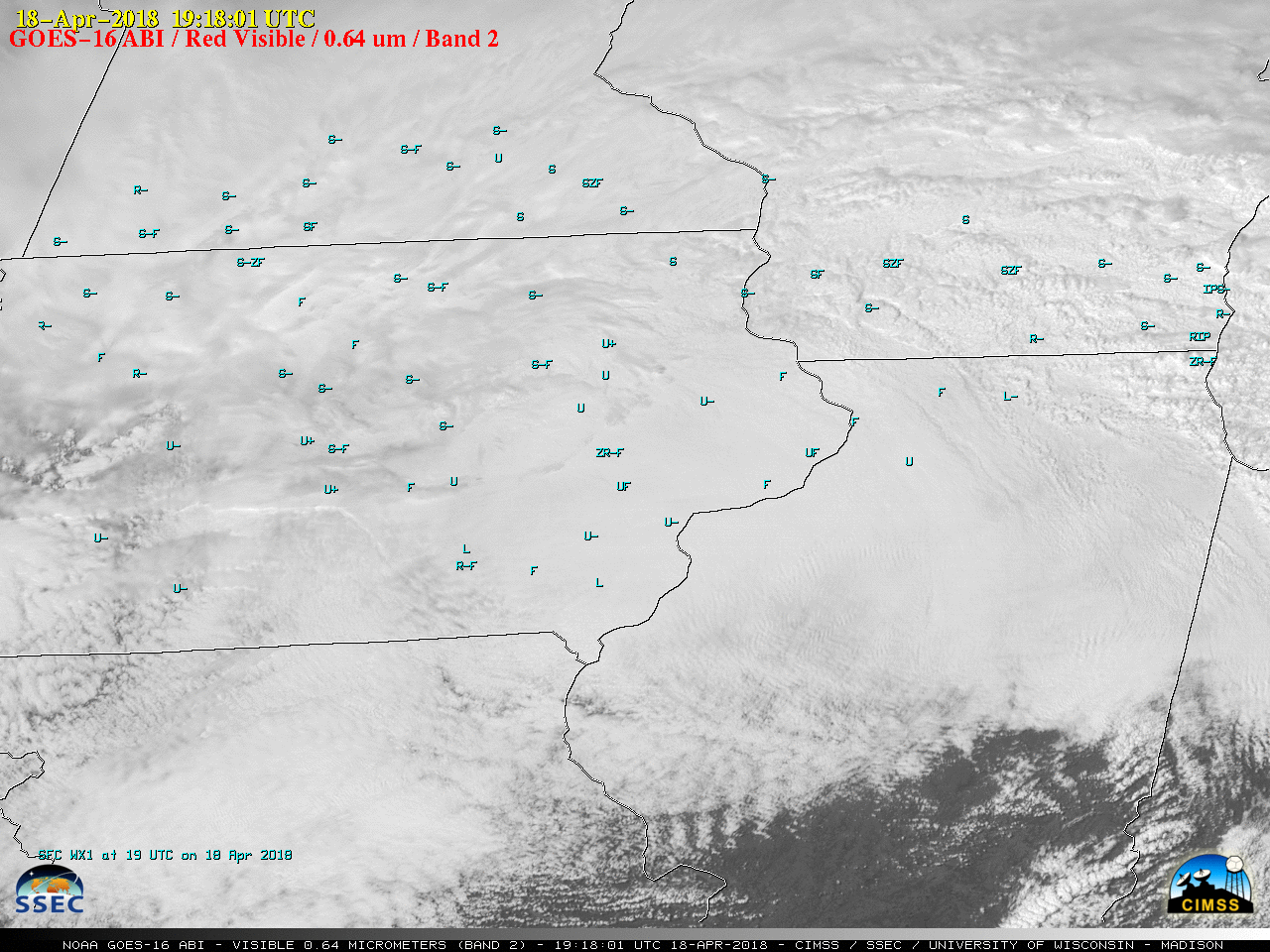
GOES-16 “Red” Visible (0.64 µm) images, with hourly surface weather type plotted in cyan [click to play MP4 animation]
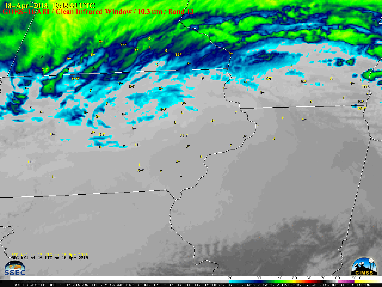
GOES-16 “Clean” Infrared Window (10.3 µm) images, with hourly surface weather type plotted in yellow [click to play MP4 animation]
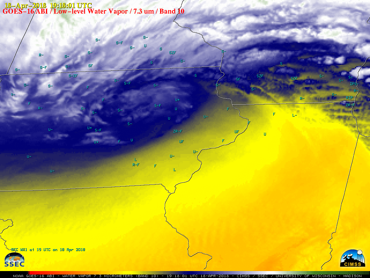
GOES-16 “Low=level” Water Vapor (7.3 µm) images, with hourly surface weather type plotted in cyan [click to play MP4 animation]
![GOES-16 GLM Groups [click to enlarge]](https://cimss.ssec.wisc.edu/satellite-blog/wp-content/uploads/sites/5/2018/04/180418_1919utc_goes16_glm_group_KMSN_thundersnow.png)
GOES-16 GLM Groups [click to enlarge]
===== 20 April Update =====
![GOES-16 true-color (daytime) and Infrared Window (10.3 µm, nighttime) images [click to play MP4 animation]](https://cimss.ssec.wisc.edu/satellite-blog/wp-content/uploads/sites/5/2018/04/180419_g16_snowmelt.jpeg)
GOES-16 natural-color RGB (daytime) and Infrared Window (10.3 µm, nighttime) images [click to play MP4 animation]