Heavy rainfall over the Hawaiian island of Kauai
![GOES-15 Water Vapor (6.5 µm, left) and Infrared Window (10.7 µm, right) images, with hourly plots of surface reports [click to play MP4 animation]](https://cimss.ssec.wisc.edu/satellite-blog/wp-content/uploads/sites/5/2018/04/G15_WV_IR_KAUAI_15APR2018_958x638_B34_2018105_150000_0002PANELS_00032.GIF)
GOES-15 Water Vapor (6.5 µm, left) and Infrared Window (10.7 µm, right) images, with hourly plots of surface reports [click to play MP4 animation]
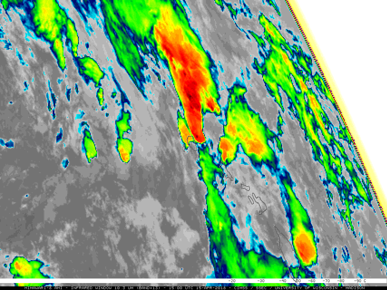
Even though the JMA Himawari-8 AHI instrument provides more frequent Water Vapor and Infrared Window images (every 10 minutes, compared to every 15-30 minutes with GOES-15) at a higher spatial resolution (2-km at satellite sub-point, vs 4-km with GOES-15), Hawai’i is located near the limb of the Himawari-8 view — so parallax was playing a major role in the apparent location of the important convective features. Note how the primary thunderstorms were displayed to the east of Kauai on the Himawari-8 images, in contrast to directly over the island on GOES-15 images.
![Himawari-8 Water Vapor (6.9 µm, left) and Infrared Window (10.4 µm, right) images, with hourly plots of surface reports [click to play MP4 animation]](https://cimss.ssec.wisc.edu/satellite-blog/wp-content/uploads/sites/5/2018/04/AHIM08_WV_IR_KAUAI_15APR2018_958x638_B913_2018105_150000_0002PANELS_00054.GIF)
Himawari-8 Water Vapor (6.9 µm, left) and Infrared Window (10.4 µm, right) images, with hourly plots of surface reports [click to play MP4 animation]
![MIMIC Total Precipitable Water product [click to play animation]](https://cimss.ssec.wisc.edu/satellite-blog/wp-content/uploads/sites/5/2018/04/180414_180416_mimic_tpw_EPAC_anim.gif)
MIMIC Total Precipitable Water product [click to play animation]
![GOES-15 Water Vapor (6.5 µm) images with mid/upper level atmospheric motion vectors [click to play animation]](https://cimss.ssec.wisc.edu/satellite-blog/wp-content/uploads/sites/5/2018/04/180414_180415_goes15_upper_level_winds_East_Pacific_anim.gif)
GOES-15 Water Vapor (6.5 µm) images with mid/upper-level atmospheric motion vectors [click to play animation]