Cyclone Marcus west of Australia and south of Java

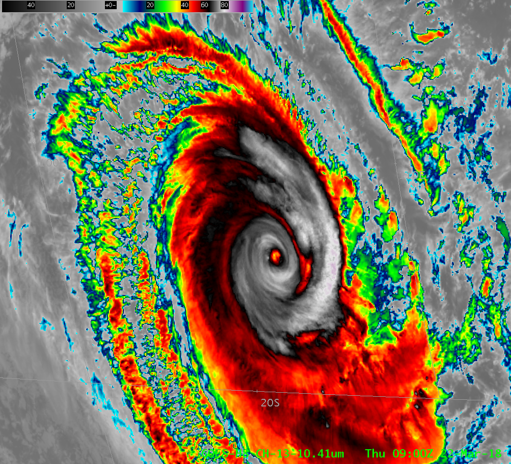
Himawari-8 AHI Band 13 (10.4 µm) infrared imagery, 0900-1540 UTC on 22 March 2018 (Click to animate)
NOAA-20 Imagery shown in this post is Non-Operational and preliminary and undergoing testing.
Himawari-8 captured the slow southward progress of Cyclone Marcus along 105 E Longitude between 0900 and 1540 UTC, as shown above. During those six hours, the storm presentation suggested weakening, with a reduction in the central dense overcast and a warming of the eye.
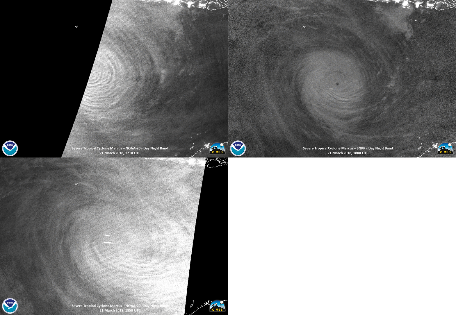
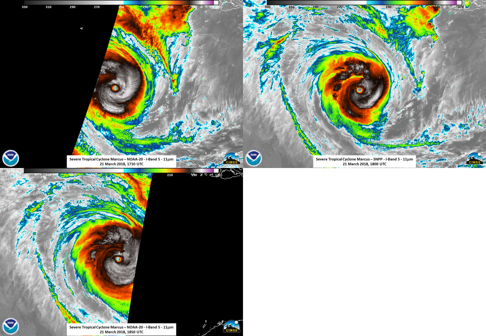
Earlier, on 21 March at around 1800 UTC, the storm was at Category 5 Intensity on the Saffir-Simpson scale, and showed excellent presentation in the Day Night Band imagery, despite the lack of lunar illumination, and in the infrared (Click here for a toggle between the 0.70 µm Day Night Band Visible imagery and the 11.45 µm infrared imagery from Suomi NPP). Significant Mesospheric Gravity Waves are apparent in all three images, the first (1710 UTC 21 March) and last (1850 UTC 21 March) from NOAA-20, and the middle (1800 UTC 21 March) from Suomi NPP. (The waves are most prominent in the 1710 UTC Image from NOAA-20) The figure shows how Suomi NPP and NOAA-20 data can be used to create animations. A similar animation with Infrared Imagery (1710, 1800, and 1850 UTC) is below. (Suomi NPP and NOAA-20 Imagery courtesy Will Straka, CIMSS).

VIIRS Day Night Band Visible (0.70 µm) Imagery at 1710 UTC (from NOAA-20), 1800 UTC (from Suomi NPP), and from 1850 UTC (from NOAA-20) (Click to enlarge)

VIIRS Day Infrared (11.45 µm) Imagery at 1710 UTC (from NOAA-20), 1800 UTC (from Suomi NPP), and from 1850 UTC (from NOAA-20) (Click to enlarge)
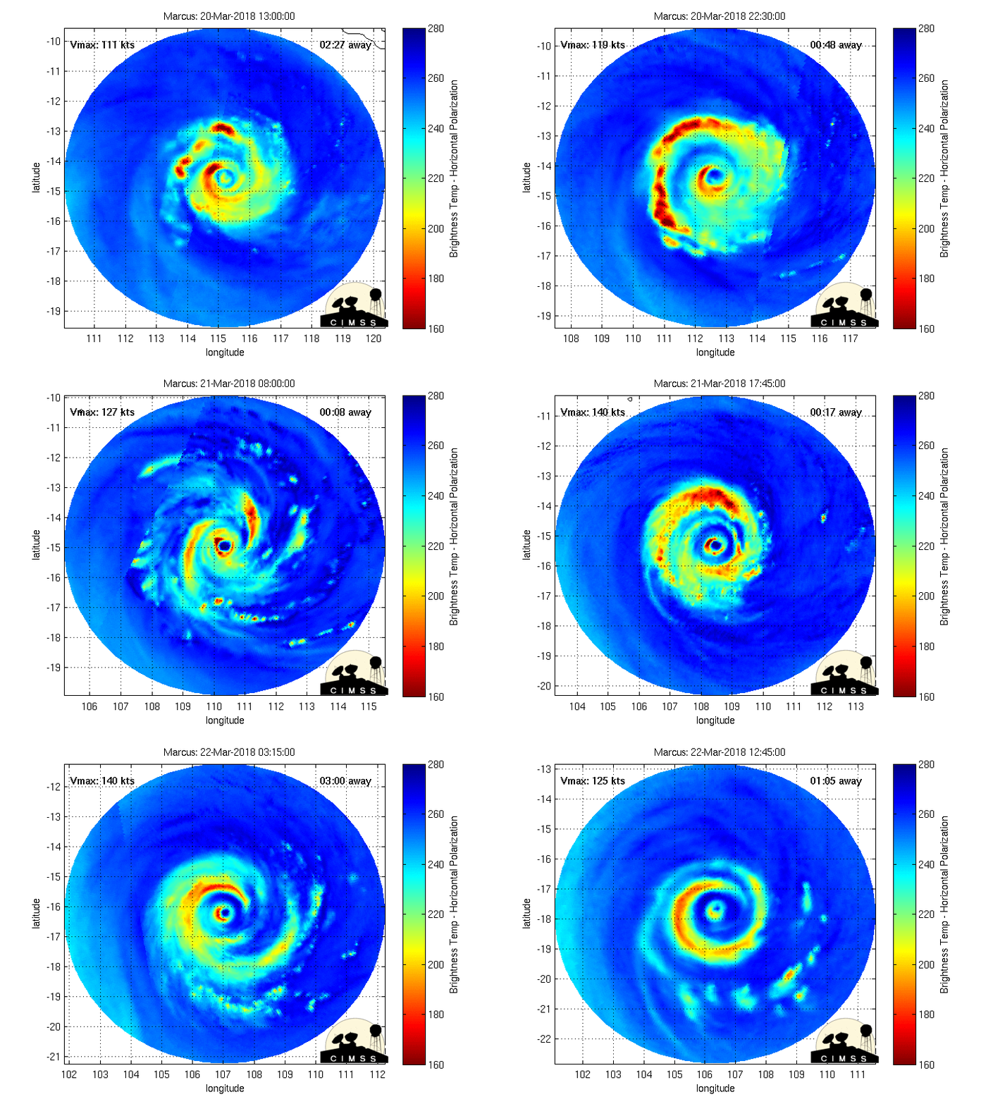
Morphed microwave imagery for the 48 hours ending at about 1300 UTC on 22 March (from this site) show the evolution of the strong convection surrounding Marcus. Eyewall convection has diminished on 22 March.

Morphed Microwave imagery centered on Cyclone Marcus for the 48 hours ending 1300 UTC on 22 March 2018 (Click to enlarge)
Added: Suomi NPP and NOAA-20 also observe the atmosphere at Microwave wavelengths using ATMS (The Advanced Technology Microwave Sounder). This toggle (created using McIDAS-V and data from the NOAA CLASS system) shows the 31 and 88 Ghz observations with the 11.45 VIIRS observations of the eye of Marcus at 1757 UTC on 21 March. The same brightness temperature enhancement is used for each image. Note that each observation shows a slightly different center location for the storm.

