Mesoscale Convective System moves across southern Wisconsin
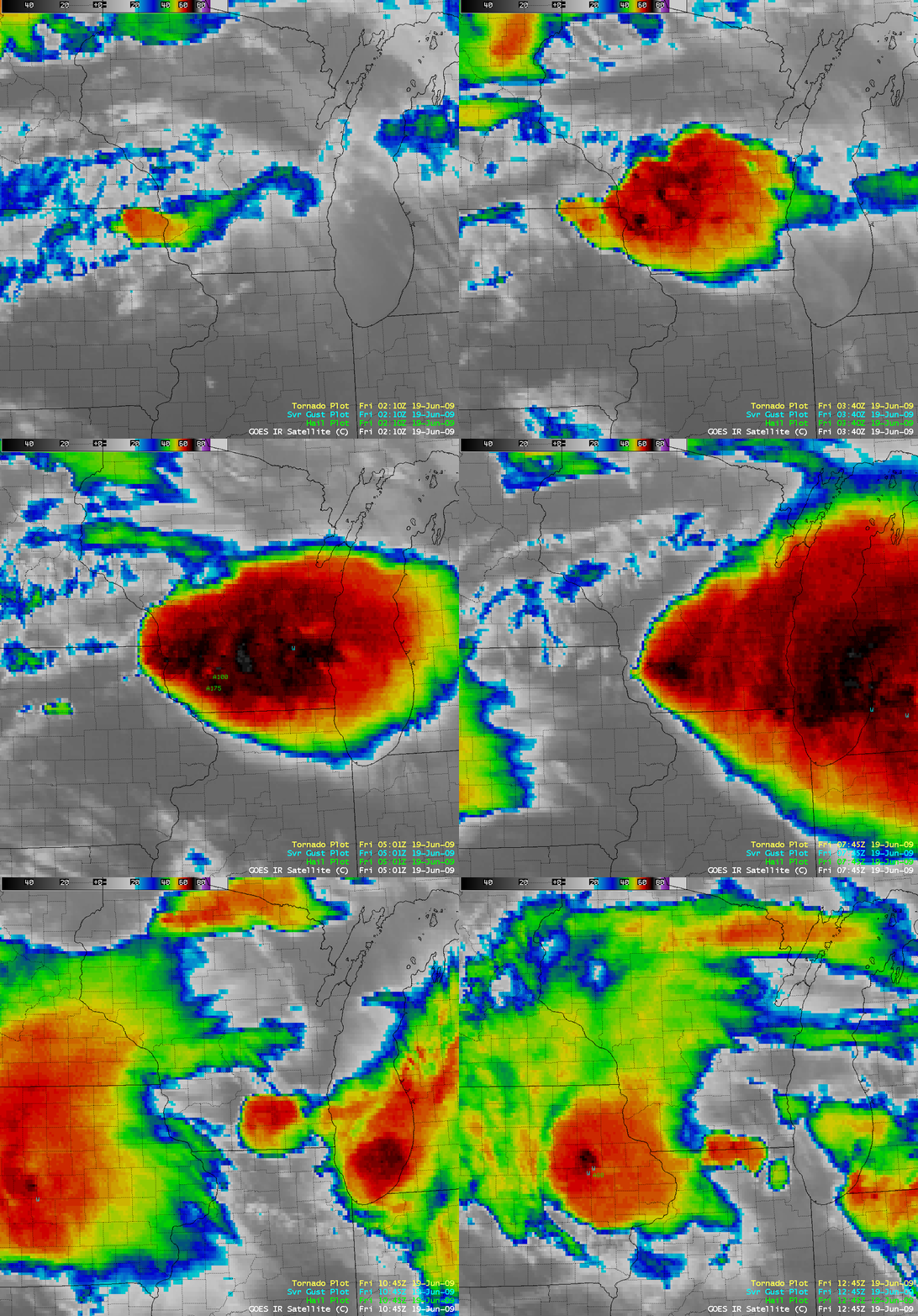
A cluster of thunderstorms developed over extreme northeastern Iowa and extreme southeastern Minnesota, and merged into a large Mesoscale Convective System (MCS) across southern Wisconsin during the early hours of 19 June 2009. AWIPS images of the 4-km resolution GOES-12 10.7 µm IR channel (above) displayed the rapid growth of this MCS, which was responsible for a number of reports of hail and damaging winds (SPC storm reports) along with heavy rainfall (5.60 inches was reported in Dodgeville, Wisconsin). GOES-12 IR brightness temperatures associated with this MCS were as cold as -75º C.
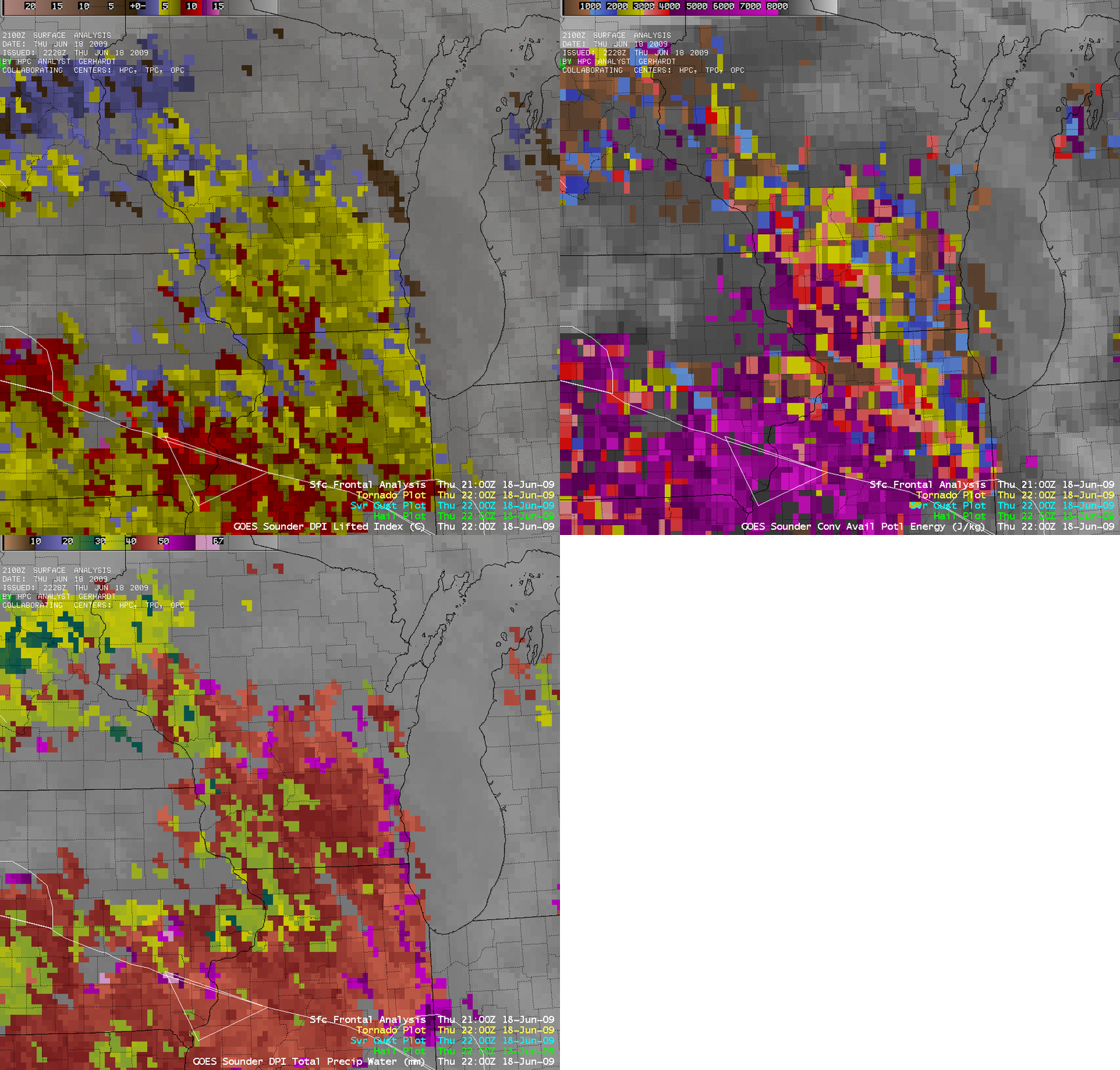
Even though the region was well to the north of a stationary frontal boundary, GOES-12 Sounder images (below) of the Lifted Index (LI), Convective Available Potential Energy (CAPE), and Total Precipitable Water (TPW) indicated that the pre-convective environment across much of southern Wisconsin was characterized by instability (LI values to -10º C and CAPE values to 3958 J/kg) and moisture (TPW values to 51 mm, or 2.00 inches).
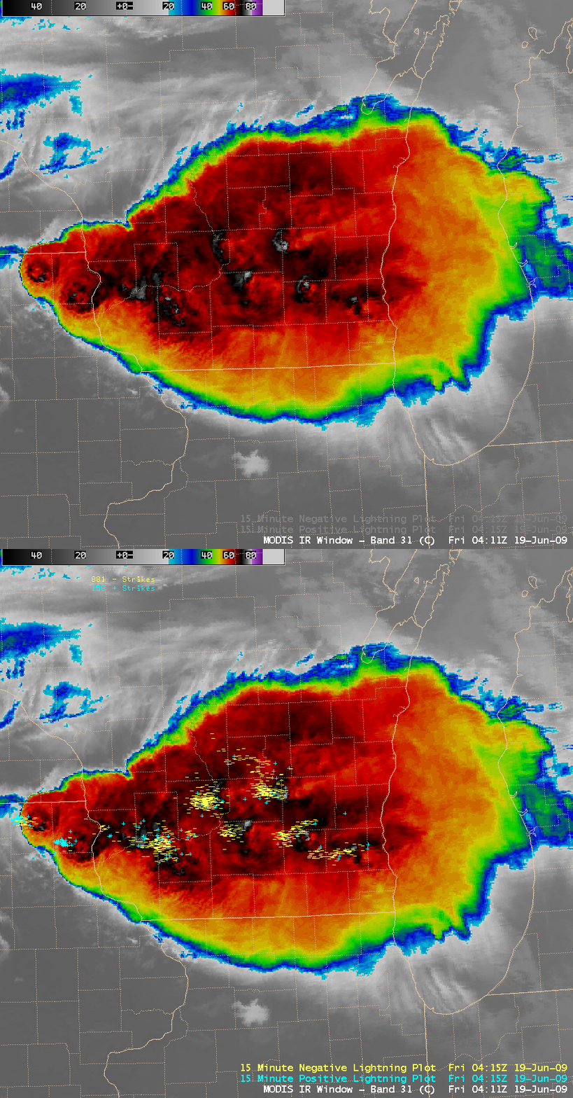
A 1-km resolution MODIS 11.0 µm IR image at 04:11 UTC (11:11 pm local time) with an overlay of cloud-to-ground lightning strikes (below) showed the tendency for lightning strikes to cluster around the many “enhanced-v” and “cold/warm couplet” signatures on the IR image. During the 15-minute interval ending at 04:15 UTC this storm produced 881 negative lightning strikes and 158 positive lightning strikes.
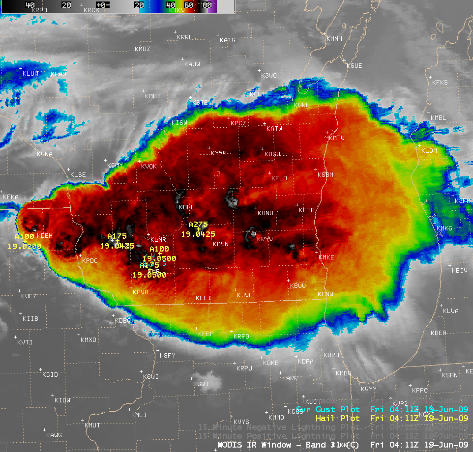
The was a report of baseball-size hail (2.75 inch diameter) just to the northwest of Madison, Wisconsin (station identifier KMSN), which was near the coldest -80º C MODIS IR cloud top pixel (below).


