Hudson Bay, Canada: slowly losing ice coverage
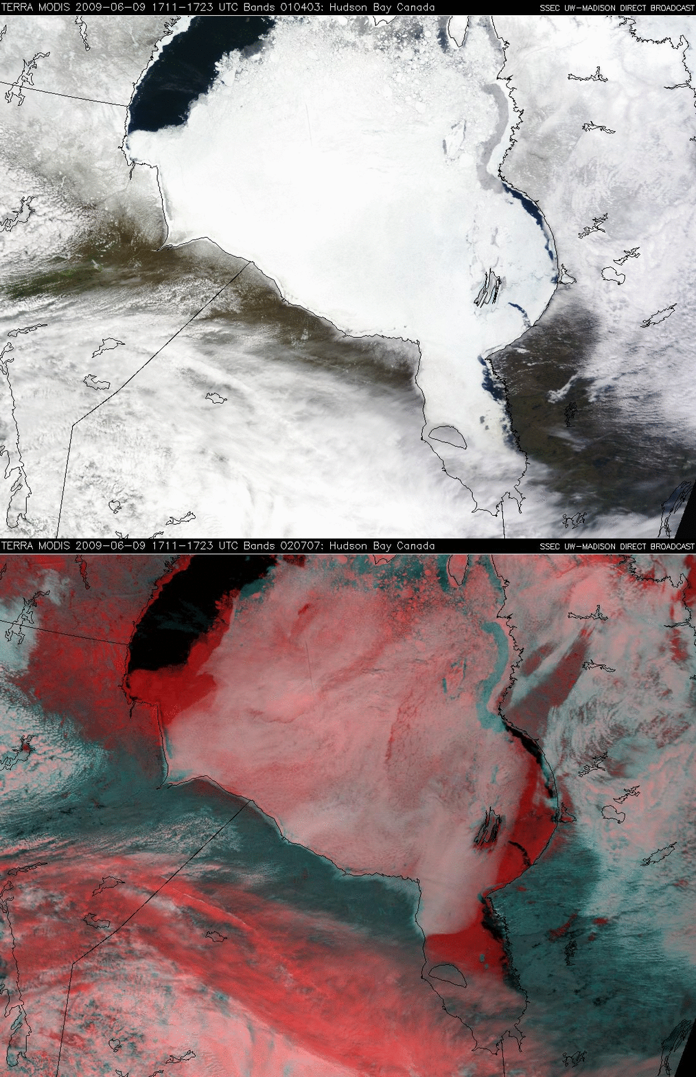
It’s a sure sign that Summer can’t be far off when Hudson Bay in Canada finally begins to lose its ice coverage — and a comparison of MODIS true color (channels 01/04/03) and false color (channels 01/07/07) Red/Green/Blue (RGB) images from the SSEC MODIS Direct Broadcast site (above) showed that large portions of the bay were indeed ice-free on 09 June 2009. Much of Hudson Bay appeared bright white on the true color image, but the false color image revealed that the bright white appearance was due not only to thick ice, but also a thin layer of supercooled water droplet cloud that had formed as warmer air moved over the cold ice surface. The ice in the bay (along with deeper areas of snow cover on the ground, and thick high clouds composed of ice crystals) appeared as darker red features on the false color image.
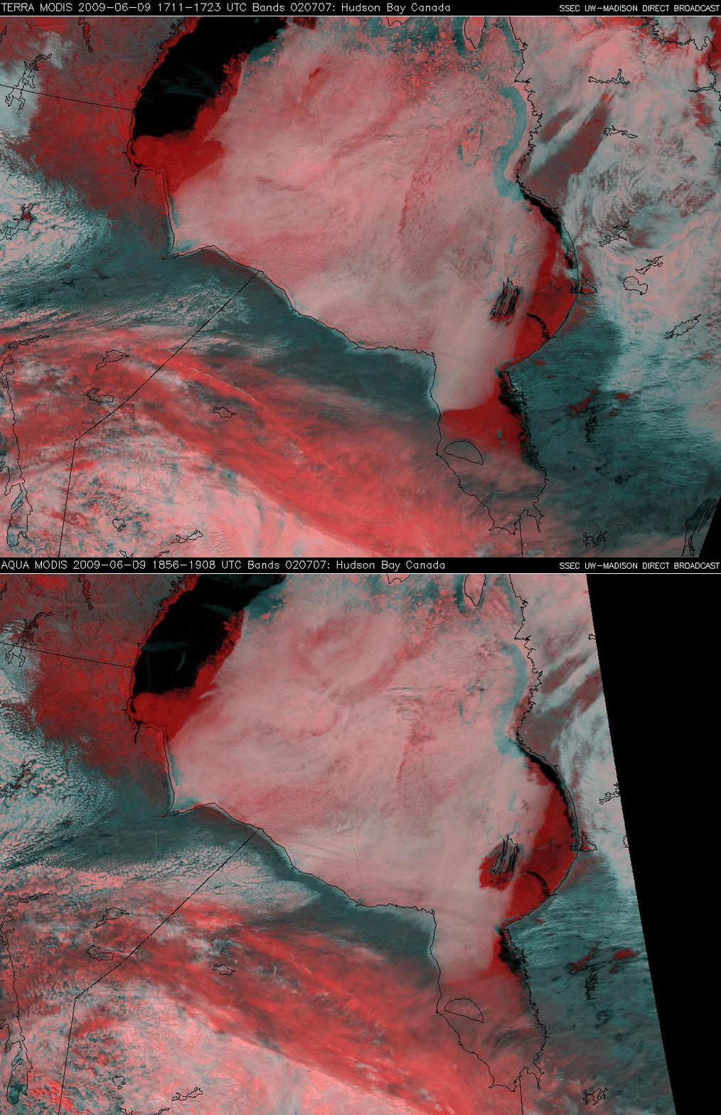
A comparison of the 17:11 UTC Terra and the 18:56 UTC Aqua MODIS false color images (below) indicated that the thin supercooled water droplet cloud layer above the ice was moving during that short time period, as evident by the changes in the location of the cloud edges.
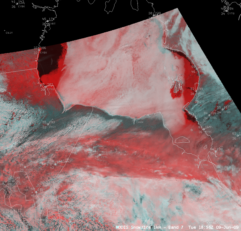
While this type of RGB imagery is currently not available on today’s 8-bit AWIPS system, changes to the AWIPS II architecture will allow 24-bit RGB images to be created and displayed; a simulated AWIPS RGB false color image is shown below.
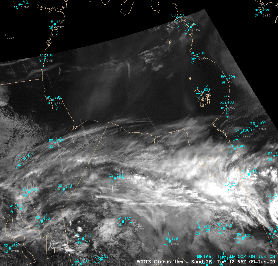
You may have noticed the appearance of several very thin linear features on the true and false color images above; these were contrail segments from aircraft flying over the region, which were more easily seen on an AWIPS image of the MODIS near-IR “cirrus detection” channel (below). In addition to ice crystal clouds, the “cirrus detection” imagery is also useful for detecting the presence of airborne particles that are good scatterers of light (such as smoke, dust, volcanic ash) — and the large patches of brighter gray shades seen over Hudson Bay could be areas of smoke aloft from recent fire activity in Alaska and northern Canada.


