Eruption of Volcán de Fuego in Guatemala
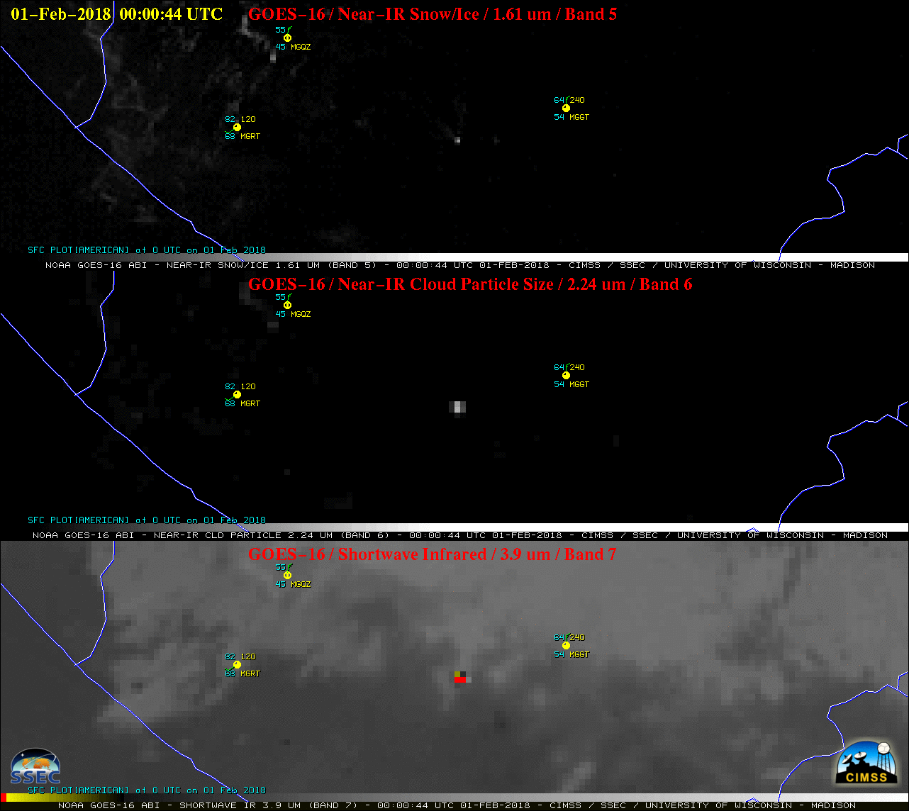
GOES-16 Near-Infrared “Snow/Ice” (1.61 µm, top), Near-Infrared “Cloud Particle Size” (2.24 µm, middle) and Shortwave Infrared (3.9 µm, bottom) images [click to animate]
Multi-spectral retrievals of Ash Cloud Height from the NOAA/CIMSS Volcanic Cloud Monitoring site (below) indicated that volcanic ash extended to altitudes in the 4-6 km range (yellow to green enhancement), with isolated 7 km pixels at 1315 UTC. The product also showed the effect of a burst of southwesterly winds just after 11 UTC, which began to transport some of the ash northeastward (as mentioned in the 1332 UTC advisory).
![GOES-16 Ash Height product [click to animate]](https://cimss.ssec.wisc.edu/satellite-blog/wp-content/uploads/sites/5/2018/02/180201_goes16_Fuego_ash_height_anim.gif)
GOES-16 Ash Height product [click to animate]
![Landsat-8 False-color RGB image [click to enlarge]](https://cimss.ssec.wisc.edu/satellite-blog/wp-content/uploads/sites/5/2018/02/180201_1624utc_landsat8_falsecolor_anim.gif)
Landsat-8 False-color RGB image [click to enlarge]