Mountain waves: GOES-11 versus GOES-13 water vapor channel
An extensive area of mountain waves was apparent on the “water vapor channel” images from GOES-11 and GOES-13 on 22 November 2006 (above). Animation of these images (QuickTime | Java) shows that the mountain waves were present for several hours across a good deal of the Northwest US, becoming well-defined over Wyoming after about 10:00 UTC. Due to the relatively dry air mass that was present over that region, the GOES-11 water vapor channel weighing function was peaking at a fairly low altitude (around 600 hPa, or about 3 km above ground level). The improvement in spatial resolution of the water vapor channel (from 8km on GOES-11 to 4 km on GOES-13) allows such mountain wave features to be detected with better clarity; in addition, the 6.5µm water vapor channel on GOES-13 is spectrally wider than the 6.7µm water vapor channel on GOES-11, which accounts for some of the improved mountain wave detection capability. This improved 4 km resolution water vapor channel is also available on GOES-12.
.
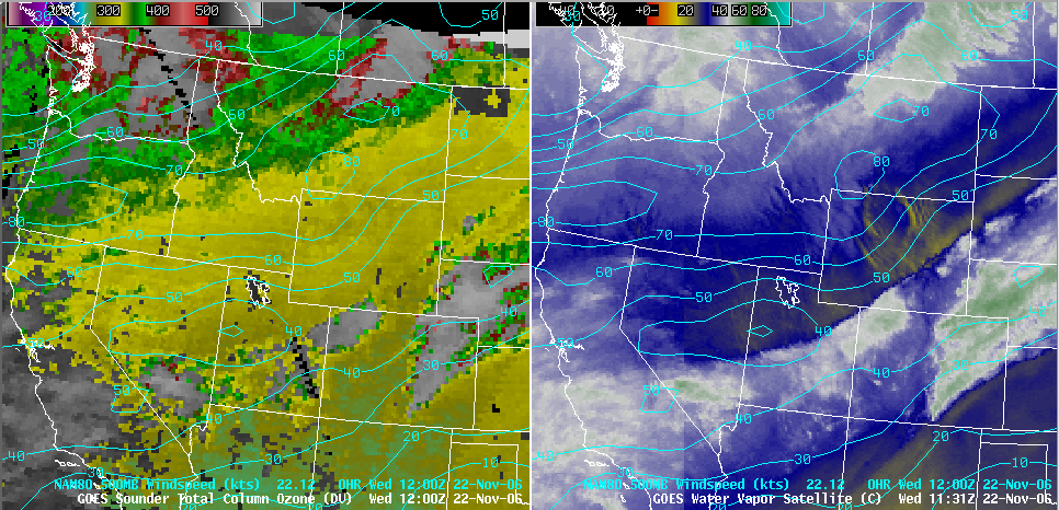
Wind speed isotachs at the 500 hPa level (below) indicated that strong winds associated with a passing jet stream axis were responsible for generating these mountain waves (also note the corresponding gradient in GOES Sounder total column ozone, poleward of the axis of strongest winds). This mountain wave signature on water vapor channel imagery is an indicator of turbulence potential; while there were no pilot reports of turbulence during that 05-14 UTC time period, the Graphical Turbulence Guidance product did indicate a Moderate to Severe potential for turbulence across the region (over Wyoming in particular).


