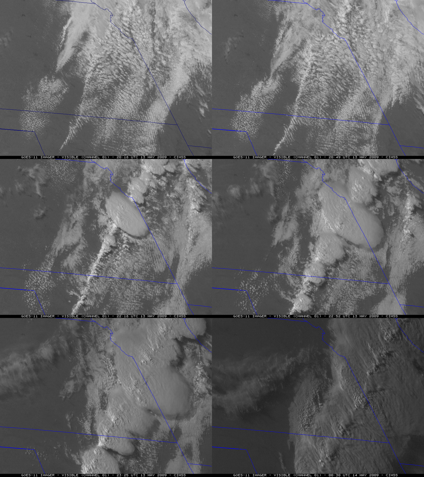
GOES-11 Super Rapid Scan Operations (SRSO) images
The GOES-11 satellite was once again placed into Super Rapid Scan Operations (SRSO) on 13 May 2009, providing images as frequently as every 1 minute during portions of the late afternoon and early evening hours. The GOES-11 visible channel imagery (above; also available as a QuickTime animation) shows the explosive development of severe convection along a dryline in Oklahoma, Kansas, and Missouri. According to the SPC Storm Reports, this line of storms produced several tornadoes, hail up to 2.75 inch in diameter, and wind gusts to 80 mph.
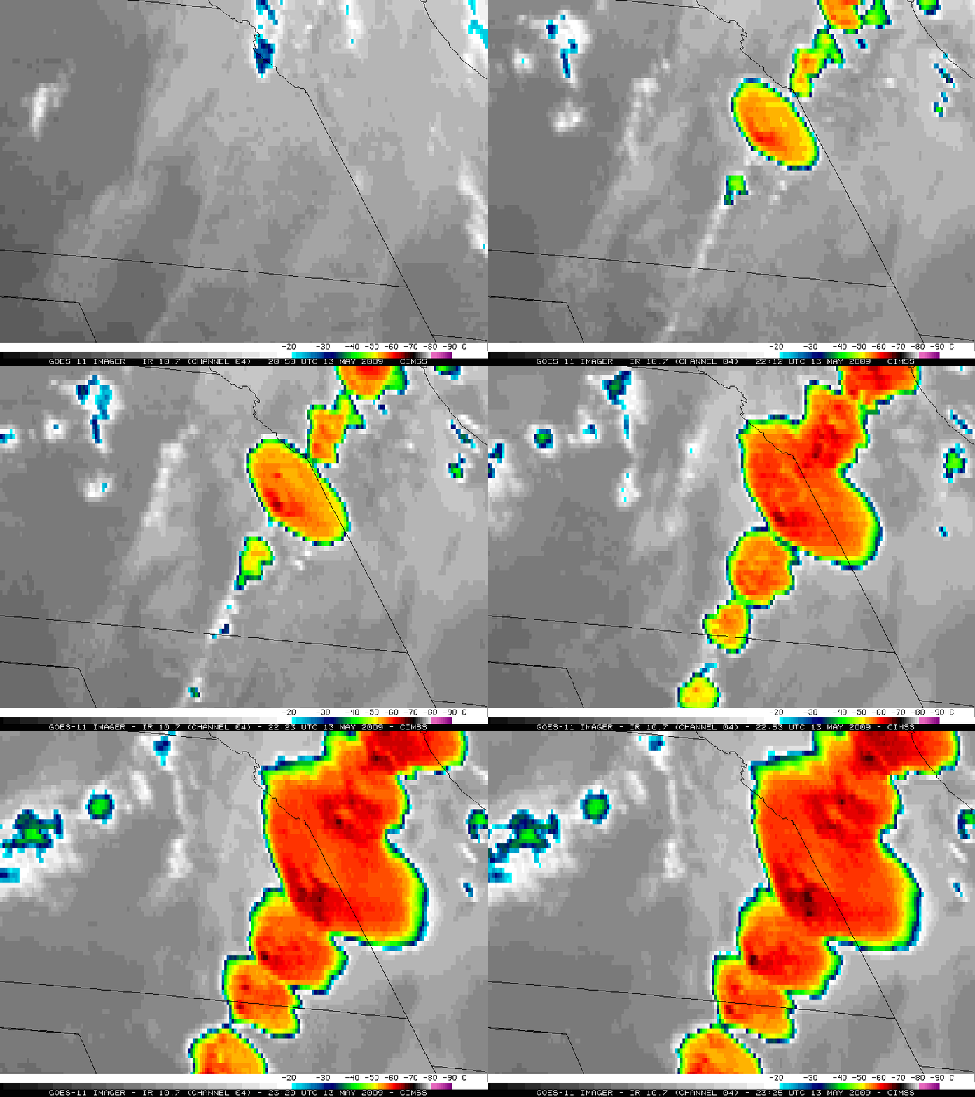
GOES-11 10.7 µm IR imagery (below; also available as a QuickTime animation) revealed that the cloud top temperatures quickly cooled to values of -60º to -70º C (red to black colors) as these thunderstorms developed and intensified.
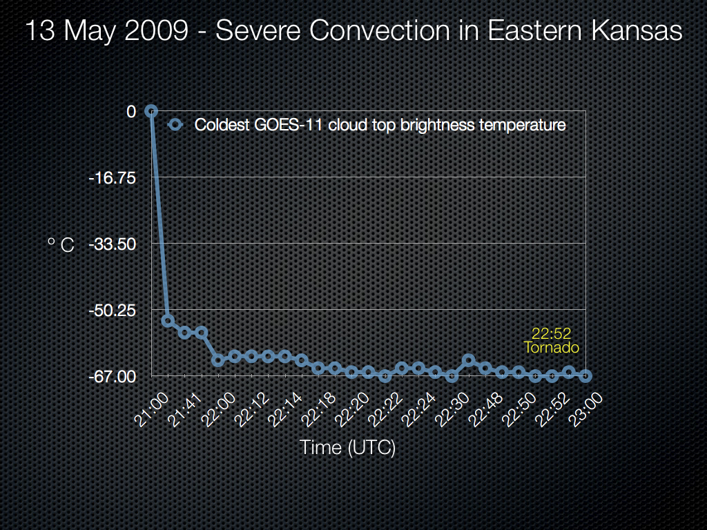
The plot of the coldest GOES-11 IR brightness temperatures (below) for the initial (and largest) storm that formed in eastern Kansas shows that the minimum cloud top temperatures cooled to within a few degrees of the -64º C tropopause temperature (taken from the Topeka, Kansas rawinsonde report) after around 22:00 UTC. It is interesting to note that there was a slight cloud top temperature warming seen at 22:45 UTC — which is about 7 minutes prior to the first reported tornado from that particular storm. If this type of “pre-tornado cloud top temperature warming” signal is something that frequently occurs, then having access to satellite imagery at a high temporal resolution will be critical to utilizing any possible predictive value of such a signal.
A comparison of the 4-km resolution GOES-11 10.7 µm and the 1-km resolution NOAA-15 10.8 µm IR images (below) demonstrates the value of higher spatial resolution: a clear “enhanced-v” signature was seen on the NOAA-15 image, while no such signature was obvious on the GOES-11 image. Note that the minimum cloud top brightness temperature in the overshooting top region was 15º C colder on the NOAA-15 IR image. Also, due to the large satellite viewing angle from the GOES-11 satellite (the satellite zenith angle for Topeka, Kansas is 61 degrees), a significant parallax shift was apparent with this particular storm — the overshooting top region was displaced farther to the northeast of Emporia, Kansas (KEMP) on the GOES-11 IR image.


