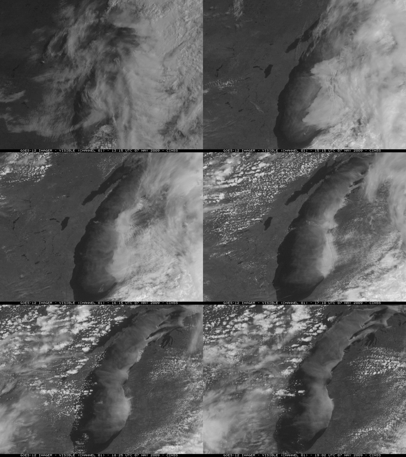
Advection fog over Lake Michigan
GOES-12 visible channel images (above) showed advection fog that developed over Lake Michigan during the day on 07 May 2009. As pointed out on the US Air Quality (aka The Smog Blog) site, this fog “fooled” the MODIS Aerosol Optical Depth (AOD) algorithm, causing a false signal of very high AOD over Lake Michigan. Also note the appearance of “shock waves” in the fog bank as it encountered obstructions to the southwesterly boundary layer flow in two areas: (1) along the western coastline of Lower Michigan (250-m resolution MODIS true color image), and (2) some of the larger islands in the northern portion of Lake Michigan (250-m resolution MODIS true color image).
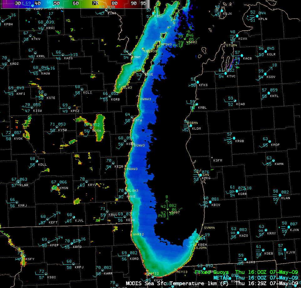
This fog formed as warm and relatively humid air (with dew points in the middle 50s F) moved across the cold waters of Lake Michigan. An AWIPS image of the MODIS Sea Surface Temperature (SST) product (below) indicated that that mid-lake SST values were still in the 37-39º F range — and this was confirmed by the water temperature values of 37º F and 38º F reported by buoys 45002 and 45007, respectively.
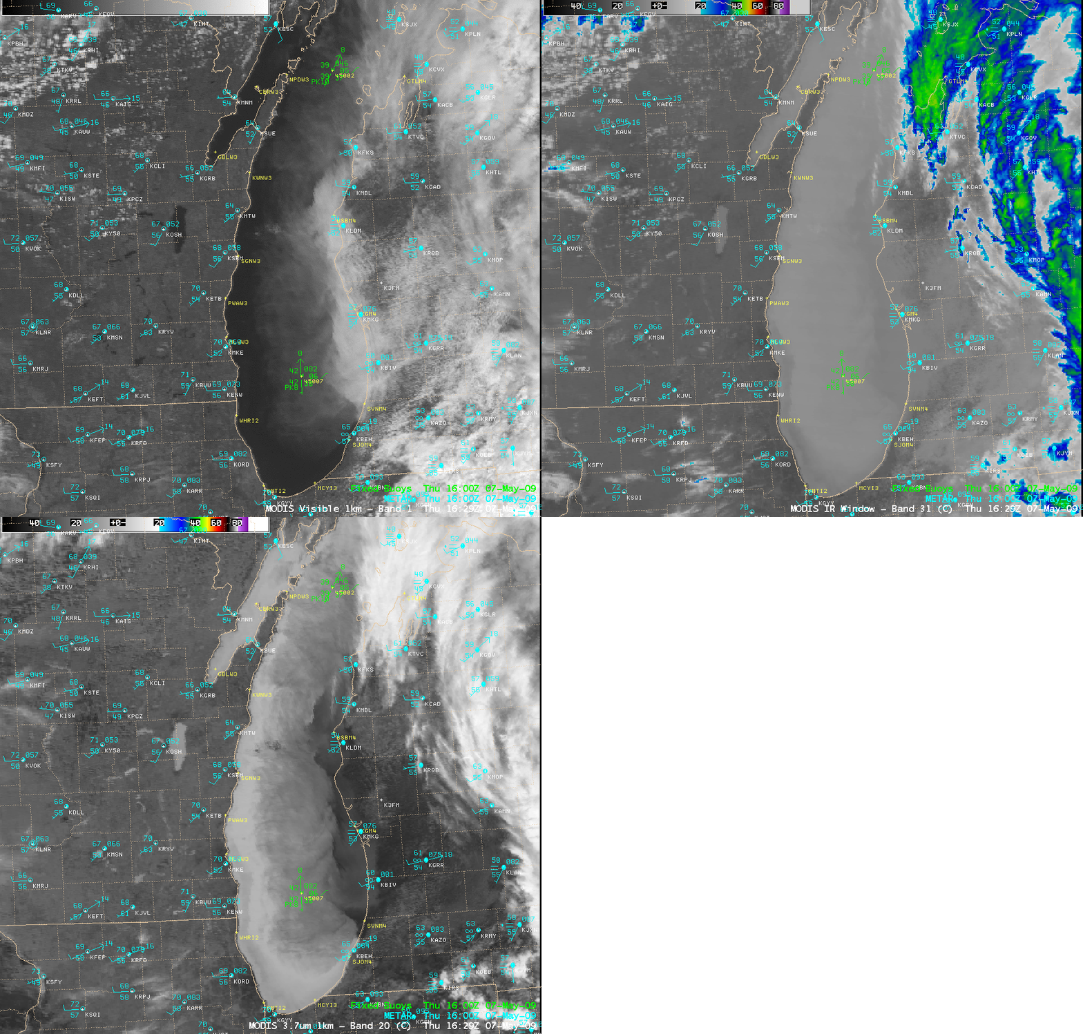
The western portion of the advection fog feature was quite thin, so the fog edge was difficult to pick out on the MODIS 11.0 µm “IR window” imagery (below). However, the fog boundaries were quite apparent on the 3.7 µm “shortwave IR” imagery, due to the reflection of solar radiation off the top of the water droplet fog feature (which made the fog appear darker/warmer).
The GOES sounder Cloud Top Height product (below) indicated that the tops of the fog feature over the southern half of Lake Michigan were generally around 2580 feet (darker brown color enhancement).


