Harvey near the coast of Texas

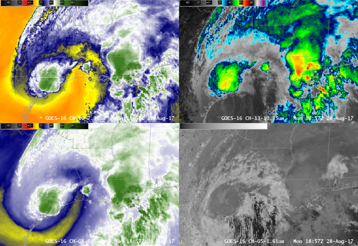
GOES-16 ABI Band 8 (6.19 µm, “Upper Level Water Vapor”, lower left), ABI Band 10 (7.3 µm, “Lower Level Water Vapor”, upper left), ABI Band 13 (10.3 µm, “Clean Window Infrared”, upper right) and ABI Band 5 (1.61 µm, “Snow/Ice Channel”, lower right) from 1542-1857 UTC on 28 August (Click to animate)
GOES-16 data (ABI and GLM) posted on this page are preliminary, non-operational and are undergoing testing
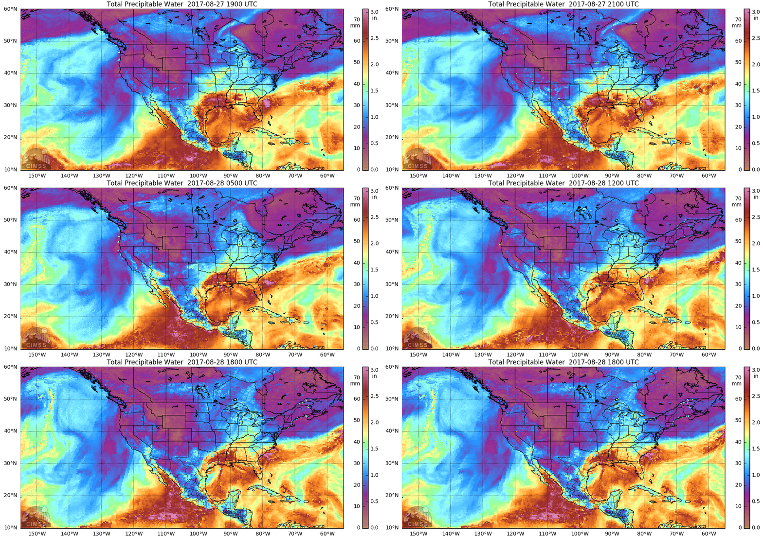
Meandering Tropical Storm Harvey is near the Gulf Coast of Texas during the day on Monday 28 August as shown in the 4-panel Animation above. The Four panels include, clockwise from lower left, Upper Level Water Vapor (6.19 µm), Lower Level Water Vapor (7.3 µm), Clean Window (10.3 µm) and Snow/Ice Channel (1.61 µm) (ABI Bands 8, 10, 13 and 5, respectively). The deepest and strongest convection with Harvey has shifted eastward into Louisiana; dry mid-tropospheric air is apparent in both water vapor infrared images; Convection continues near the center of the storm; onshore low-level flow is apparent in the Snow/Ice channel. Total Precipitable Water computed from Microwave Imagery (at this site), below, shows that abundant moisture remains over southeast Texas and Louisiana.
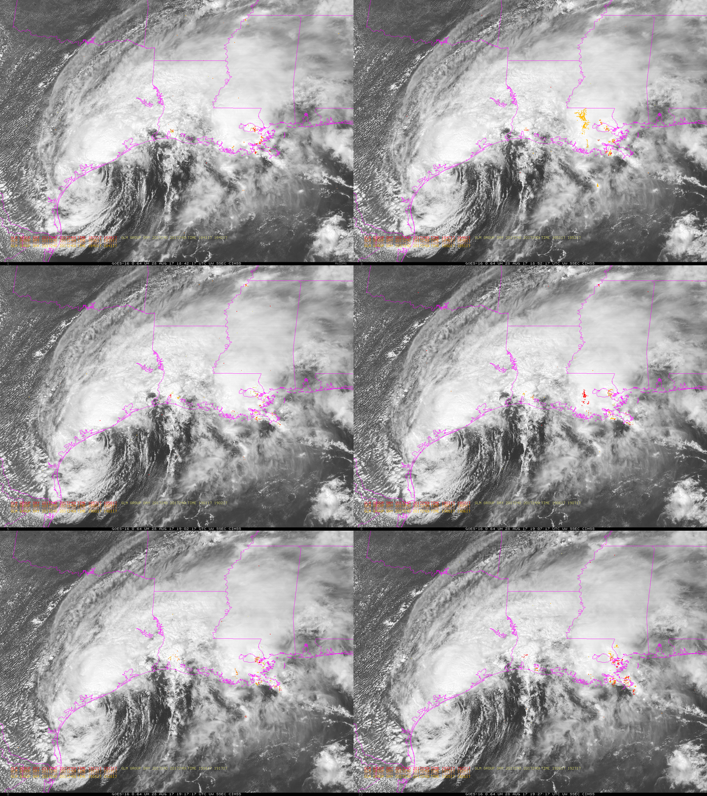
GOES-16 Visible Imagery (0.64 µm), below, show the center of Harvey to be just offshore (Click here for the latest National Hurricane Center advisories on Harvey), with moist low-level flow from the Gulf into southeast Texas and southwest Louisiana. Geostationary Lightning Mapper (GLM) observations of Lightning Groups (Events are grouped into Groups, Groups are grouped into Flashes), show scant lightning associated with the center of Harvey. More lightning activity is apparent over southeastern Louisiana (including some apparently spurious signals near Baton Rouge). A similar animation over Infrared Imagery is here.

GOES-16 ABI Visible Imagery (0.64 µm) and GLM Observations of Lightning Groups from 1842-1927 UTC on 28 August (Click to enlarge)
For the latest on Harvey and its dangerous rainfall, consult the National Hurricane Center website, or the CIMSS Tropical Weather Website, or the Hydrologic Prediction Website.


