Large hail in eastern Colorado
![GOES-16 Visible (0.64 µm, left) and Infrared Window (10.4 µm, right) images, with surface station identifiers in yellow and SPC reports of hail size in cyan [click to play MP4 animation]](https://cimss.ssec.wisc.edu/satellite-blog/images/2017/05/170508_goes16_mesoscale_visible_infrared_spc_storm_reports_Colorado_hail_storm_anim.gif)
GOES-16 Visible (0.64 µm, left) and Infrared Window (10.35 µm, right) images, with surface station identifiers plotted in yellow and SPC reports of hail size plotted in red/cyan [click to play animation | MP4]
Severe thunderstorms developed over eastern Colorado on 08 May 2017, producing large hail (especially in the Denver area: SPC storm reports | NWS Boulder summary). Both GOES-16 Mesoscale Sectors were positioned over that region, providing 30-second interval images — Visible (0.64 µm) and Infrared Window (10.35 µm) images (above) showed the convection in great detail, with SPC storm reports of hail size (inches; H275 = 2.75 inches in diameter) plotted in red/cyan. Several of the storms exhibited well-defined overshooting tops in the Visible imagery, as well as “enhanced-V” and/or cold-warm “thermal couplet” signatures on the Infrared imagery.
#GOES16 30-sec visible texture (blue (red) lines, weak (strong) overshooting) and IR cold spot (magenta) detects strong CO storms on 8 May pic.twitter.com/ApGrC0NLNH
— Kris Bedka (@krisbedka) May 11, 2017
A comparison of 30-second interval GOES-16 Mesoscale Sector and 15-minute interval GOES-13 (GOES-East) Routine Scan visible images (below) demonstrated the clear advantage of rapid-scan imagery for monitoring convective development. Also note the degradation of GOES-13 visible imagery (the cloud features do not appear as bright), due to the age of that satellite — the GOES-R series ABI instrument features on-board visible detector calibration, so this type of visible image degradation over time will not occur.
![GOES-16 Visible (0.64 µm, left) and GOES-13 Visible (0.63 µm, right) images, with surface station identifiers in yellow [click to play animation | MP4]](https://cimss.ssec.wisc.edu/satellite-blog/wp-content/uploads/sites/5/2017/05/170508_goes16_goes13_visible_Colorado_hail_storm_anim.gif)
GOES-16 Visible (0.64 µm, left) and GOES-13 Visible (0.63 µm, right) images, with surface station identifiers plotted in yellow [click to play animation | MP4]
/na2017_05_08_128_npp.gif)
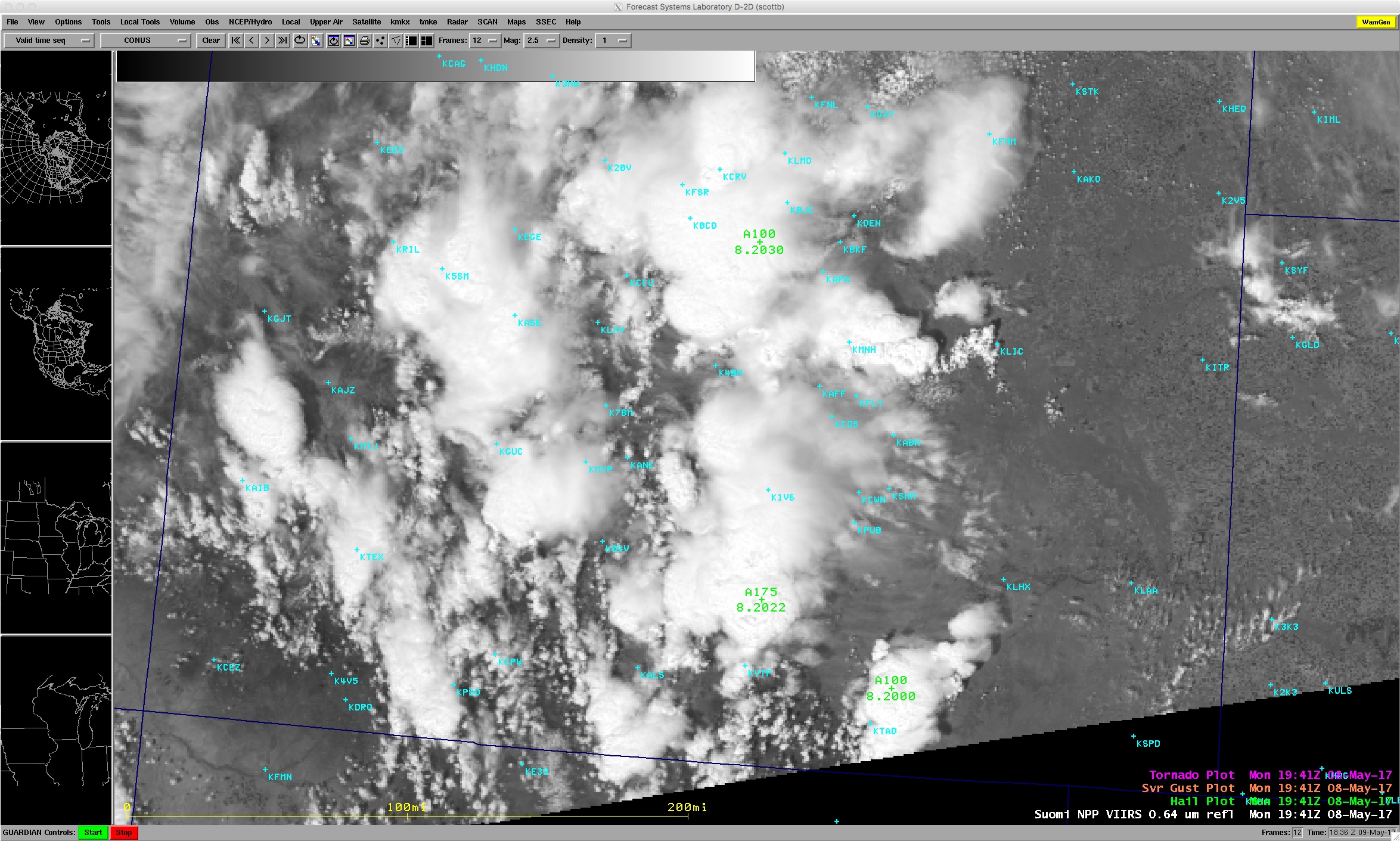
![Suomi NPP VIIRS Visible (0.64 µm) and Infrared Window (11.45 µm) images [click to enlarge]](https://cimss.ssec.wisc.edu/satellite-blog/wp-content/uploads/sites/5/2017/05/170508_1937utc_viirs_visible_infrared_Colorado_anim.gif)
Suomi NPP VIIRS Visible (0.64 µm) and Infrared Window (11.45 µm) images, with surface station identifiers plotted in cyan [click to enlarge]