Undular bore in Florida
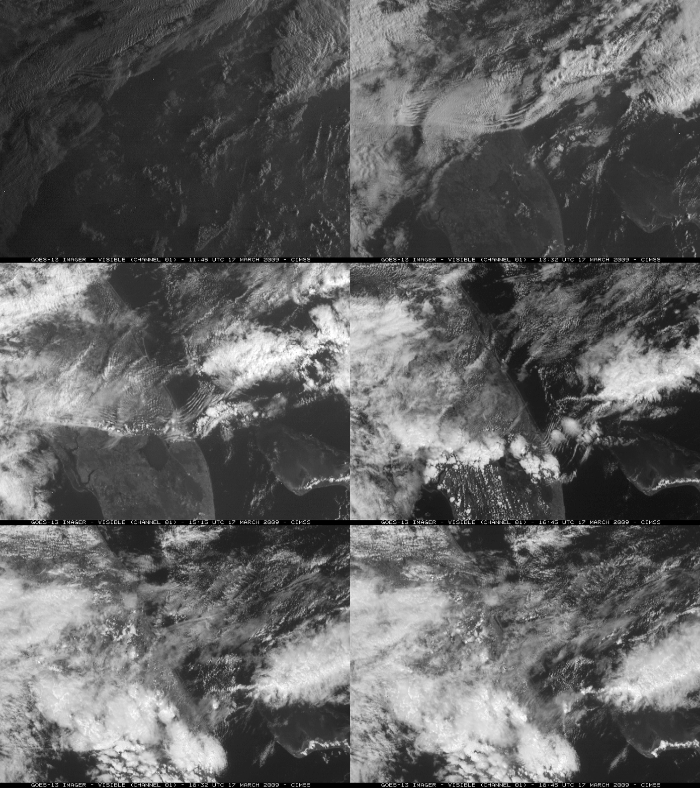
GOES-13 visible imagery (above) showed an undular bore that was propagating southward across the Florida peninsula on 17 March 2009. This bore feature appeared to play a role in the initiation of a line of convective clouds that developed over central and southern Florida after about 15 UTC (10am local time). The resulting precipitation was farily light, however, with rainfall amounts of 0.10 inch or less.
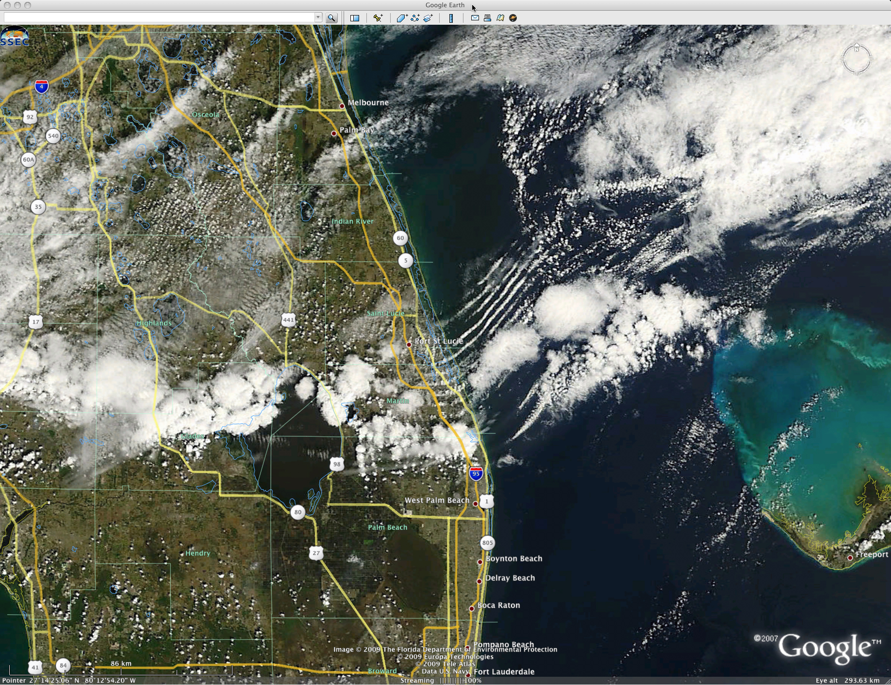
A MODIS true color image (below, displayed using Google Earth) revealed that there were at least 10 individual cloud bands (also known as “solitons”) associated with this undular bore. The fact that this particular bore feature appeared to help with convective initiation might seem counter-intuitive, given that the propagation of bores requires a stable layer to propagate — but the convection may have fired along the leading edge of the cold frontal boundary (which was likely out ahead of the undular bore).
The photo below shows the leading edge of the undular bore clouds (taken just south of Melbourne, along the coast, around 9:00 am local time).


