Typhoon Lionrock in the West Pacific
![Track of Typhoon Lionrock [click to enlarge]](https://cimss.ssec.wisc.edu/satellite-blog/wp-content/uploads/sites/5/2016/08/Typhoon_Lionrock_track.jpg)
Track of Typhoon Lionrock [click to enlarge]
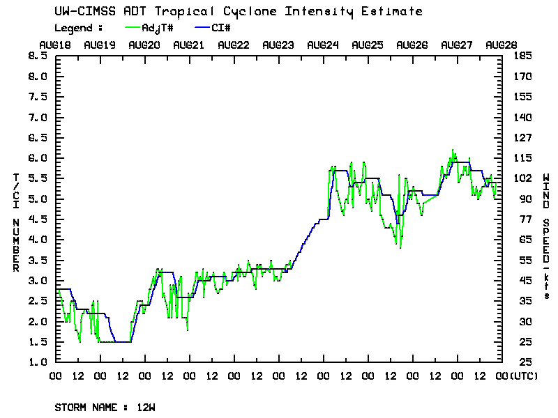
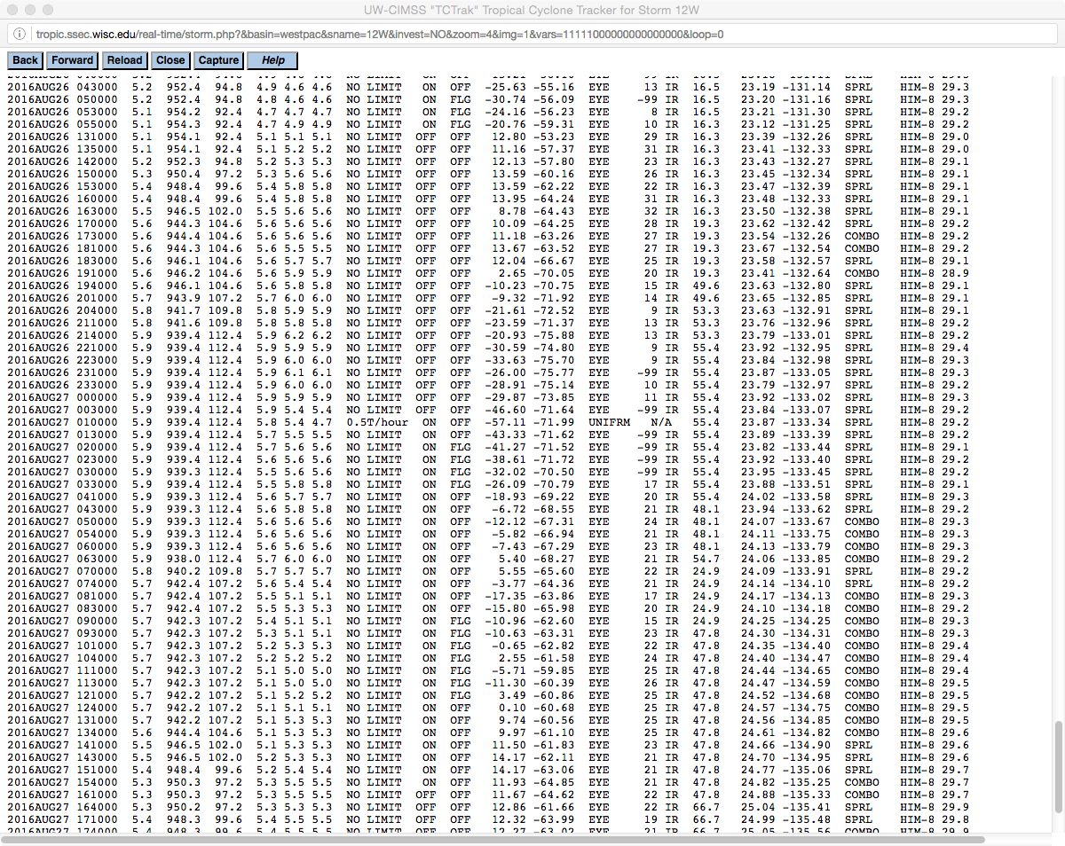
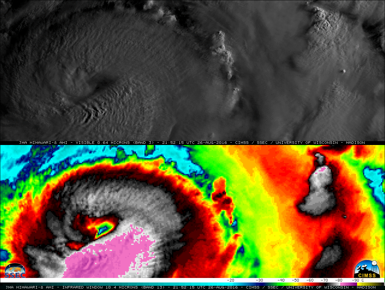
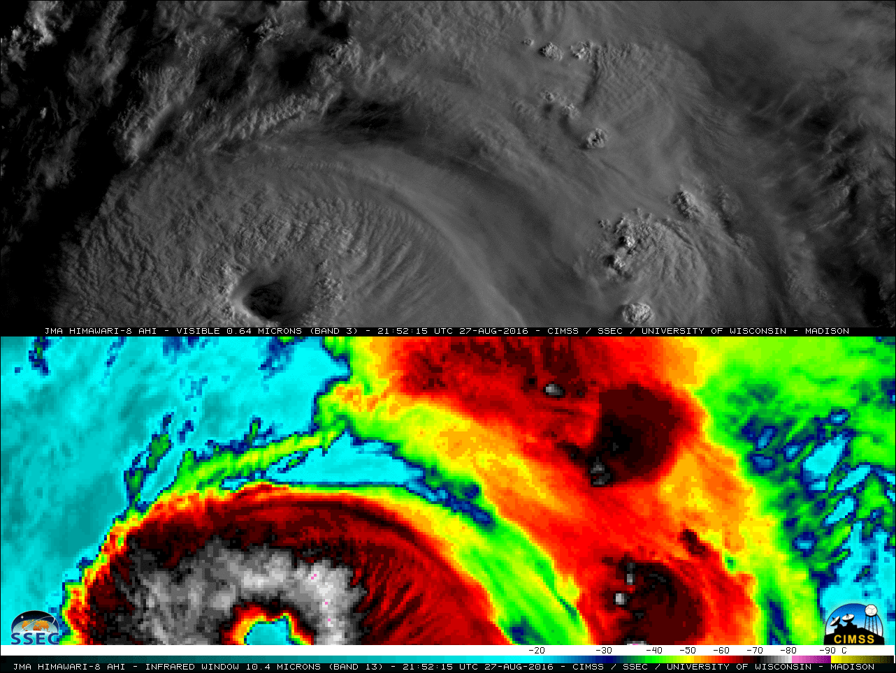
During this period of intensification, 2.5 minute interval rapid-scan Himawari-8 Visible (0.64 µm) and Infrared Window (10.4 µm) images (below; also available as a large 85 Mbyte animated GIF) revealed complex patterns of cloud-top radial and transverse banding. Surface mesoscale vortices were also seen at times within the open eye feature.
![Himawari-8 0.64 µm Visible (top) and 10.4 µm Infrared Window (bottom) images [click to play MP4 animation]](https://cimss.ssec.wisc.edu/satellite-blog/wp-content/uploads/sites/5/2016/08/480x1280_AHIM08_B313_HIM08_VIS_IR_LIONROCK_27AUG2016_2016239_222215_0002PANELS.GIF)
Himawari-8 0.64 µm Visible (top) and 10.4 µm Infrared Window (bottom) images [click to play MP4 animation]
![DMSP-15 SSMI Microwave (85 GHz) and Himawari-8 Infrared Window (10.4 µm) images [click to enlarge]](https://cimss.ssec.wisc.edu/satellite-blog/wp-content/uploads/sites/5/2016/08/160827_18utc_msp15_ssmi_himawari8_infrared_Typhoon_Lionrock_anim.gif)
DMSP-15 SSMI Microwave (85 GHz) and Himawari-8 Infrared Window (10.4 µm) images [click to enlarge]
![Suomi NPP VIIRS Day/Night Band (0.7 µm) and Infrared Window (11.45 µm) images [click to enlarge]](https://cimss.ssec.wisc.edu/satellite-blog/wp-content/uploads/sites/5/2016/08/160826_1631utc_viirs_dnb_infrared_Typhoon_Lionrock_anim.gif)
Suomi NPP VIIRS Day/Night Band (0.7 µm) and Infrared Window (11.45 µm) images [click to enlarge]
===== 28 August Update =====
![Himawari-8 0.64 µm Visible (top) and 10.4 µm Infrared Window (bottom) images [click to play MP4 animation]](https://cimss.ssec.wisc.edu/satellite-blog/wp-content/uploads/sites/5/2016/08/480x1280_AHIM08_B313_HIM08_VIS_IR_LIONROCK_28AUG2016_2016241_064945_0002PANELS.GIF)
Himawari-8 0.64 µm Visible (top) and 10.4 µm Infrared Window (bottom) images [click to play MP4 animation]