Cold air diving southward across the Plains

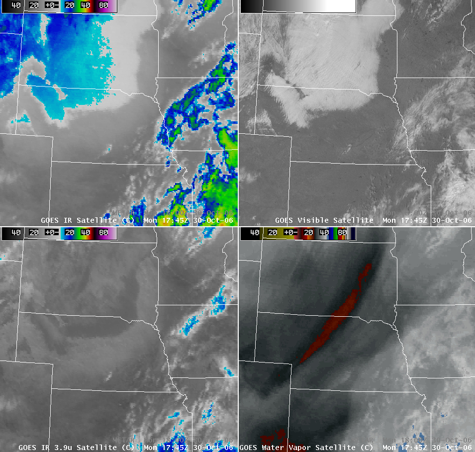
A strong cyclone centered over the northcentral US was producing heavy snow across much of North Dakota on 30 October; an associated cold frontal boundary was moving rapidly southward across Nebraska, Colorado, and Kansas during the morning and afternoon hours. The southward push of the cold air behind the front can be seen on an animation of GOES imagery from AWIPS (above), evident as an area of lighter gray enhancement on the 10.7 µm IR window and 3.9µm shortwave IR images (above, upper left and lower left panels) — the leading edge of this cold air was well south of the low cloud deck that was covering parts of South Dakota and northern Nebraska.
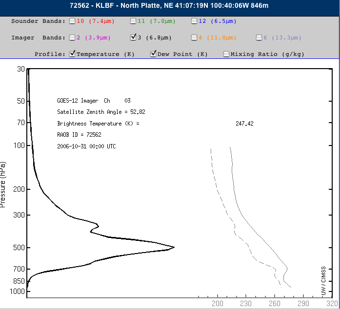
In addition, if you look closely, you can also see a subtle reflection of this surface-based boundary moving southward across northeastern Colorado on the 6.5µm “water vapor channel” imagery (above, lower right panel), even though this is a channel which normally senses radiation from altitudes higher in the middle troposphere. A plot of the GOES-12 imager water vapor channel’s weighting function at North Platte, Nebraska (below) indicates that the altitude of the peak contribution for that particular air mass had indeed shifted downward to near 500 hPa (~ 18,000 feet in altitude).


