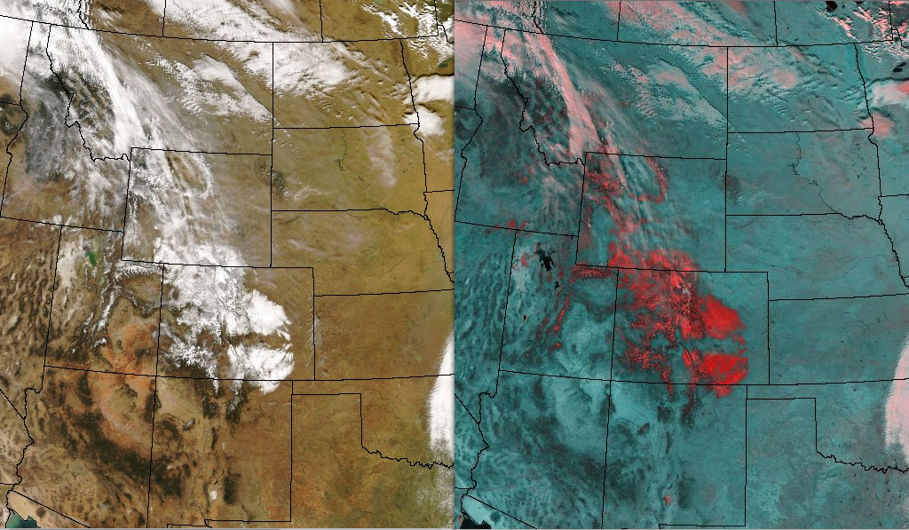
Heavy snow in the Colorado plains

An early season winter storm dumped up to 25 inches of snow across parts of Colorado on 26 October (NWS snowfall reports); as fate would have it, on that particular day Alaska also reported its first below zero temperature of the season (-7ËšF at Bettles), making for two ominous signs that winter is fast approaching. Aqua MODIS imagery from one day after the storm (above) shows the extent of the resulting snow cover, both in the mountains and also in the eastern Plains of the state; the false-color composite using MODIS channels 2 and 7 (above, right) displays the snow cover as dark red features on the image. Note how the snow cover is distributed both north and south of the Palmer Divide (a west-to-east oriented ridge of higher terrain across eastern Colorado) — upslope flow played an important role in focusing heavy snowfall during different stages of the storm.
A closer view of the Denver area using a MODIS 500-meter resolution true color image (below) shows that many of the small lakes are still unfrozen, and stand out against the surrounding snow covered land surfaces.


