Occluding cyclone off the Pacfic Northwest coast
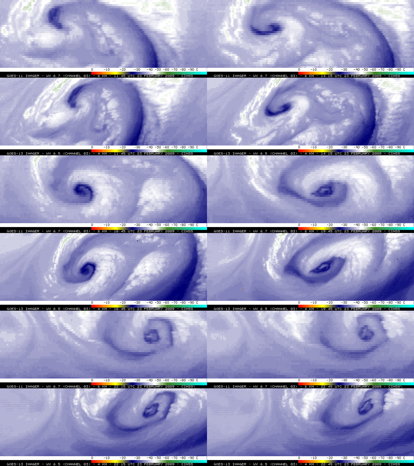
A cyclone off the Pacific Northwest coast was maturing and entering the occluded stage on 23 February 2009. An animation of GOES-11 and GOES-13 water vapor channel imagery (above) showed a very compact “dry swirl” signature that often signals a cyclone’s transition to the occluded stage. Note that the subtle features and gradients are more clear on the 4-km resolution GOES-13 water vapor channel data (compared to the 8-km resolution of the GOES-11 water vapor channel data).
An AWIPS image of the GOES-11 water vapor image with surface reports and HPC-analyzed surface fronts (below) displayed the relationship between the satellite features and the surface features. Note that ship 3FMH7 (located to the north of the occluded front) reported blowing spray (group 70722) at 18 UTC — the present weather symbol on the station model plot that is used for “blowing dust/sand” is also used for blowing spray at sea.
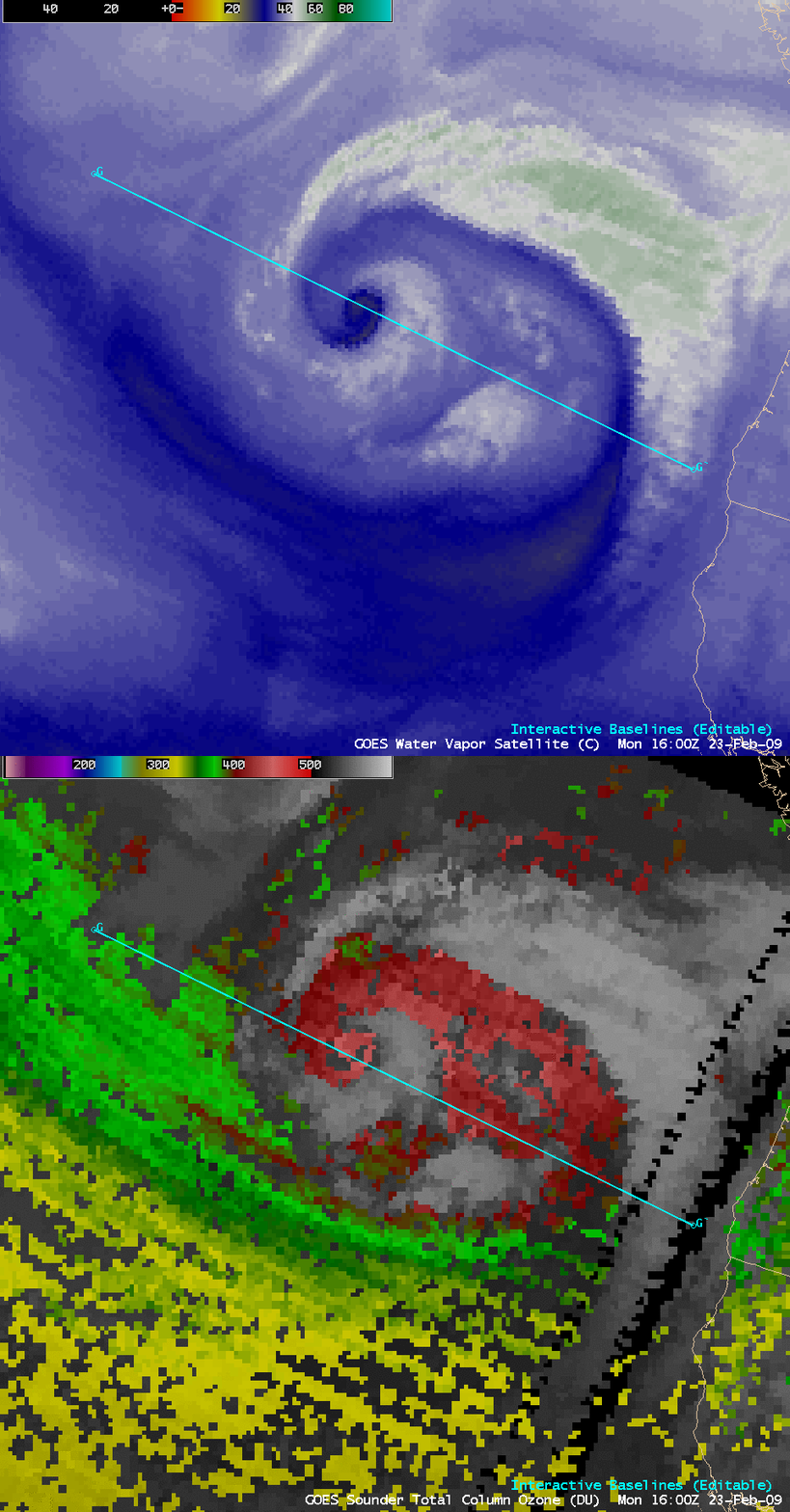
A comparison of the GOES-11 water vapor image and the GOES-11 sounder Total Column Ozone product at 16:00 UTC (below) indicated that ozone values were quite high (in excess of 450 Dobson Units, lighter red color enhancement) over the region of the occluding cyclone.
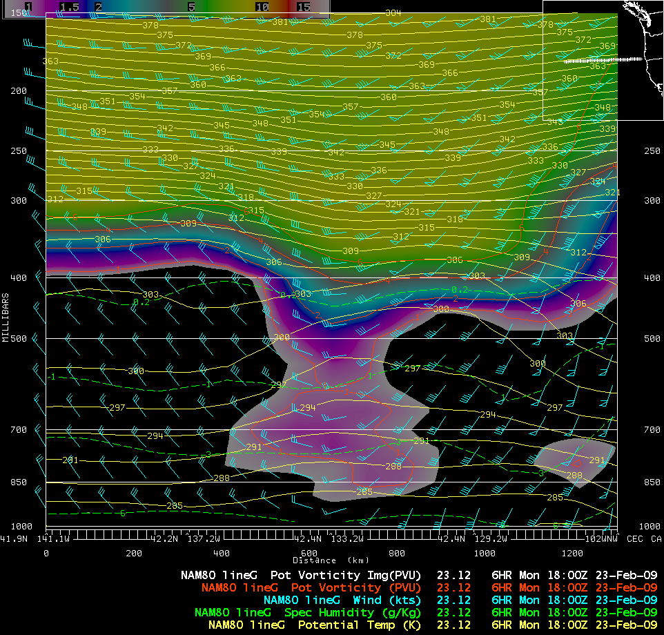
A west-to-east cross section along Line G-G’ using 18:00 UTC NAM80 model fields (below) showed that the dynamic tropopause (taken to be the height of the PV1.5 potential vorticity surface) had descended to below the 500 hPa pressure level in the vicinity of the occluding cyclone.


