Hurricane Kate
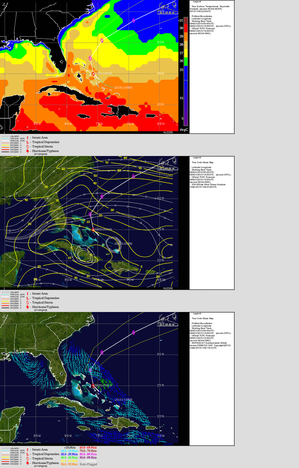
GOES-13 Visible Imagery, above, shows Tropical Storm Kate northeast of the Bahamas late in the day on 9 November. The storm is over a region of warm sea surface temperatures, below (imagery from the CIMSS Tropical Weather Site), in an environment of low shear. RapidScat winds show winds between 35 and 40 knots to the northeast of the storm center. The projected path is also shown, paralleling the East Coast before moving out to sea. The path takes the storm north of Bermuda as well.
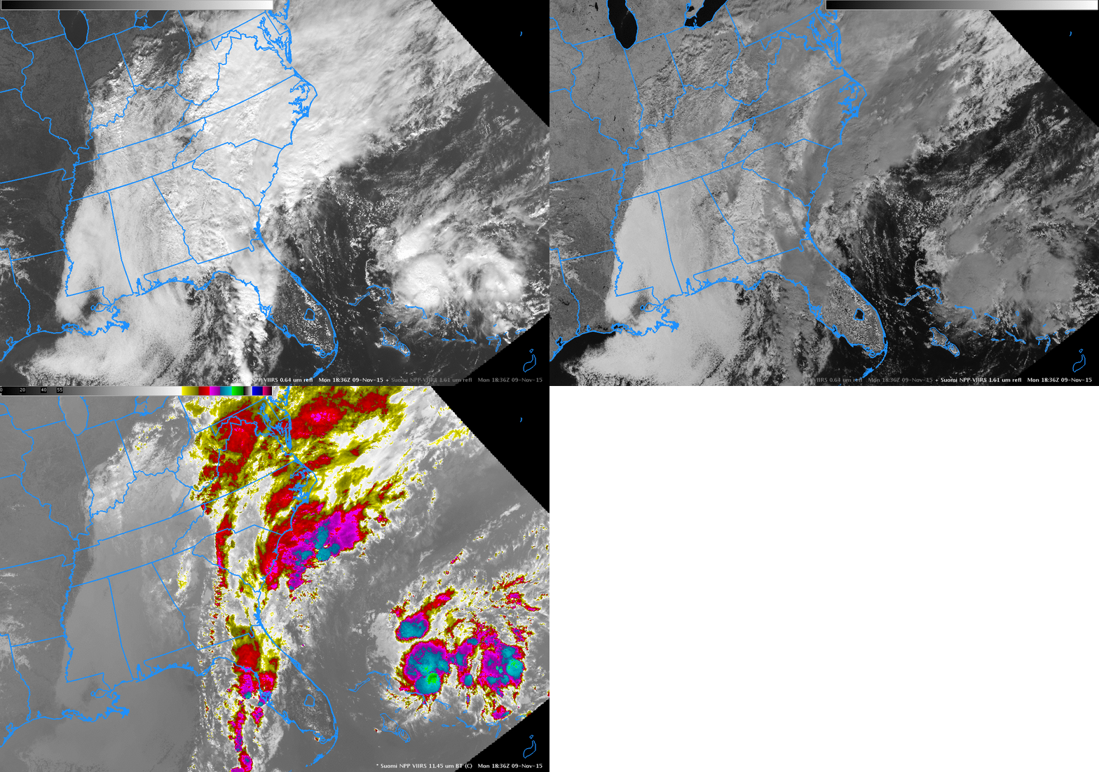
Suomi NPP viewed the storm as well, shortly after noon on 9 November. The Visible (0.64 µm), near-infrared (1.61 µm) and 11.35 µm imagery are shown below. The 1.61 imagery shows darker returns over ice clouds because of absorption at that wavelength. The extensive cirrus shield over Kate’s convection (and along the East Coast is association with frontal system) is readily apparent. Water-based clouds, in contrast, are bright white in both the visible and near-infrared channels.

Suomi NPP Visible (0.64 µm), near-infrared (1.61 µm) and infrared (11.45 µm) at 1836 UTC, 9 November 2015 (Click to enlarge) (Click to enlarge)
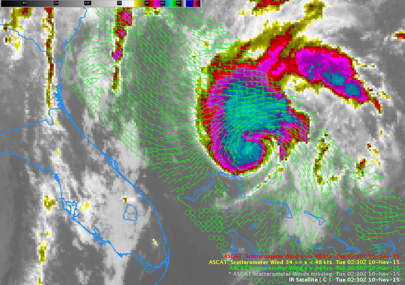
ASCAT winds from 0230 UTC on 10 November (below) also show strongest winds on the northern and eastern sides of the storm.

METOP Scatterometer winds and GOES-13 Infrared (10.7 µm) at 0230 UTC 10 November 2015 (Click to enlarge)
Kate was upgraded to a minimal Hurricane at 0900 UTC on 11 November.


