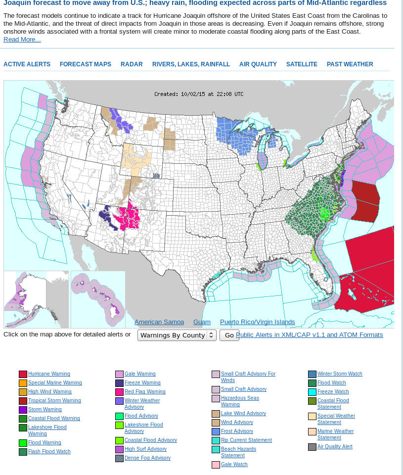
Moisture moves inland over the Carolinas as Hurricane Joaquin moves through the Bahamas
![METOP ASCAT Scatterometer Winds, 1356 UTC 2 October and GOES-13 Visible (0.63 µm) imagery [click to enlarge]](https://cimss.ssec.wisc.edu/satellite-blog/wp-content/uploads/sites/5/2015/09/ASCAT_Joaquin_1356_02Oct2015.png)
METOP ASCAT Scatterometer Winds, 1356 UTC 2 October and GOES-13 Visible (0.63 µm) imagery [click to enlarge]
![MIMIC Total Precipitable Water for the 72 hours ending 1900 UTC on 2 October [click to enlarge]](https://cimss.ssec.wisc.edu/satellite-blog/wp-content/uploads/sites/5/2015/09/MIMICTPW_ending1900UTC_2October2015.gif)
MIMIC Total Precipitable Water for the 72 hours ending 1900 UTC on 2 October [click to enlarge]
Water Vapor Imagery, below, shows a strong trough over the northern Gulf of Mexico. This trough is serving to move Joaquin out of the Bahamas, and it will also serve as a potent precipitation producer on the East Coast. Percent-of-Normal plots from NESDIS’s Blended Precipitable Water product shows a large region of nearly 200% of normal over South Carolina, and greater than 200% of normal over North Carolina and regions north and east. Flood Watches have been issued from northeast Georgia to southern New Jersey.
![GOES-13 Water Vapor Infrared Imagery (6.5 µm) and NESDIS Percent-of-Normal Blended Total Precipitable Water Product, 1745 UTC 2 October 2015 [click to enlarge]](https://cimss.ssec.wisc.edu/satellite-blog/wp-content/uploads/sites/5/2015/09/GOES_WV_BlendedTPW_1800UTC_02Otc2015toggle.gif)
GOES-13 Water Vapor Infrared Imagery (6.5 µm) and NESDIS Percent-of-Normal Blended Total Precipitable Water Product, 1745 UTC 2 October 2015 [click to enlarge]