NOAA/CIMSS ProbSevere with a Nebraska Hailstorm
![GOES-13 Visible (0.63 µm) images [click to play rocking animation]](https://cimss.ssec.wisc.edu/satellite-blog/wp-content/uploads/sites/5/2015/09/VIS_22SEP2015_1245_1700rock.gif)
GOES-13 Visible (0.63 µm) images [click to play rocking animation]
A severe hail-producing thunderstorm moved over northeast Nebraska before noon on 22 September (SPC Storm Reports). The region hit was just south of a Marginal Risk of Severe Weather (The update at 1630 UTC included the region of severe weather). The GOES-13 visible animation, above, shows the initial development occurring along a subtle cloud line aligned mostly east-west.
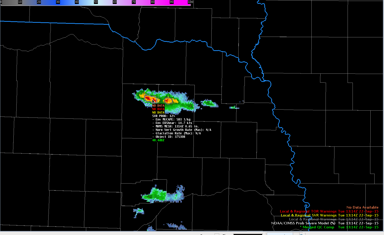
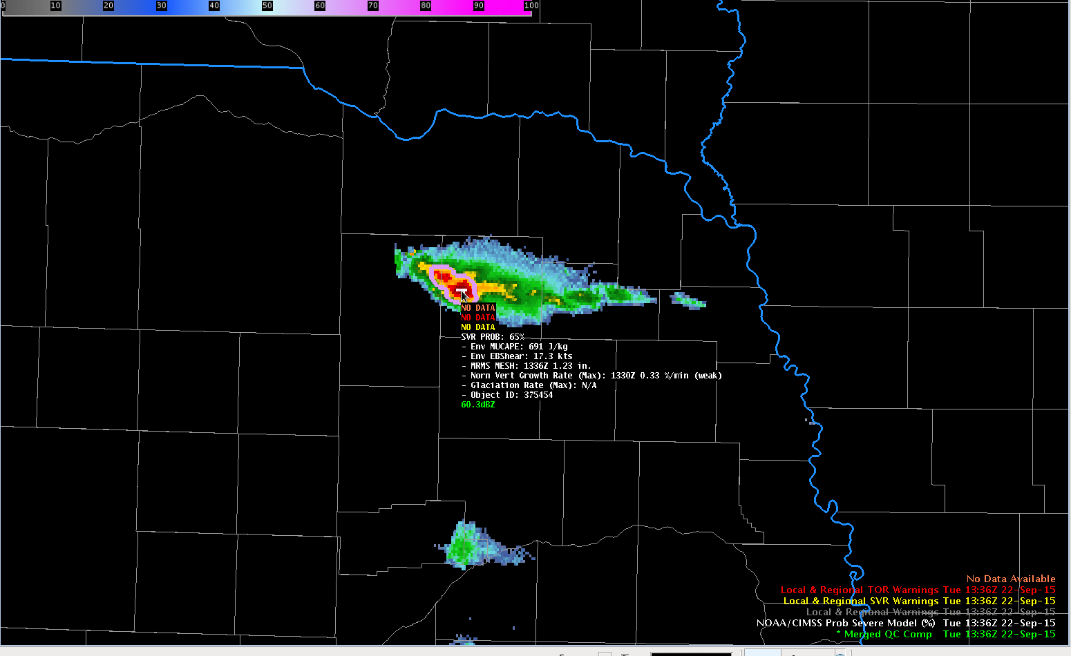
The NOAA/CIMSS ProbSevere model produces a probability that a developing thunderstorm will initially produce severe weather within the next sixty minutes. It consistently supplies information with a good lead time, and the storm on 22 September was no exception. The animation below shows the product for about an hour before the first storm report at 1408 UTC. The storm out of which the hail dropped was, at 1300 UTC, flagged as having a ProbSevere under 10%; values exceeded 10% at 1314 UTC and then jumped to 60+% at 1336 UTC (the first time that the value exceeded 50%) Values fluctuated between 60 and 80% between 1336 and 1400 UTC. After 1400 UTC, values increased into the mid-80s. The first report of hail was at 1408 UTC, 32 minutes after ProbSevere jumped above 50%. A severe thunderstorm warning for hail was issued at 1412 UTC.
![NOAA/CIMSS ProbSevere values, 1300-1412 UTC on 22 September 2015 [click to play animation]](https://cimss.ssec.wisc.edu/satellite-blog/wp-content/uploads/sites/5/2015/09/ProbSevere1300_1412_22Sep2015anim.gif)
NOAA/CIMSS ProbSevere values, 1300-1412 UTC on 22 September 2015 [click to play animation]
The GOES Sounder Lifted index product, below, (also available here) showed the instability that was present over the central Plains.
![GOES-13 Sounder DPI Values of Lifted Index [click to play animation]](https://cimss.ssec.wisc.edu/satellite-blog/wp-content/uploads/sites/5/2015/09/GOESSounder_LI_08-1622Sep2015anim.gif)
GOES-13 Sounder DPI Values of Lifted Index [click to play animation]