Bore over Kansas
GOES-13 Imager 0.63 µm visible channel images (click to play animation)
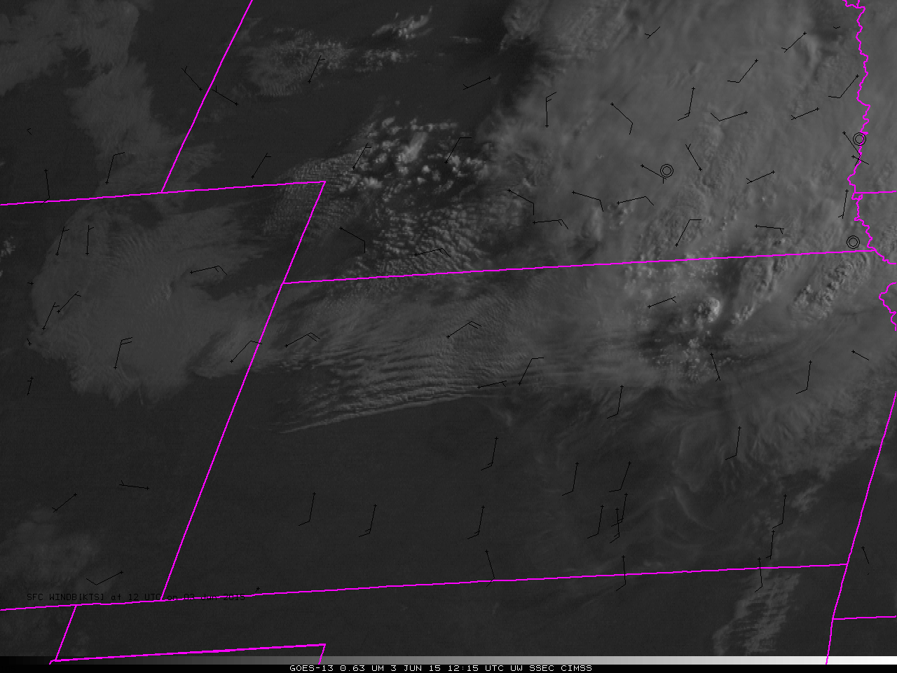
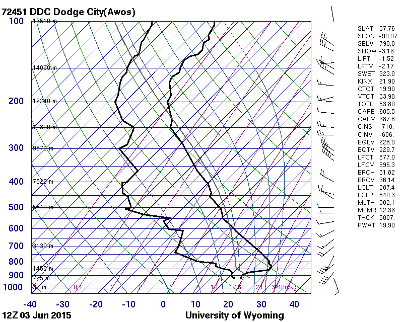
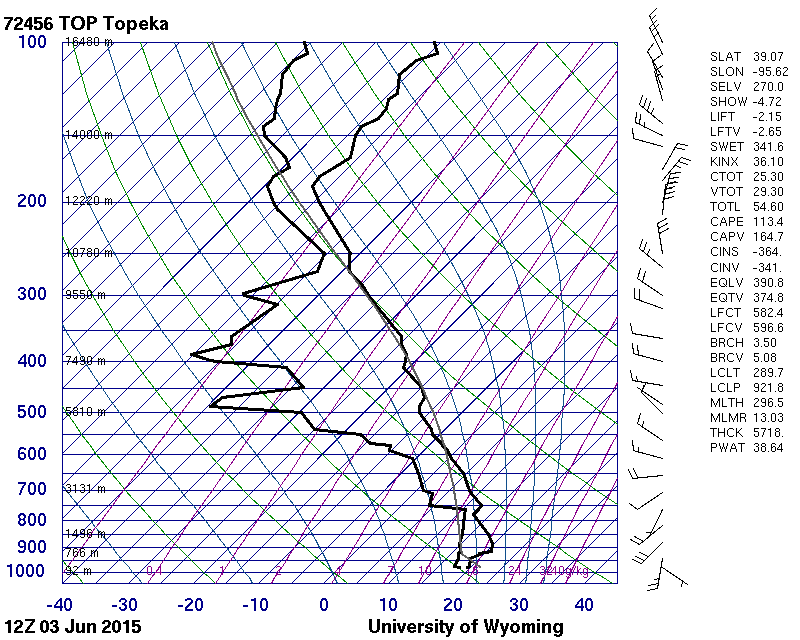
Visible imagery after sunrise on 3 June 2015 over Kansas, above, shows the parallel lines of low clouds that characterize a bore feature. As the bore penetrated southward, winds initially shifted before becoming more variable. Bore propagation requires the presence of an inversion, and 1200 UTC Soundings from both Dodge City and from Topeka contain inversions. Because inversions are present, it is unusual for convection to form in the presence of a bore.
The initial southward push the became the bore may have emerged from strong convection over central Nebraska early in the morning of 3 June. Suomi NPP VIIRS imagery captured that convection; the Day Night Band (under near-Full Moon conditions) and 11.45 µm infrared imagery, below, show the strong convection at 0848 UTC on 3 June 2015).
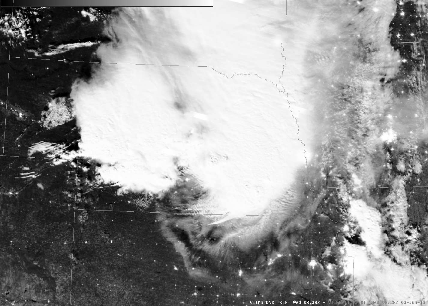
Suomi NPP VIIRS 0.70 µm visible Day Night Band and 11.45 µm infrared imagery at 0848 UTC on 3 June 2015 (click to play animation)
GOES-14 was performing SRSO-R observations over Kansas on 3 June. One-minute imagery of the bore evolution is available here in animated gif format (74 M in size) and here in mp4 format (2.8M in size). The YouTube video is embedded below.