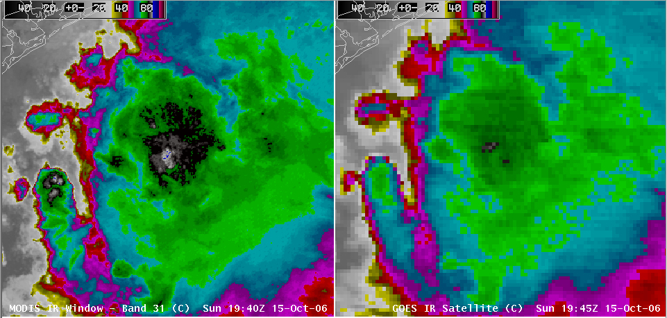
Cold cloud top temperatures

A large Mesoscale Convective System formed over the Gulf of Mexico (just off the Texas coast) on 15 October, and this convection exhibited some very cold cloud top temperatures on AWIPS images of IR window channel data (above) — IR brightness temperatures were as cold as -91 C (-132 F) on the 1-km resolution 11.0 µm MODIS IR channel, and as cold as -87 C (-125 F) on the 4-km resolution GOES IR channel. Such cold cloud top temperatures are common in a tropical atmosphere, where the tropopause pressures are usually lower and the tropopause temperatures colder than atmospheres at mid-latitudes; the rawinsonde reports from Brownsville, Texas indicated a tropopause near the 100 mb level, with a nearly moist adiabatic lapse rate that is also typical of tropical air masses.
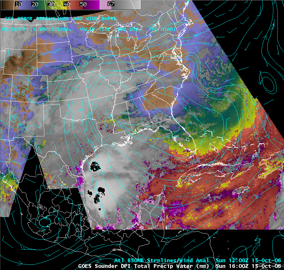
GOES sounder total precipitable water values were also quite high across the Caribbean and Gulf of Mexico, with PW exceeding 60 mm (2.4 inches) at some locations (below). This feed of tropical moisture helped to fuel severe convection on the following day which produced a few tornadoes along the Gulf Coast, along with record daily rainfall amounts at Houston, Texas (5.17 inches) and Galveston, Texas (3.91 inches) which caused fatal flash flooding to occur.


