Himawari-8 visible images

Himiwari-8 AHI 0.63 µm visible channel images (click to play animation)
0.5-km resolution Himawari-8 AHI 0.63 µm visible channel images from the SSEC RealEarth web map server (above; click image to play animation) revealed a number of interesting features from the Sea of Okhotsk to the Bering Sea during the 18 April – 19 April 2015 period, which included (1) a series of lee waves immediately west of the Kuril Islands (the chain of islands south of the Kamchatka Peninsula), (2) the cyclonic circulation that formed over the western Bering Sea off the Russian coast, along the far northern edge of a remnant frontal boundary, and (3) cloud streets in the central Bering Sea, streaming southward and southwestward from the sea ice across the open waters.
A comparison of Suomi NPP VIIRS 0.7 µm Day/Night Band and 11.45 µm IR channel images with an overlay of the19 April / 00 UTC surface analysis (below) showed the location of the remnant frontal boundary, which was an axis of convergence between strong northerly winds over the central Bering Sea (causing the cloud streets and heavy freezing spray which would be a concern for shipping activities in that area) and a ridge of high pressure southeast of the Kamchatka Peninsula.
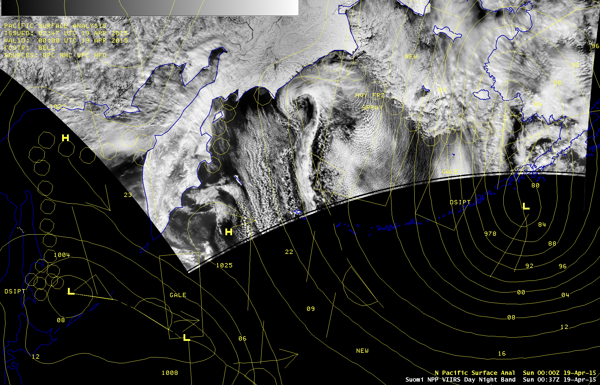
Suomi NPP VIIRS 0.7 µm Day/Night Band and 11.45 µm IR channel images.