Volcanic Eruption on Kamchatka
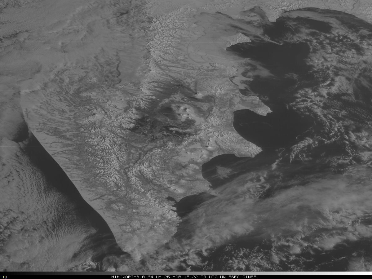
Himawari-8 Visible (0.64µm) Imagery (click to animate)
Infrared imagery from Himawari-8 has a nominal resolution of two km (at the sub-satellite point), but a visible channel has a nominal resolution of 0.5 km which can provide imagery with great detail. In the example above, the visible imagery captures the eruption, beginning around 2210 UTC on 25 March 2015, of the Shiveluch volcano on Russia’s Kamchatka Peninsula. The volcanic plume then moves downstream in northwesterly flow. Himawari-8 remains in post-launch testing, the period when the satellite calibration and navigation is thoroughly checked.
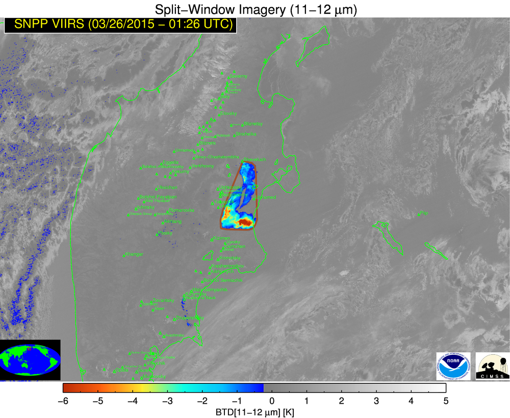
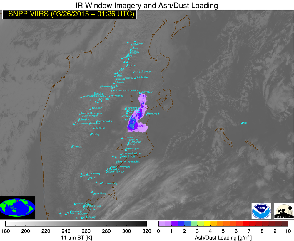
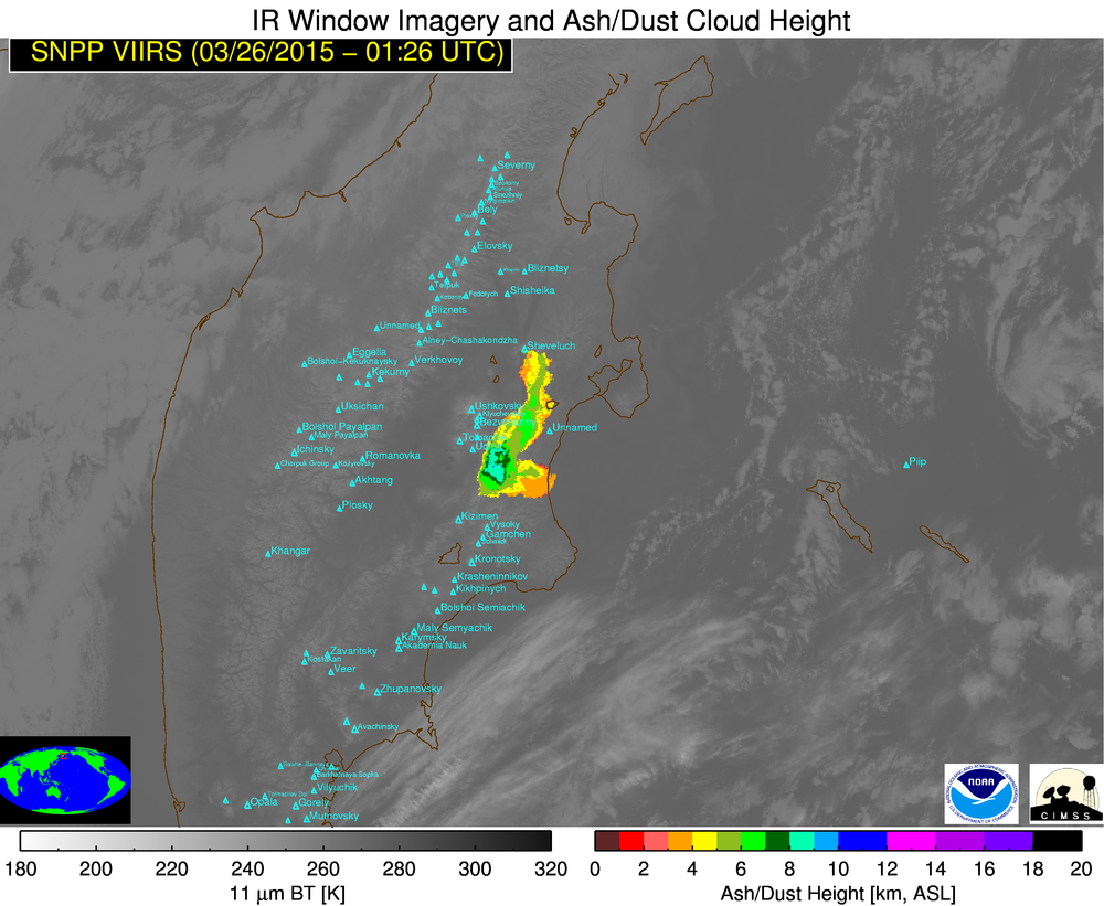
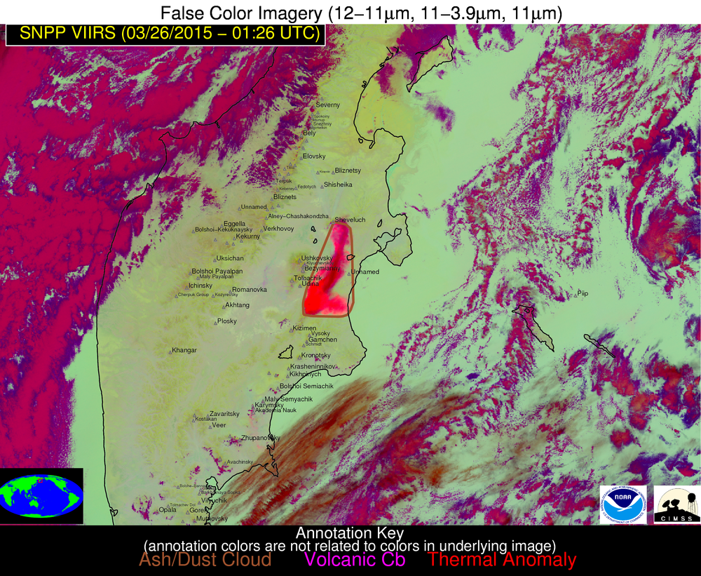
Suomi NPP overflew this region multiple times on 26 March 2015. VIIRS data from a 0126 UTC overpass, below, taken from this website, show satellite-based diagnostics of this event. The animation cycles through a Brightness Temperature Difference (11µm – 12µm), Ash Loading, Ash Height and a False Color RGB presentation of the volcanic plume.
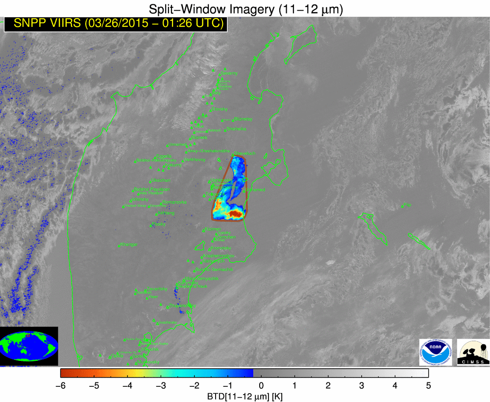
Suomi NPP VIIRS Brightness Temperature Difference (11µm -12µm), Ash Loading, Ash Height, and False Color Imagery, 0126 UTC 26 March 2015 (click to enlarge)
Update: On 26 March, a Suomi NPP VIIRS true-color RGB image from the SSEC RealEarth site provided a nice view of the Shiveluch volcanic plume (below); also evident on the true-color image (as well as on images from the previous two days) to the north of Shiveluch were a pair of volcanic ash “fall streaks”, where the tan-colored ash landed on top of the existing snow cover.
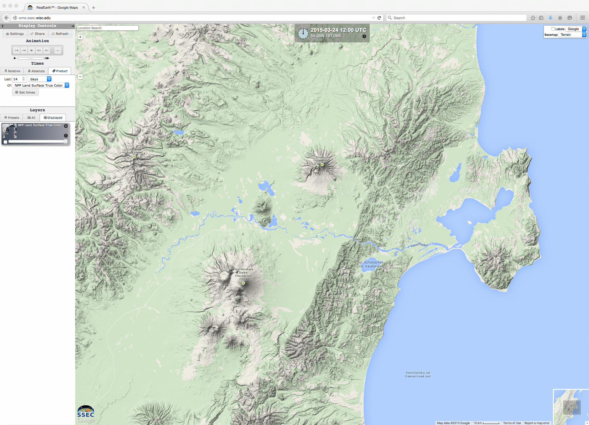
Suomi NPP VIIRS true-color images from 24, 25, and 26 March
GOES-15 also viewed the eruption, at the extreme edge of its limb, as seen on the sequence of 0.63 µm visible channel images below (Shiveluch is at the center of the images).
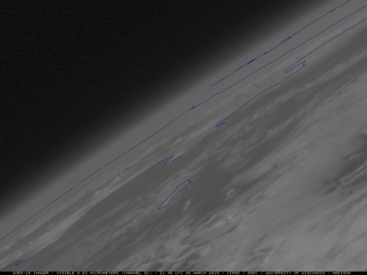
GOES-15 0.63 µm visible channel images (click to play animation)