Sea fog along the northeast Florida coast
GOES-13 (GOES-East) 0.63 µm visible channel images (above; click to play animation) showed a patch of sea fog just off the coast of northeastern Florida on 21 March 2015. As daytime inland heating increased, a sea breeze circulation began to draw some of the offshore sea fog toward the coast.
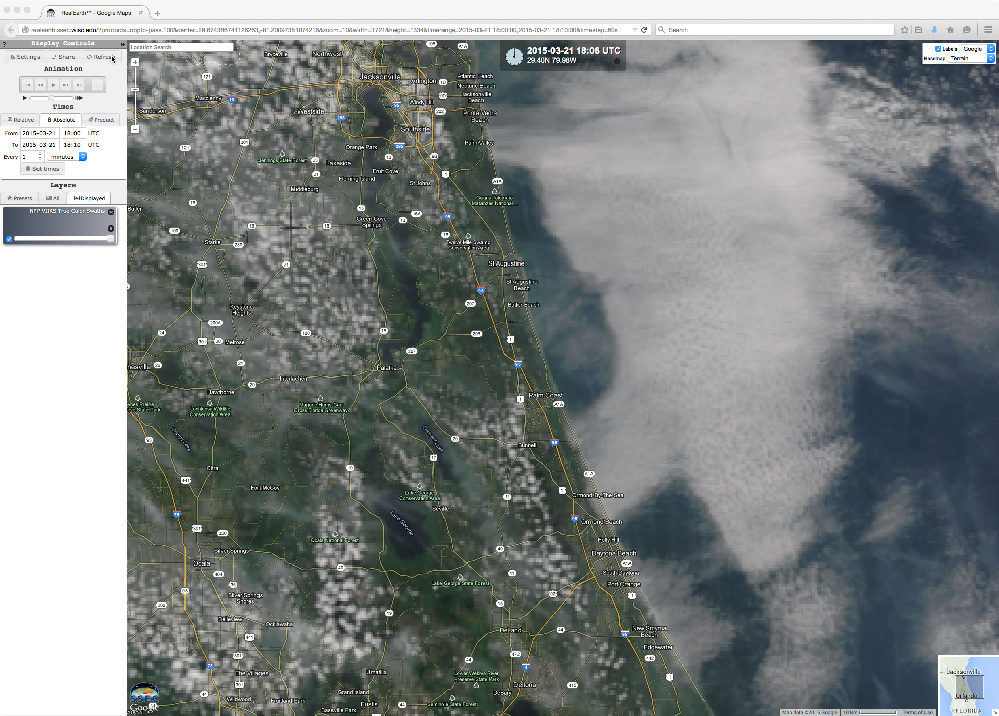
A closer view is provided by a Suomi NPP VIIRS true-color Red/Green/Blue (RGB) image at 18:08 UTC (below), visualized using the SSEC RealEarth web map server site. The surface visibility at New Smyrna Beach was reduced to 1 mile at the time.
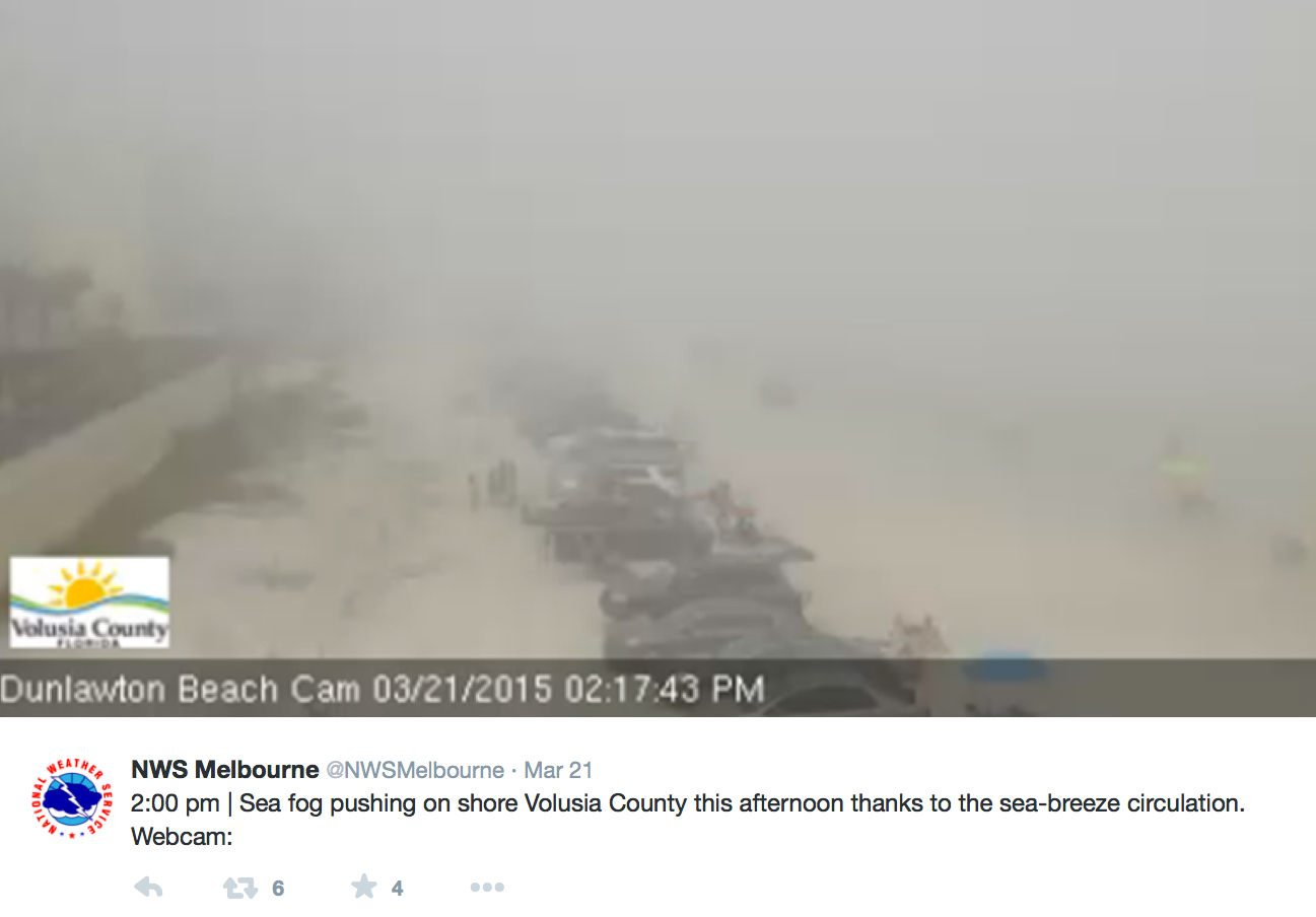
A web camera image at 18:17 UTC or 2:17 PM local time (below) showed the dramatic reduction in visibility as the dense sea fog moved inland at Dunlawton Beach (near Daytona Beach).
A comparison of Suomi NPP VIIRS 0.64 µm visible channel, 3.74 µm shortwave IR channel, and 11.45 µm longwave IR images (below) showed that the patch of sea fog exhibited a strong signal on the shortwave IR image (due to the efficient reflection of incoming solar radiation by the spherical water droplets), but no signal at all on the longwave IR image (since the temperature of the sea fog feature was nearly identical to that of the surrounding ocean waters).

Suomi NPP VIIRS 0.64 µm visible channel, 3.74 µm shortwave IR channel, and 11.45 µm longwaveIR channel images
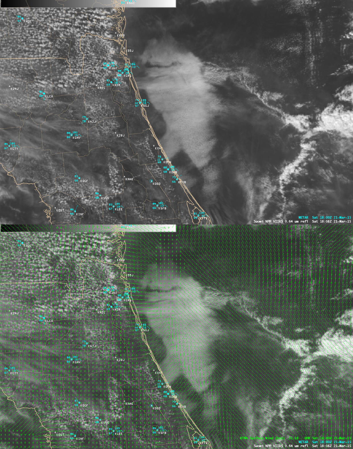
The easterly to northeasterly onshore flow along the coast (enhanced by the sea breeze circulation) was well-depicted by the 18 UTC Real-Time Mesoscale Analysis (RTMA) surface winds (below).


