Storm “Nina” affects the northern British Isles and Norway
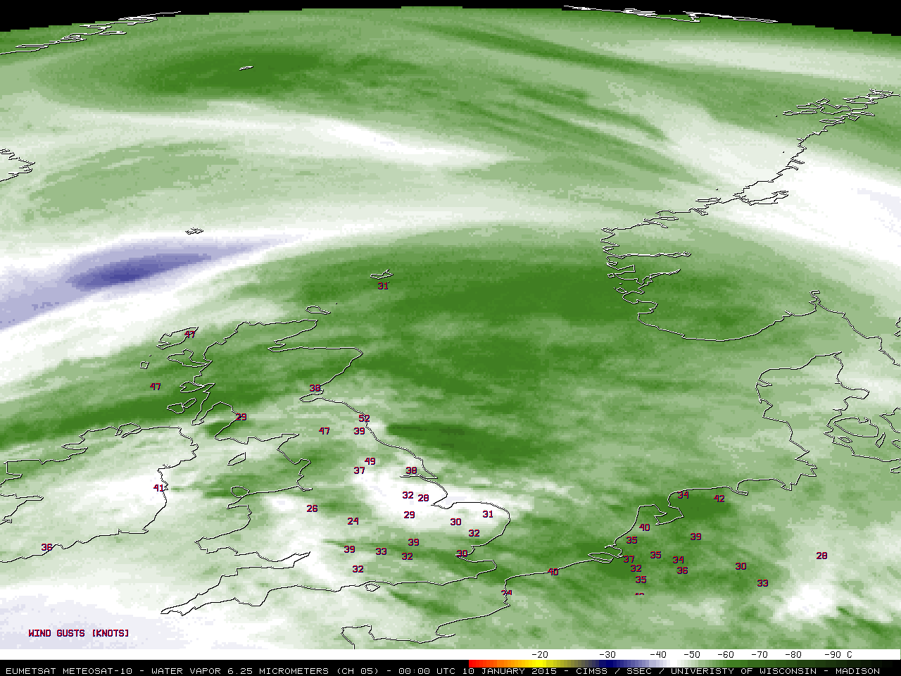
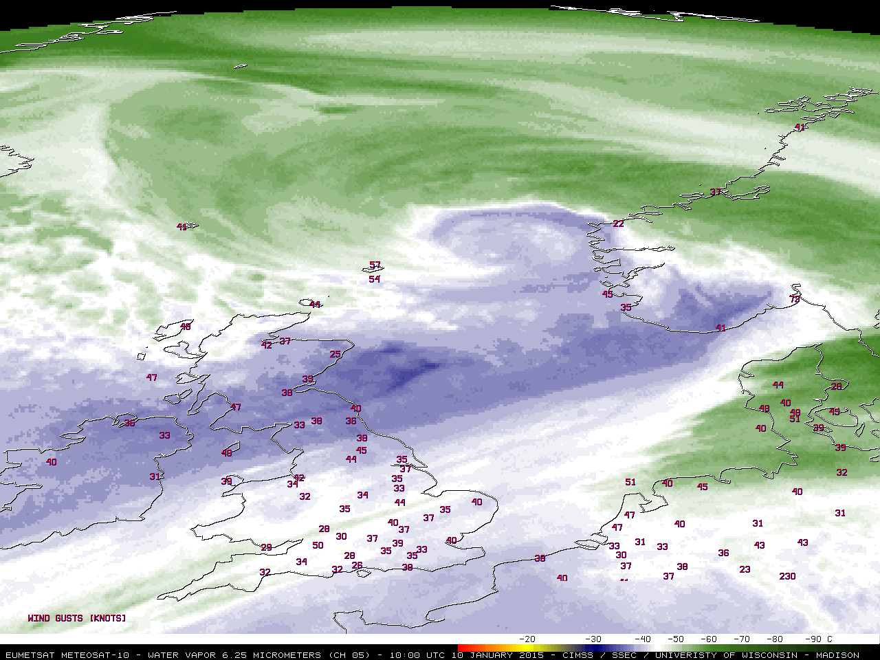
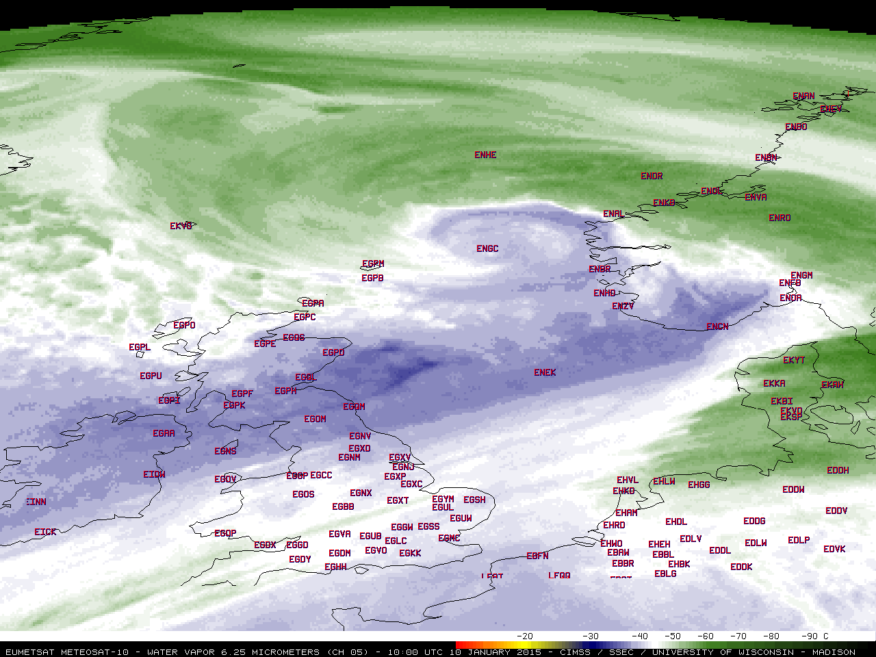
Meteosat-10 6.25 µm water vapor channel images (click to play animation)
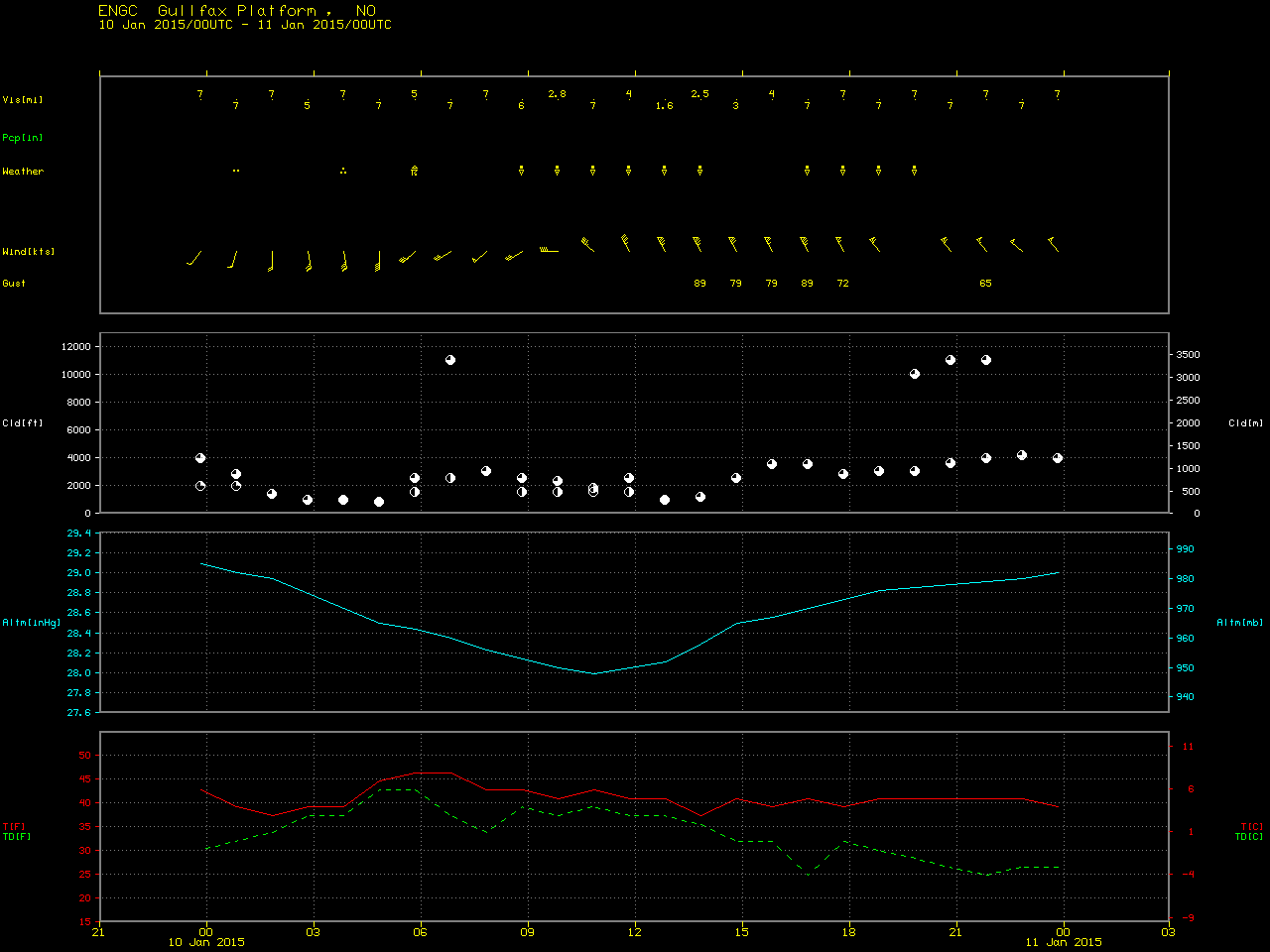
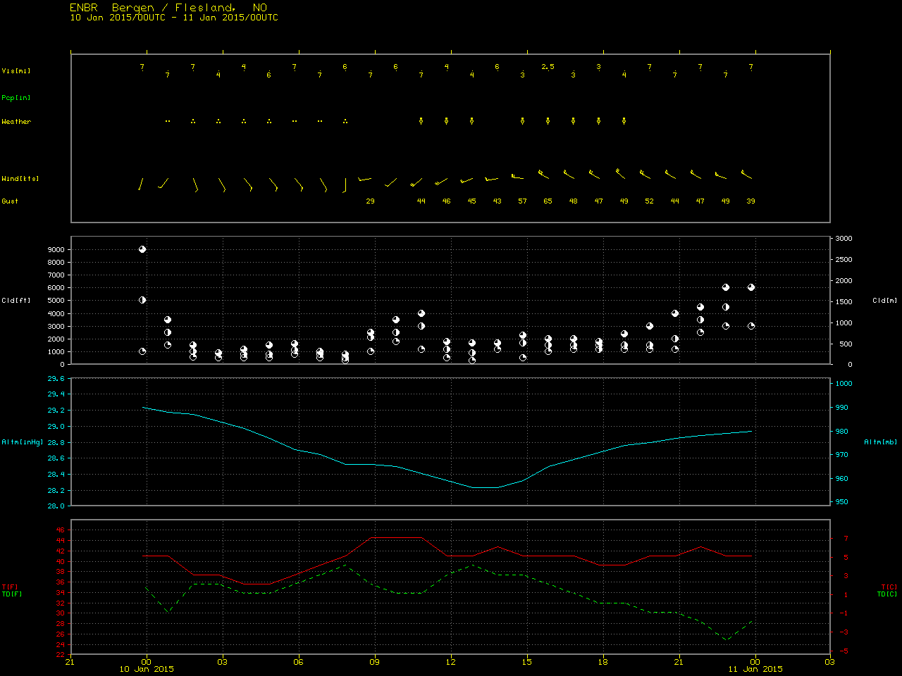
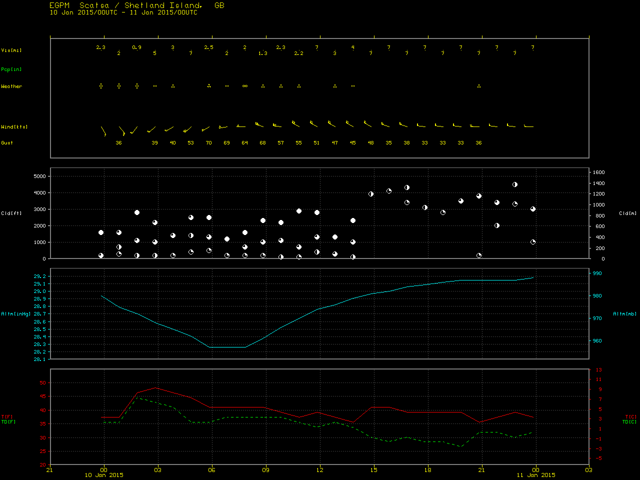
The intense extratropical cyclone referred to in Norway as “Extreme Weather Nina” was described as the strongest storm to hit the western part of that country in 20 years, bringing high winds that caused widespread tree and property damage, disrupted power for an estimated 170,000 people, and halted some forms of transportation on 10 January 2015 (The Nordic Page). EUMETSAT Meteosat-10 6.25 µm water vapor channel images (above; click image to play animation; also available as an MP4 movie file) showed the well-defined circulation of the storm, which included a “scorpion tail” signature (10 UTC image) over the North Sea west of Norway suggesting that a sting jet feature may have been present. About 3 hours after the leading edge of this middle-tropospheric sting jet signature moved over Haugesund, winds there gusted to 71 knots/36.5 meters per second. Winds gusted as high as 89 knots/45.7 meters per second at the offshore oil platform Gullfax, and the Flesland airport at Bergen was briefly closed due to strong winds (which peaked at 65 knots/33.4 meters per second). In the northern British Isles, wind gusts as strong as 70 knots/36 meters per second were reported on Shetland Island, along with thunderstorms (water vapor image with 4-letter station identifier locations).
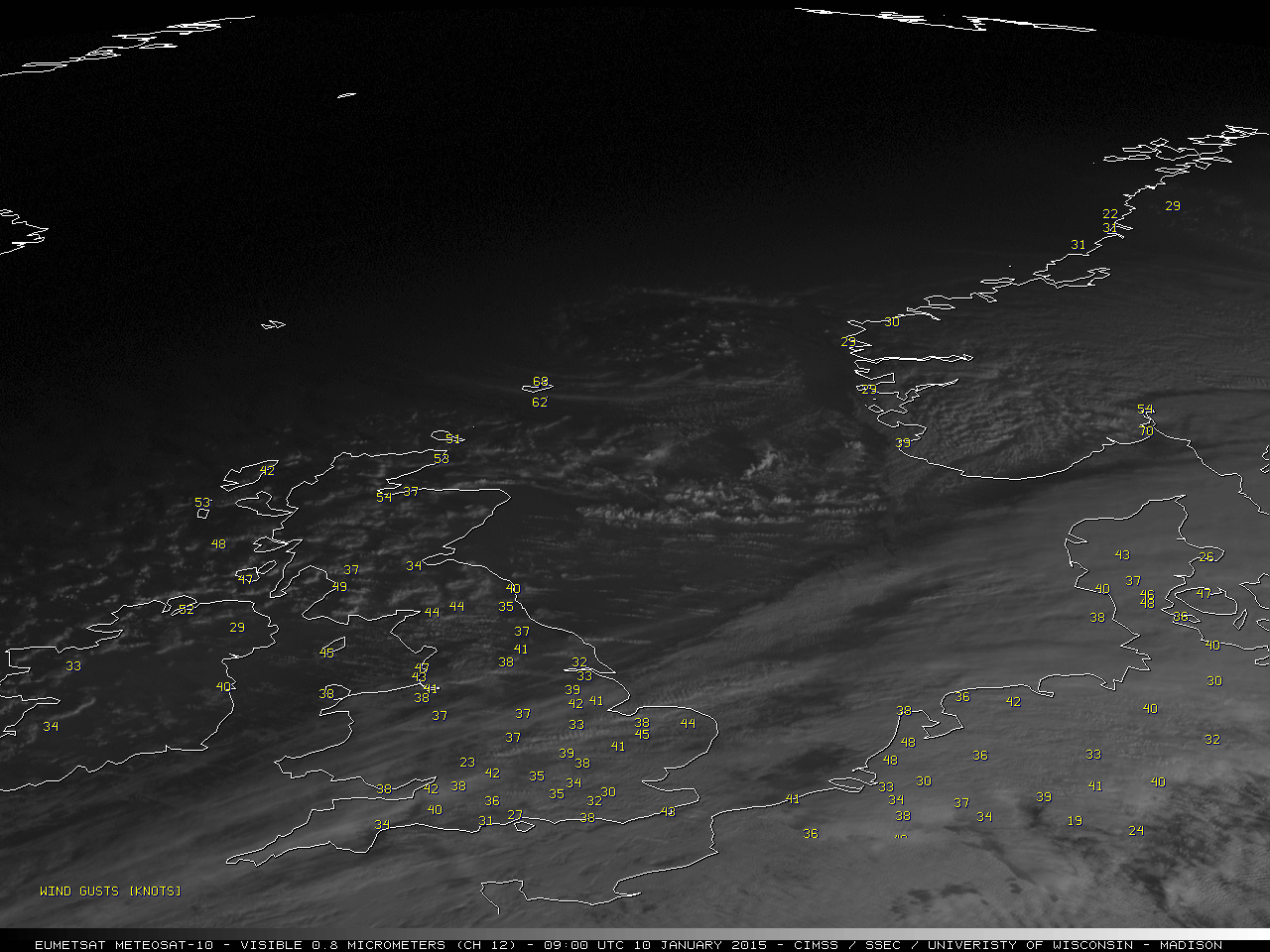
Meteosat-10 0.8 µm High Resolution Visible images (below; click image to play animation; also available as an MP4 movie file) revealed the development of numerous showers and thunderstorms across the southern sector of the storm.
Meteosat-10 0.8 µm High Resolution Visible images (click to play animation)
A SSEC RealEarth Suomi NPP VIIRS true-color Red/Green/Blue (RGB) image around 12:00 UTC (below) showed the storm center just off the west coast of Norway.
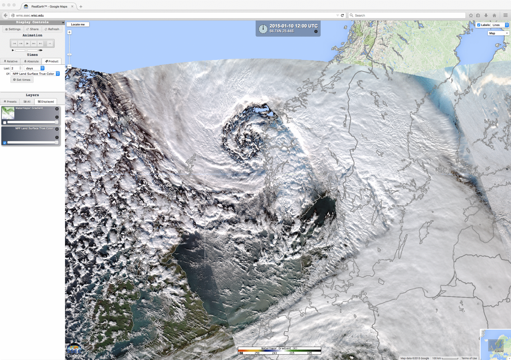
Suomi NPP VIIRS true-color image