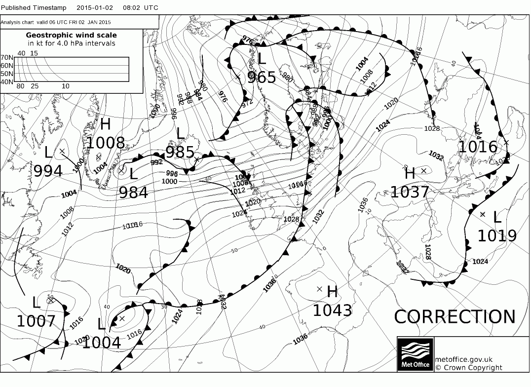
Strong winds in parts of northern Scotland and southern Norway

EUMETSAT Meteosat-10 6.25 µm water vapor channel images (click to play animation)
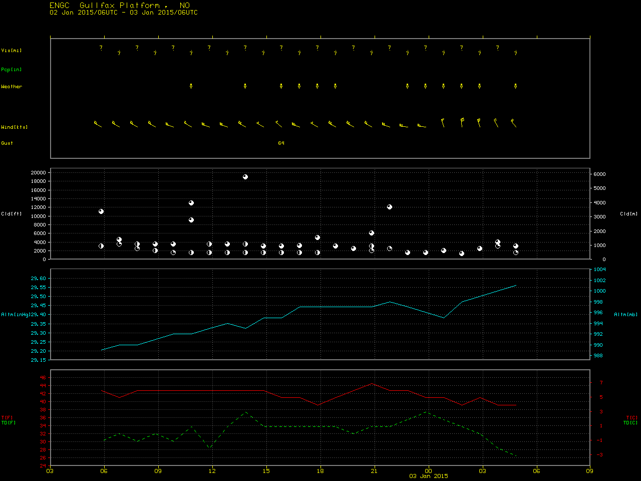
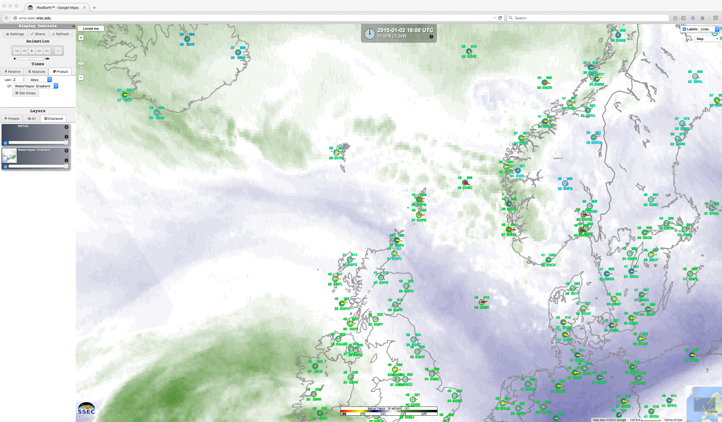
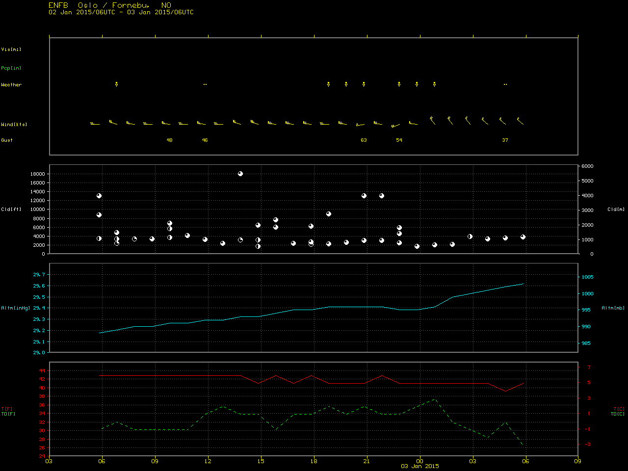
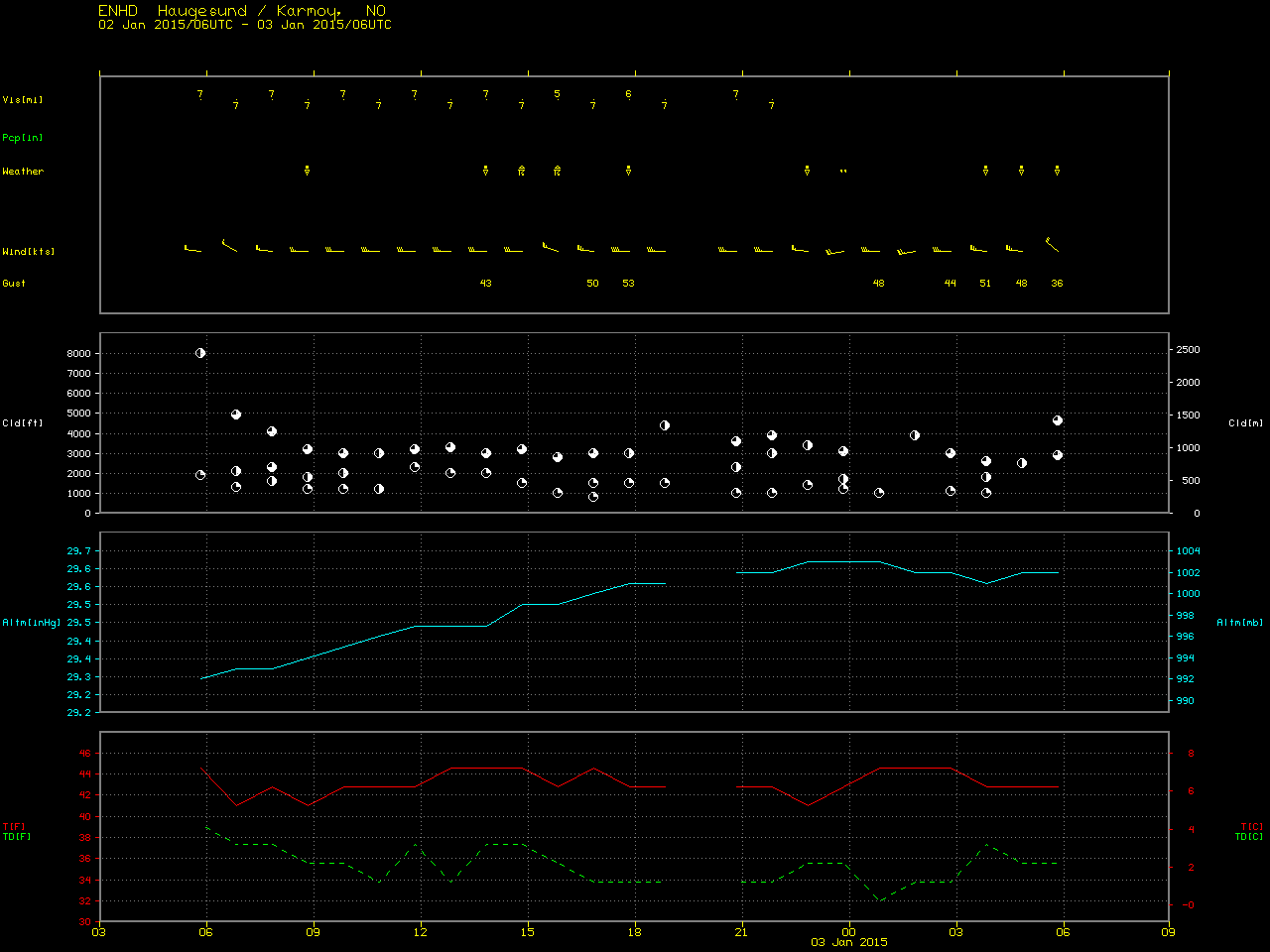
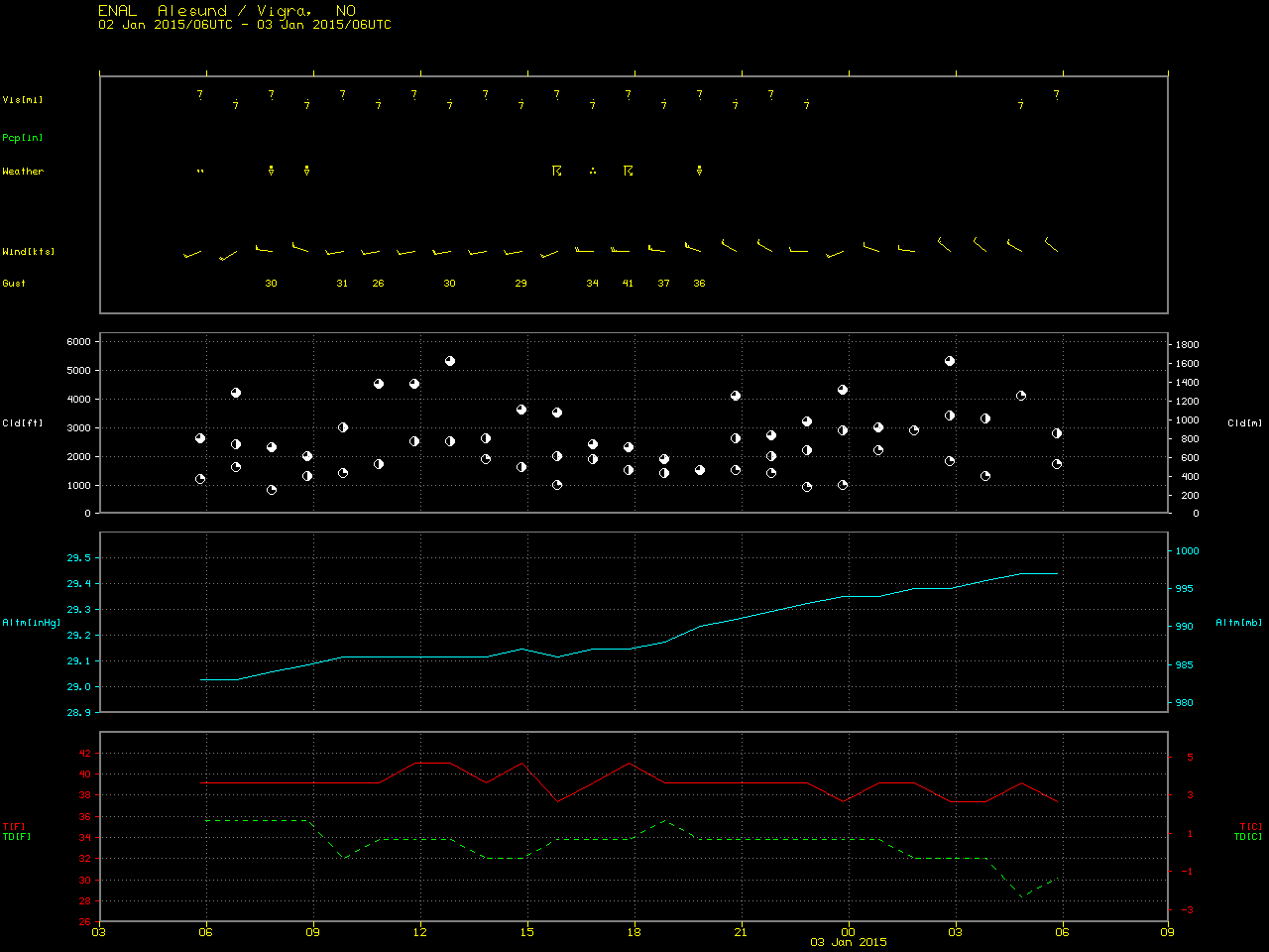
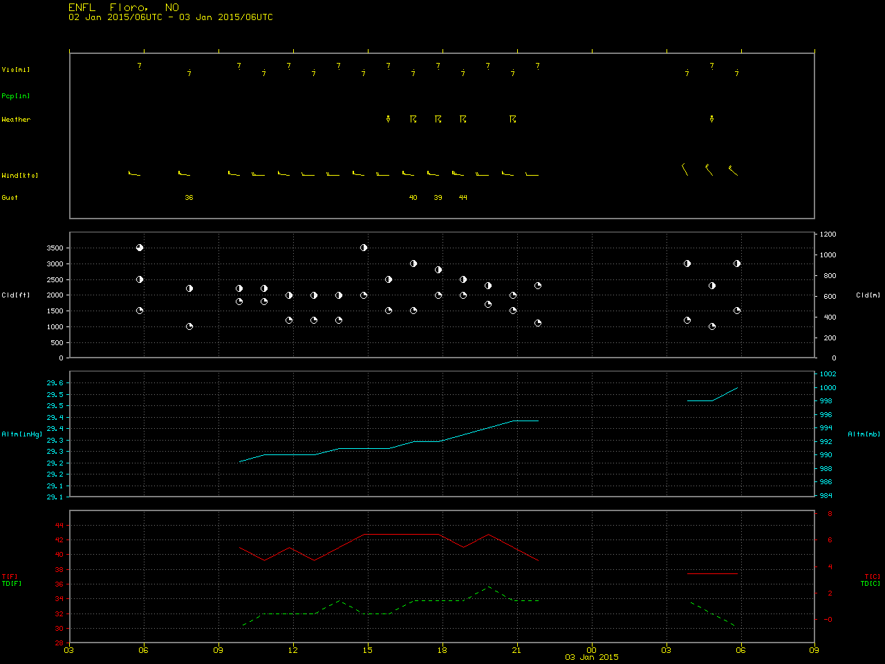
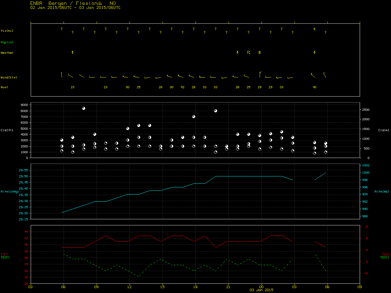
A band of strong westerly/northwesterly winds moved across northern Scotland and southern Norway on 02 January 2015 (surface analyses), with a number of locations reporting wind gusts in excess of 50-60 knots. The highest wind gust seen was 64 knots at the Gullfax Platform (ENGC) in the North Sea at 16 UTC, with a wind gust to 63 knots at Oslo Fornebu airport (ENFB) at 21 UTC; in the morning hours, an aircraft was blown off the runway at Stornoway Airport, Isle of Lewis, in the Outer Hebrides of Scotland (EGPO). Ferry services between Kristiansand and Denmark as well as those between Sandefjord and Sweden were cancelled due to the strong winds. EUMETSAT Meteosat-10 6.25 µm water vapor channel images (above; click image to play animation; also available as an MP4 movie file) showed that most of the stronger wind gusts occurred beneath a ribbon of drier air aloft, in which instability rain/snow showers (and even thunderstorms) were developing.
A Suomi NPP VIIRS true-color Red/Green/Blue (RGB) image at 10:57 UTC visualized using the SSEC RealEarth web map server (below) showed a more detailed view of the instability showers and thunderstorms as they were developing over the North Sea. Along the west coast of Norway, thunderstorms were reported at Haugesund, Ålesund, Florø, and Bergen.
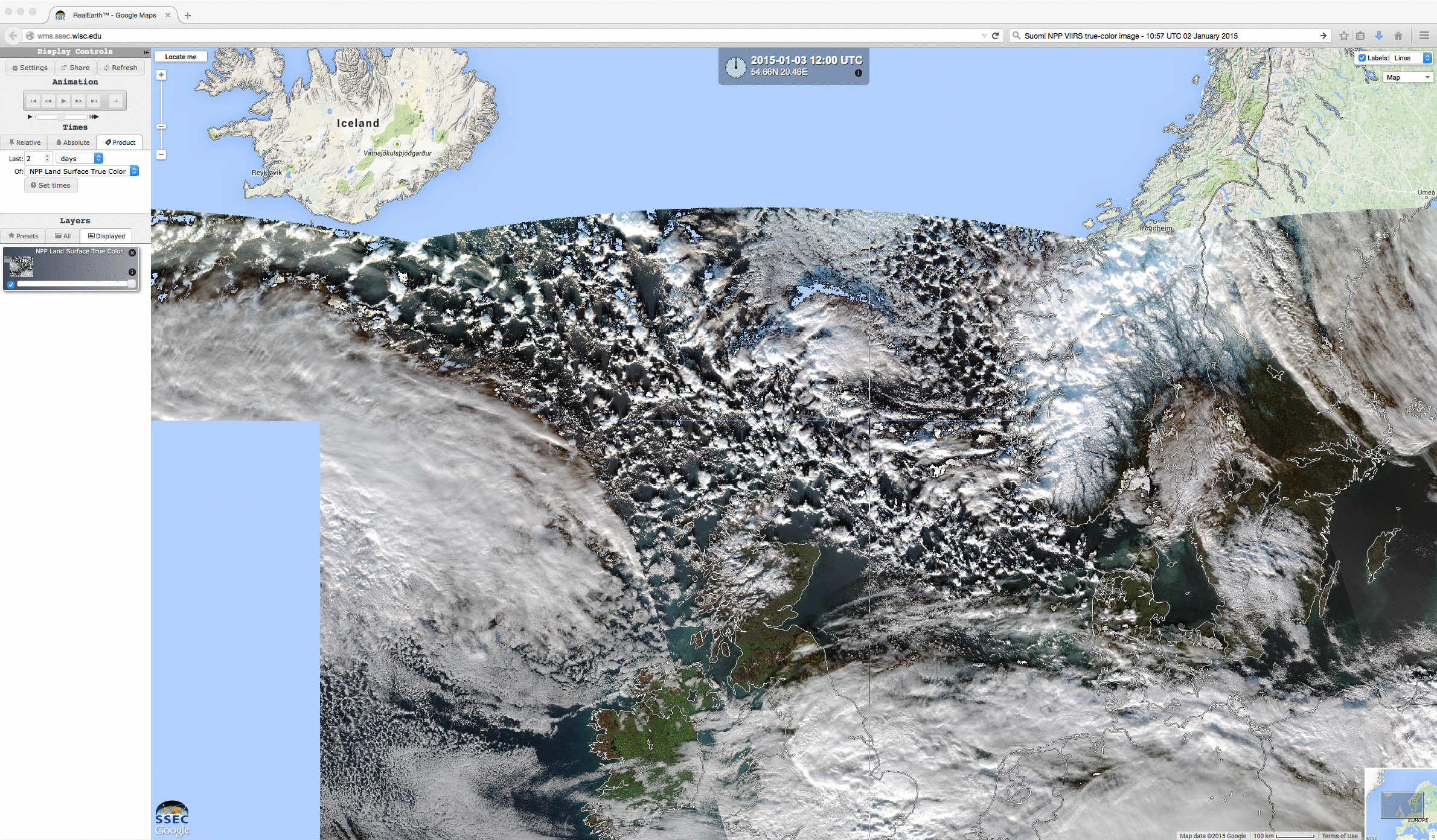
Suomi NPP VIIRS true-color image