The effect of stratus clouds on temperatures
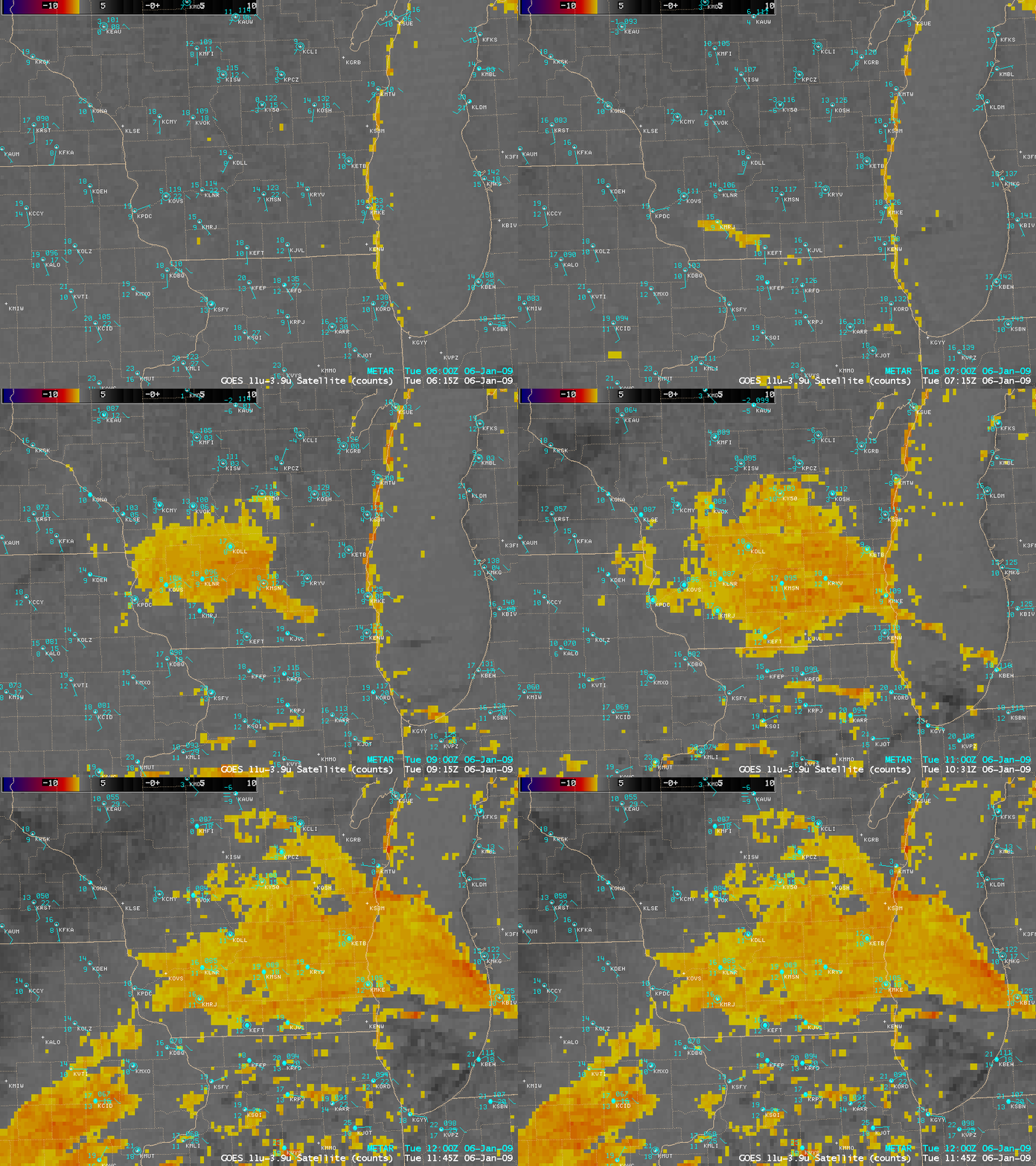
AWIPS images of the GOES-13 fog/stratus product (above) showed a patch of stratus cloud that developed quickly as it moved northeastward across southern Wisconsin during the pre-dawn hours on 06 January 2009. In advance of this cloud feature, air temperatures were dropping off as clear skies and light winds were promoting strong radiational cooling – in southern Wisconsin, Boscobel (station identifier KOVS) dropped to 2º F (-17º C) and Madison (station identifier KMSN) dropped to 6º F (-14º C) shortly after 08 UTC (2 AM local time). However, after the arrival of the cloud feature, surface air temperatures quickly began to rise into the middle to upper teens F as the cloud deck began to trap heat that was radiating from the surface.
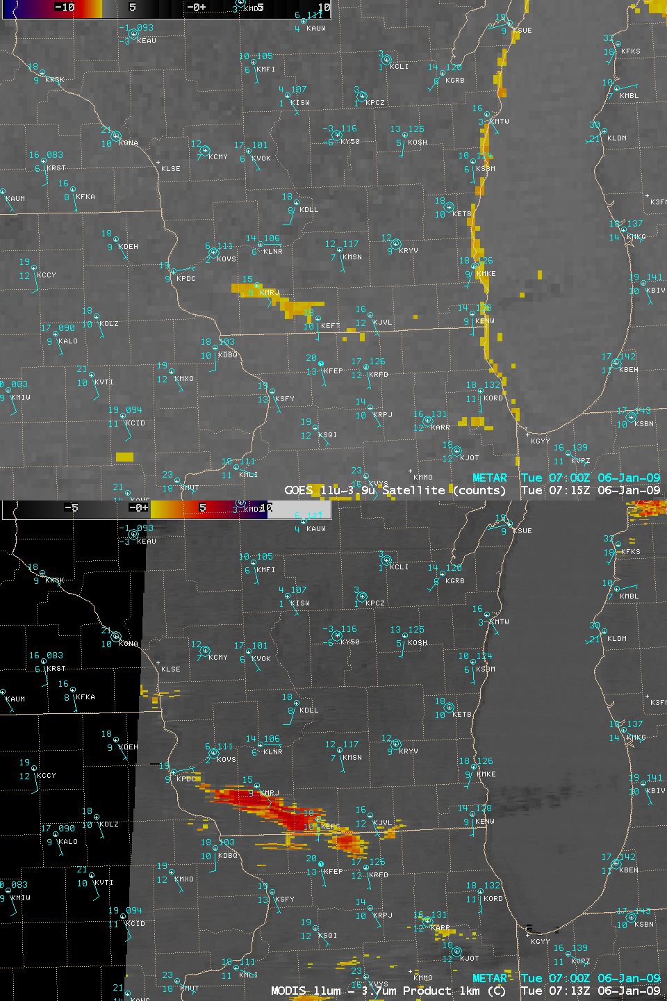
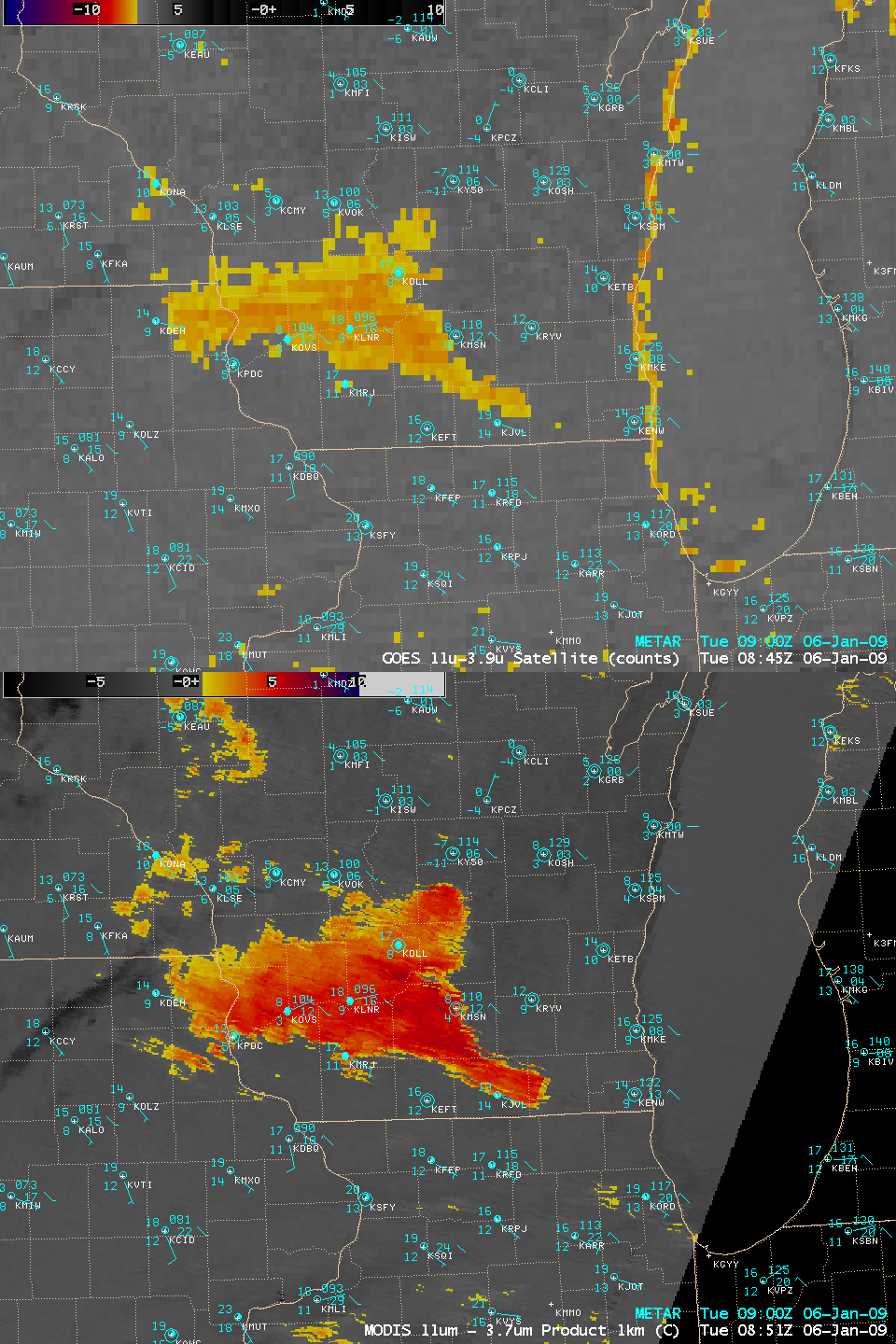
Comparisons of the 4-km resolution GOES-13 fog/stratus product with the 1-km resolution MODIS fog/stratus product during the early stages of formation of this stratus cloud deck (below) demonstrated the superior feature detection capability of the MODIS instrument. Also note that the GOES-13 fog/stratus product exhibited a “false signal” along the western coast of Lake Michigan, where colder water temperatures in the low-mid 30s F were “confusing” the product — the improved spatial and spectral resolution of the MODIS channels allowed the creation of a “cleaner” fog/stratus product.
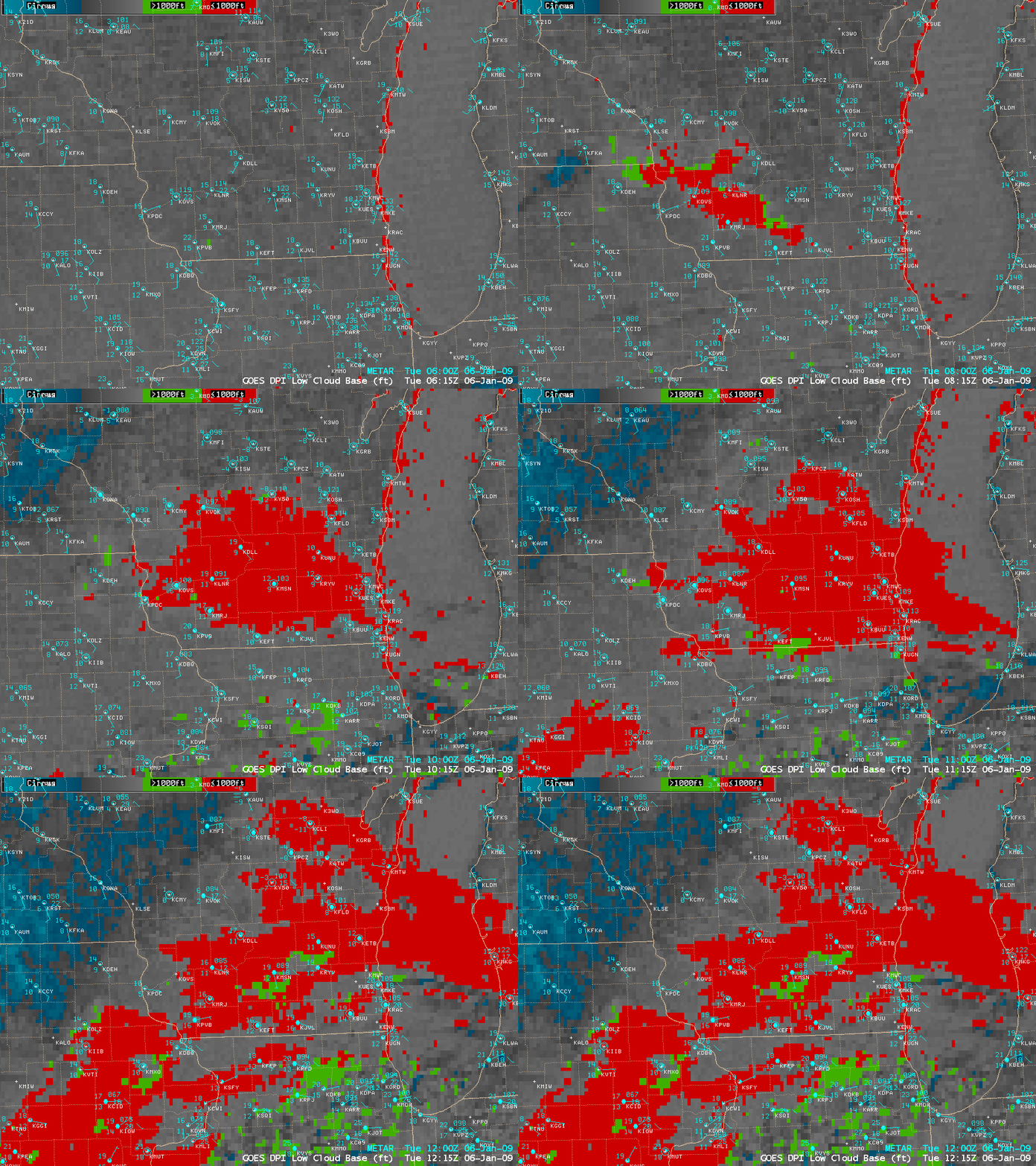
The development and growth of the stratus cloud feature was also evident on the GOES-13 Low Cloud Base product (below), portrayed an an extensive area of clouds having bases less than 1000 feet above the surface (red color enhancement).
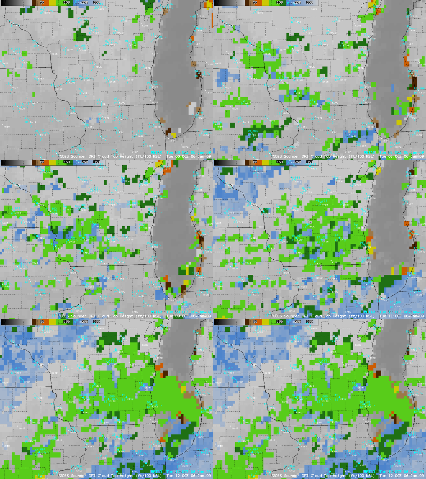
This cloud feature was apparently fairly deep, with the GOES-13 sounder Cloud Top Height product (below) indicating cloud tops in the 12,000 to 14,000 feet range (light green color enhancement).


