Gonzalo in the Leeward Islands
Tropical Storm Gonzalo is moving through the Leeward Islands today, October 13. The animation above shows the visible imagery from GOES-13. Slow strengthening of the storm is indicated. Eye formation may be occurring in the later part of the animation. (Note that imagery over the Leeward Islands is available only every half-hour because of an RSO called for GOES-13 associated with severe weather; in normal operations, the Caribbean is scanned every 15 minutes as discussed here).

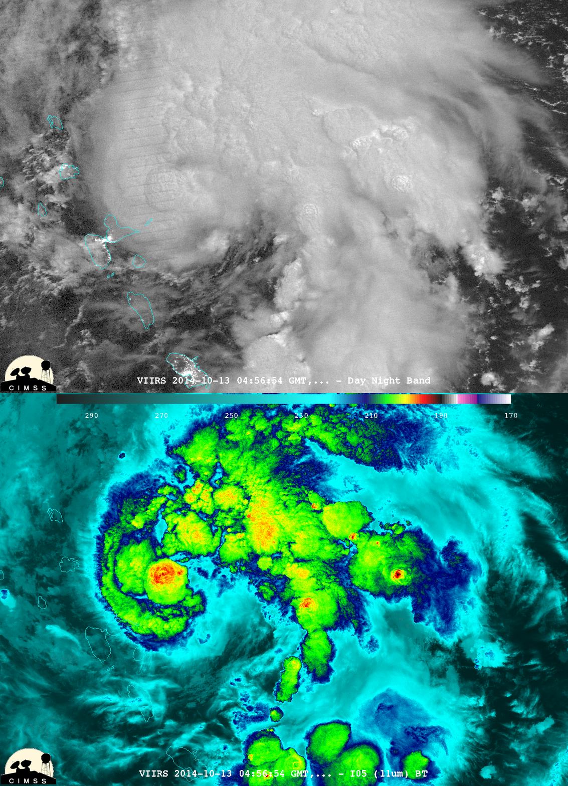
Suomi NPP Day Night Band visible (0.70 µm) and 11.35 µm infrared imagery at 0456 UTC, 13 October (click to enlarge)
Suomi NPP overflew the developing system at 0456 UTC on 13 October, and a toggle between the Day Night Visible Band and the 11.35 infrared imagery (courtesy of W. Straka, CIMSS) is above. Cold cloud tops associated with numerous overshooting tops are obvious. (Click here for a graph of the number of overshoots as detected from GOES-13 as a function of time)

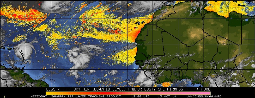
Saharan Air Analysis from Meteosat, 1200 UTC 12 October through 1200 UTC 13 October (click to play animation)
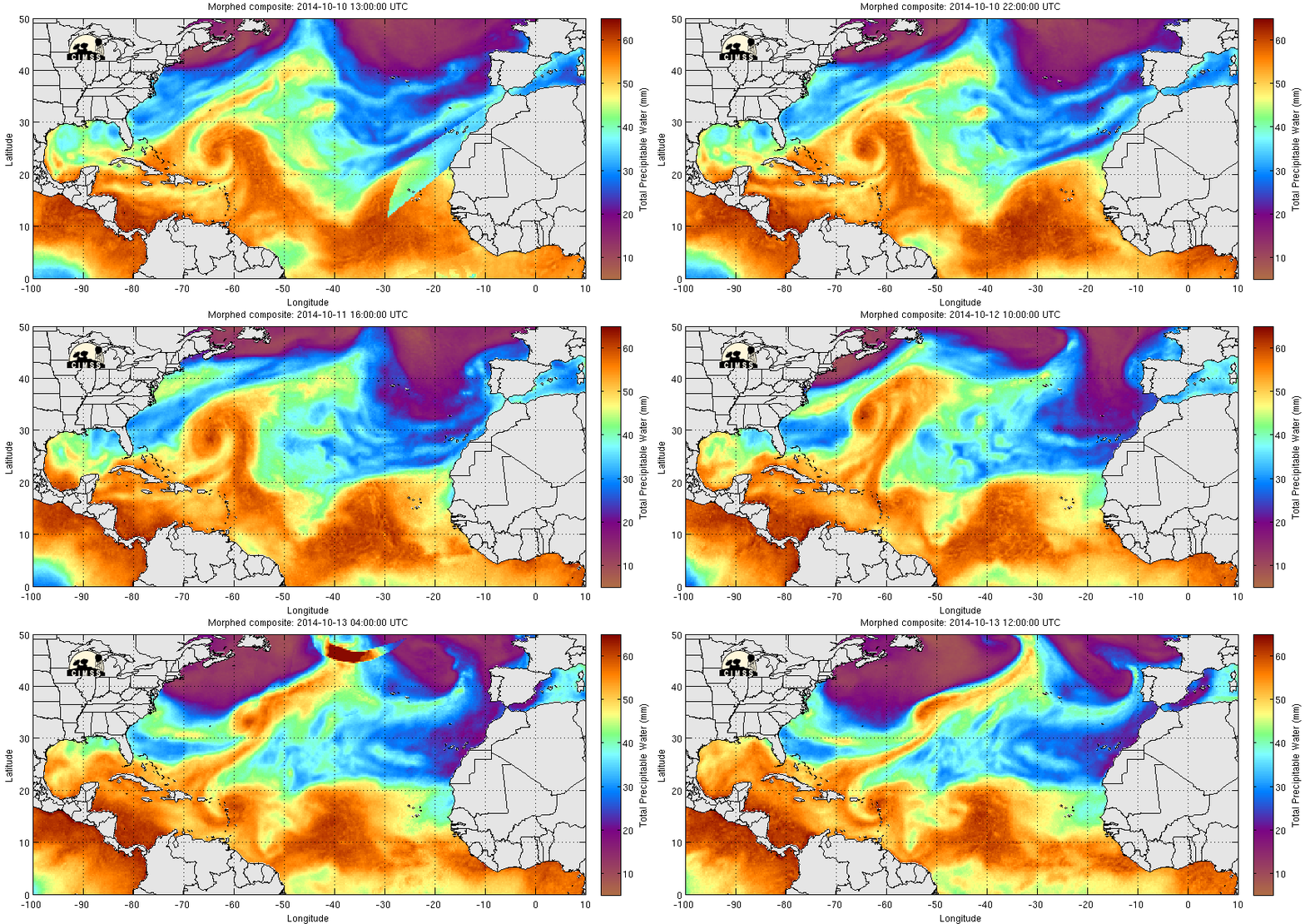
The Atlantic Tropical Storm season has been comparatively quiet this year in part because of strong Saharan Air Layer events (discussed in Blog Posts here and here). When this dry air that originates over the Sahara moves over the tropical Atlantic, the convection necessary for tropical storm formation is suppressed. Lately, however, Saharan Air Layer events have decreased, and tropical systems are developing in the tropical Atlantic. The 24-hour animation above (from CIMSS Tropic Web site) shows very little Saharan Air over the Atlantic, and two named storms — Fay (at 50 º W on the northern border of the domain) and Gonzalo (approaching the Leeward Islands) — are present. In addition, a strong tropical wave is moving across the tropical Atlantic at 15 º N, 40 º W. MIMIC Total Precipitable Water animations (below) also show a moist environment over much of the tropical Atlantic.
GOES-13 10.8 µm Infrared Imagery every six hours from 2045 UTC 12 October through 1445 UTC 13 October (click to play animation)
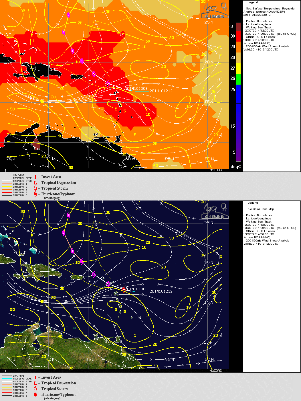
A storm-centered animation of the 10.8 µm imagery from GOES-13, above, shows the gradual organization of Gonzalo as it moved towards the Leeward Islands. In particular, between 0845 and 1445 UTC on 13 October (the last two images in the 4-frame loop), a central dense overcast (CDO) has formed, and outflow to the east has become established. Gonzalo’s projected path (see below, from here) is over very warm water, and through an atmosphere with little shear; slow strenghtening is expected. See the National Hurricane Center website for more details, including warnings for the Leeward Islands.


