Advection fog in Oklahoma
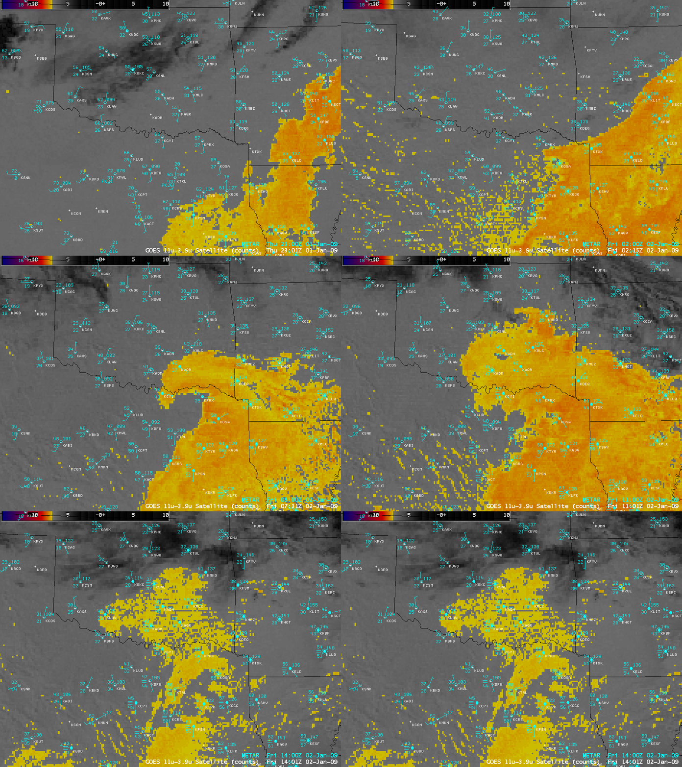
AWIPS images of the GOES-13 fog/stratus product (above) showed a plume of advection fog curling northwestward across southern Oklahoma on 02 January 2009. A relatively moist low-level air mass with dew points in the 40s F was flowing from northeastern Texas into southeastern Oklahoma (where radiational cooling was allowing surface air temperatures to drop into the upper 30s F). Once the fog moved in, the surface visibility was restricted to 1/4 mile at Ardmore (station identifier KADM) and Stillwater (station identifier KSWO) in Oklahoma.
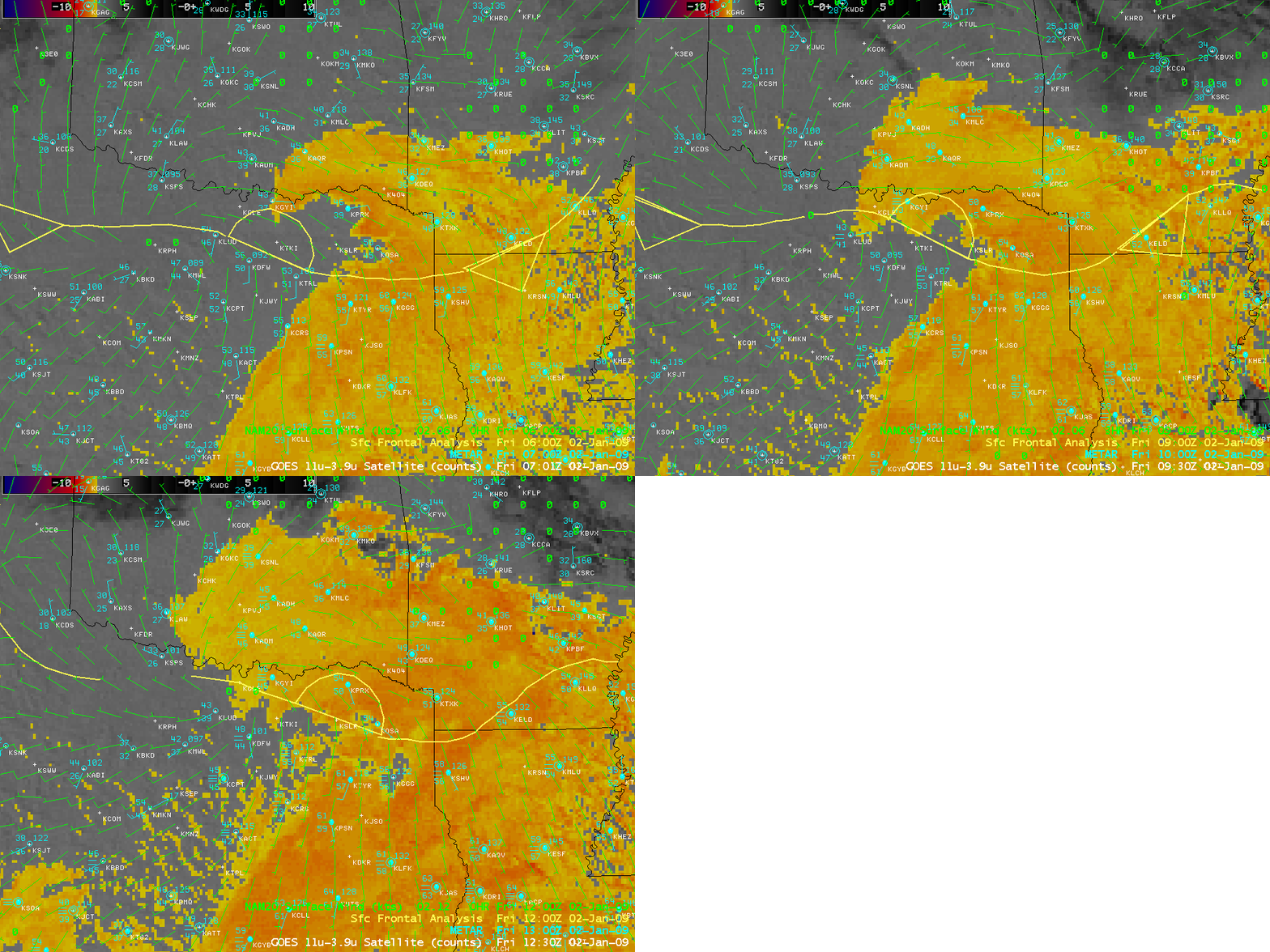
A sequence of GOES-13 fog/stratus product images with an overlay of the surface frontal analysis and the NAM20 surface winds (above) indicated that there was a weak surface low located over northern Texas, which was helping to feed the moisture across the decaying stationary frontal boundary and into Oklahoma.
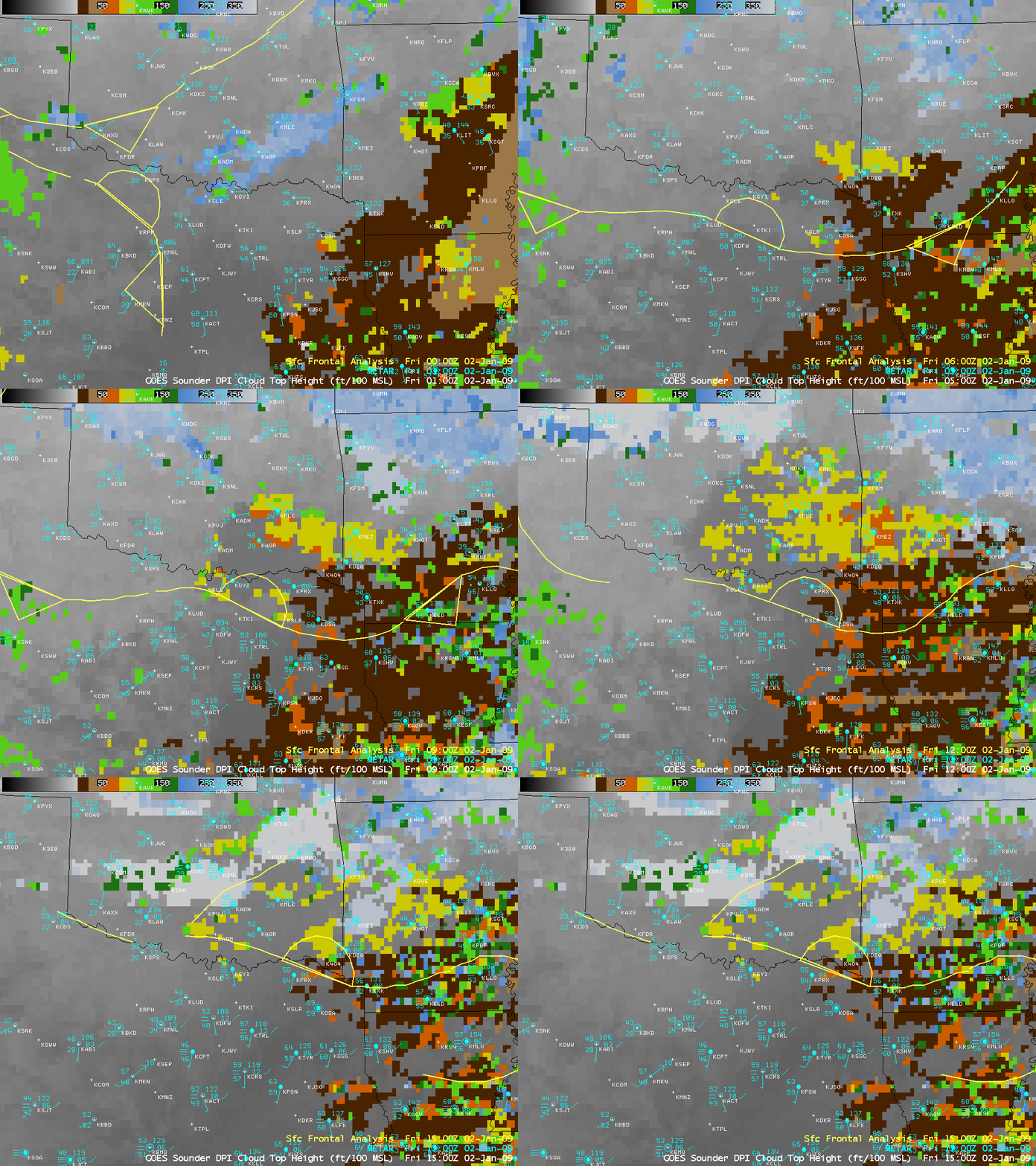
Images of the GOES-13 sounder Cloud Top Height product (above) indicated that the cloud tops were generally in the 7500-8000 foot range (yellow to light green colors) across southeastern Oklahoma.


