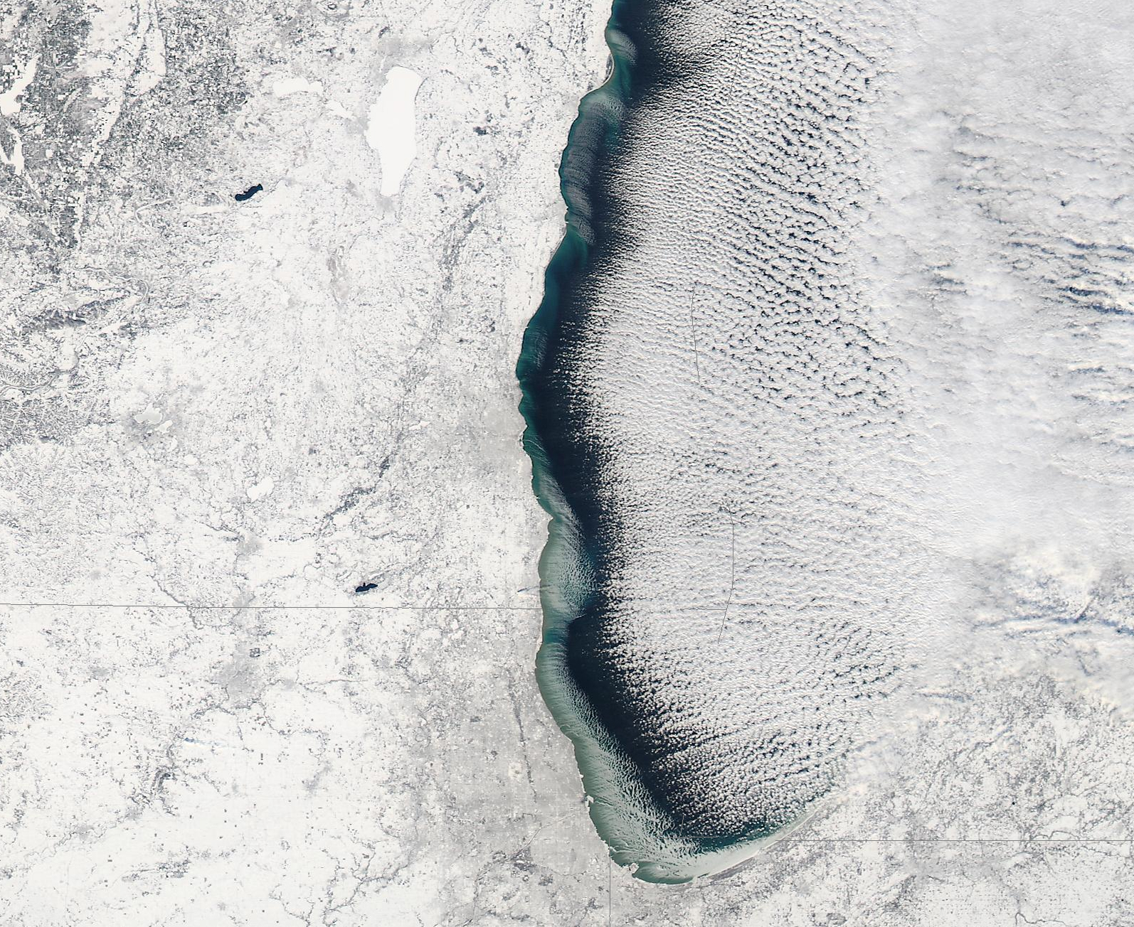
Ice forming in Lake Michigan
Unusually cold temperatures were experienced across much of the Upper Midwest and Great Lakes region during the month of December 2008 — as of 21 December, monthly temperatures were 6.4º F below normal at Milwaukee WI (their low that morning was -5º F), 7.2º F below normal at Chicago IL (their low that morning was -6º F), and 8.6º F below normal at Madison WI (their low that morning was -10º F). On the following day (22 December 2008), 250-meter resolution MODIS Red/Green/Blue (RGB) true color imagery from the SSEC MODIS Today site (above) revealed that significant amounts of ice had begun forming in the western and southern near-shore waters of Lake Michigan. During the previous winter season, similar ice formation was not seen until 19-20 January.
The satellite image confirms that there was abundant snow cover over the area (snow depths on the morning of 22 December were as great as 18 inches in southeastern WI, 12 inches in northeastern IL, and 30 inches in southwestern Lower Michigan). Also note that some of the smaller inland lakes in southeastern WI remained unfrozen — those particular lakes are quite deep, and take longer to freeze.
Another item of interest was the fact that there was a “convergence” of the Lake Michigan cloud bands seen over southwestern Lower Michigan: winds (and the resulting cloud bands) were oriented southwest-to-northeast over the southern portion of Lake Michigan, and oriented northwest-to-southeast farther to the north. Lake-effect snowfall amounts in that part of southwestern Lower Michigan included 13.4 inches at Muskegon and 12.6 inches at Grandville.
Farther to the north, ice was also seen forming in the far southwestern portions of Lake Superior — and the long tornado damage path from the 07 June 2007 EF3 tornado in northeastern WI was still quite visible in the MODIS true color imagery.


