Second-latest snowfall on record at Rockford, Ilinois
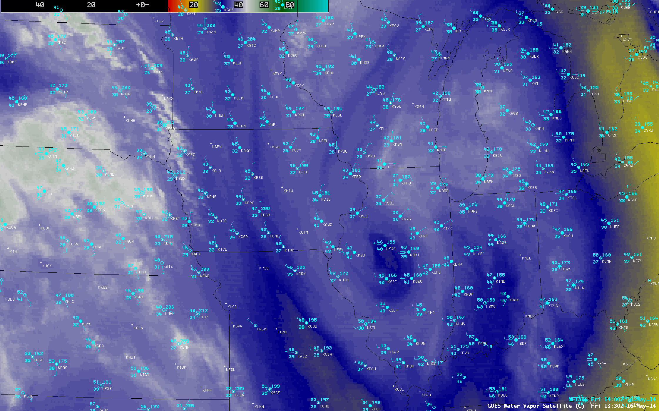
According to the NWS Chicago, Rockford Illinois had their second-latest snowfall on record during the morning of 16 May 2014. AWIPS images of 4-km resolution GOES-13 6.5 µm water vapor channel data (above; click image to play animation) showed the distinct signature of the center of the upper-level low that moved southeastward across Iowa and Illinois during the 15-16 May period.
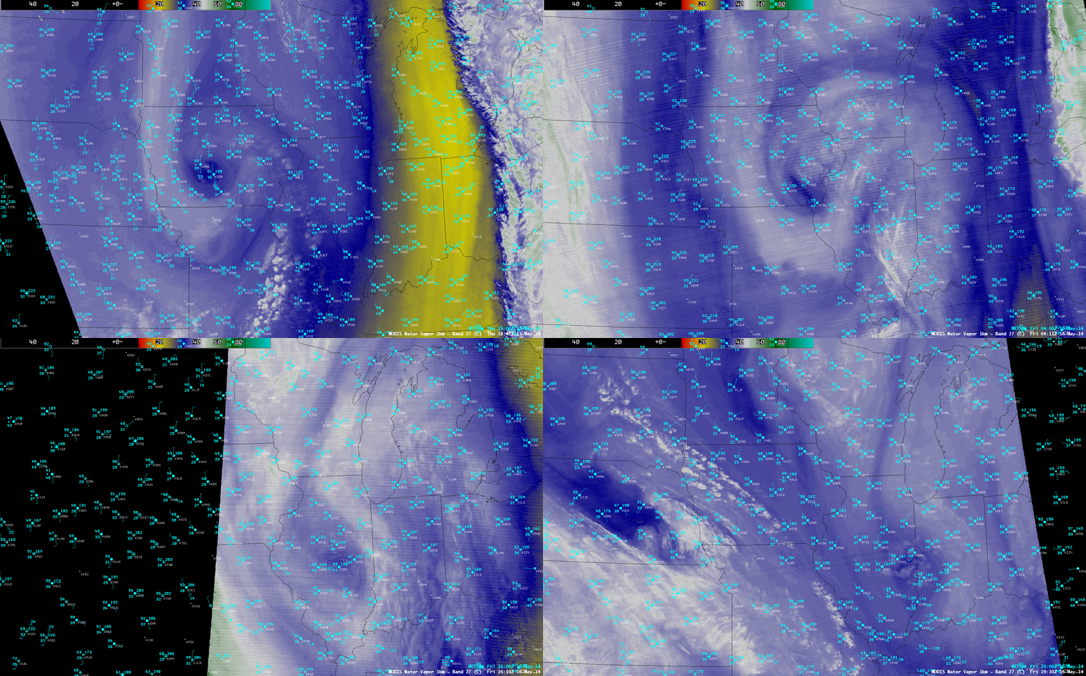
The relatively dry “eye-like” signature of the center of the upper-level low also showed up well on 1-km resolution Terra and Aqua MODIS 6.7 µm water vapor channel imagery (below).
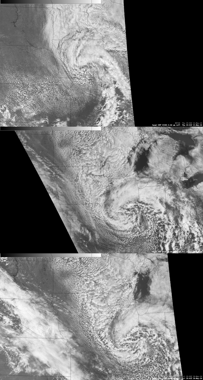
Widespread convective features could be seen beneath the upper-level low on 375-meter resolution (projected onto a 1-km AWIPS grid) Suomi NPP VIIRS 0.64 µm visible channel images (below).


