Fog and stratus along the California coast
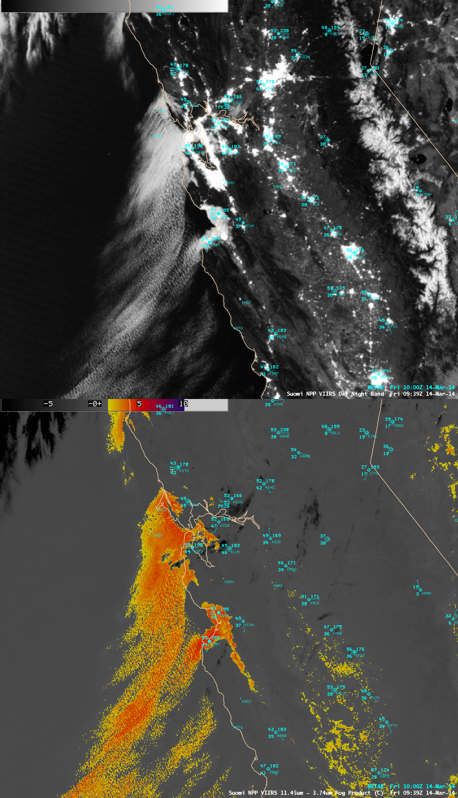
In their Area Forecast Discussion issued at 11:57 UTC or 4:57 AM local time on 14 March 2014, the NWS San Francisco/Monterey Bay Area forecast office mentioned the Suomi NPP VIIRS Day/Night Band imagery which showed the coverage of coastal fog in their area of responsibility:
AREA FORECAST DISCUSSION
NATIONAL WEATHER SERVICE SAN FRANCISCO BAY AREA
457 AM PDT FRI MAR 14 2014

.DISCUSSION...AS OF 4:10 AM PDT FRIDAY...THE DRY TAIL END OF A
WEATHER SYSTEM MOVING IN TO THE PACIFIC NORTHWEST IS APPROACHING
OUR DISTRICT...AND RESULTING IN ENHANCEMENT OF THE MARINE LAYER
AND A RETURN OF THE MARINE STRATUS. LATEST GOES FOG PRODUCT
IMAGERY...AND IN RATHER SPECTACULAR DETAIL JUST REC`D SUOMI VIIRS
NIGHTTIME HIGH RES VISUAL IMAGE...SHOW COVERAGE ALONG MUCH OF THE
COAST FROM PT REYES SOUTH TO THE VICINITY OF THE MONTEREY
PENINSULA...AND A BROAD SWATH EXTENDING INLAND ACROSS SAN
FRANCISCO AND THROUGH THE GOLDEN GATE TO THE EAST BAY. LATEST
BODEGA BAY AND FT ORD PROFILER DATA INDICATE A MARINE LAYER DEPTH
OF ABOUT 1300 FT. SOME THIN HIGH CLOUDS ARE ALSO PASSING THROUGH ABOVE.
A comparison of AWIPS images of the Suomi NPP VIIRS 0.7 µm Day/Night Band (DNB) and the corresponding 11.45-3.74 µm Infrared brightness temperature difference (BTD) “fog/stratus product” (below) showed this band of fog and stratus at 09:39 UTC or 2:39 AM local time. With ample illumination from the Moon (which was in the Waxing Gibbous phase, at 97% of full), the DNB image served as a “visible image at night” to help highlight the fog/stratus features along the coast. Farther inland over the eastern portion of the satellite scene, the bright signature of deep snow cover in the higher elevations of the Sierra Nevada was also very evident on the DNB image.
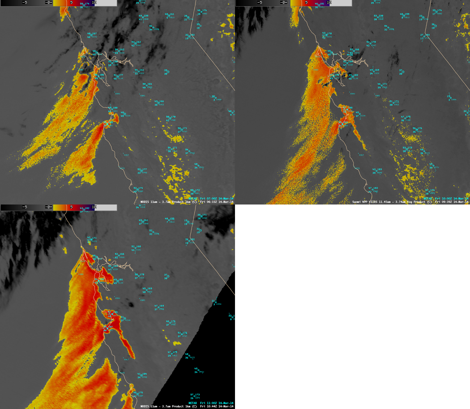
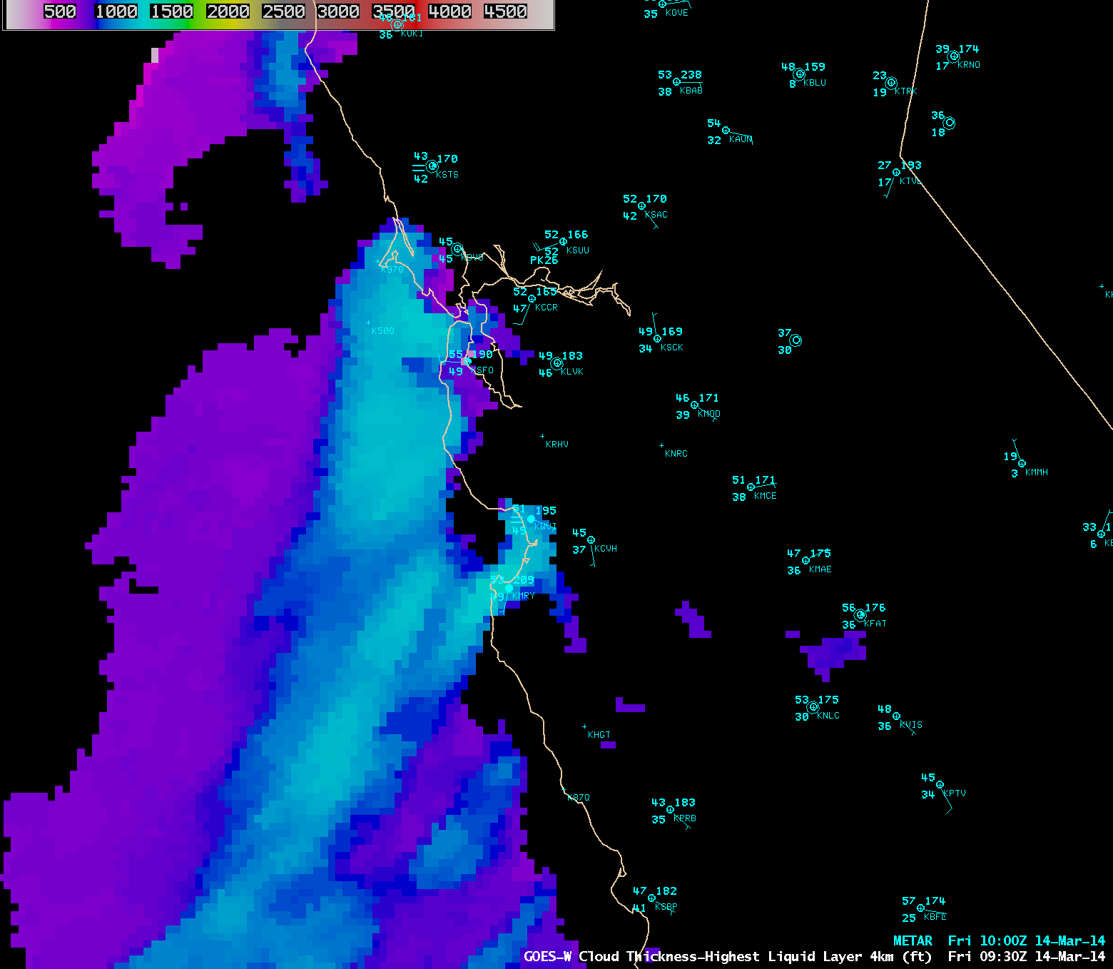
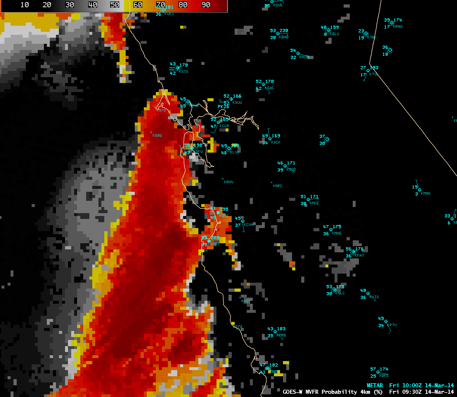
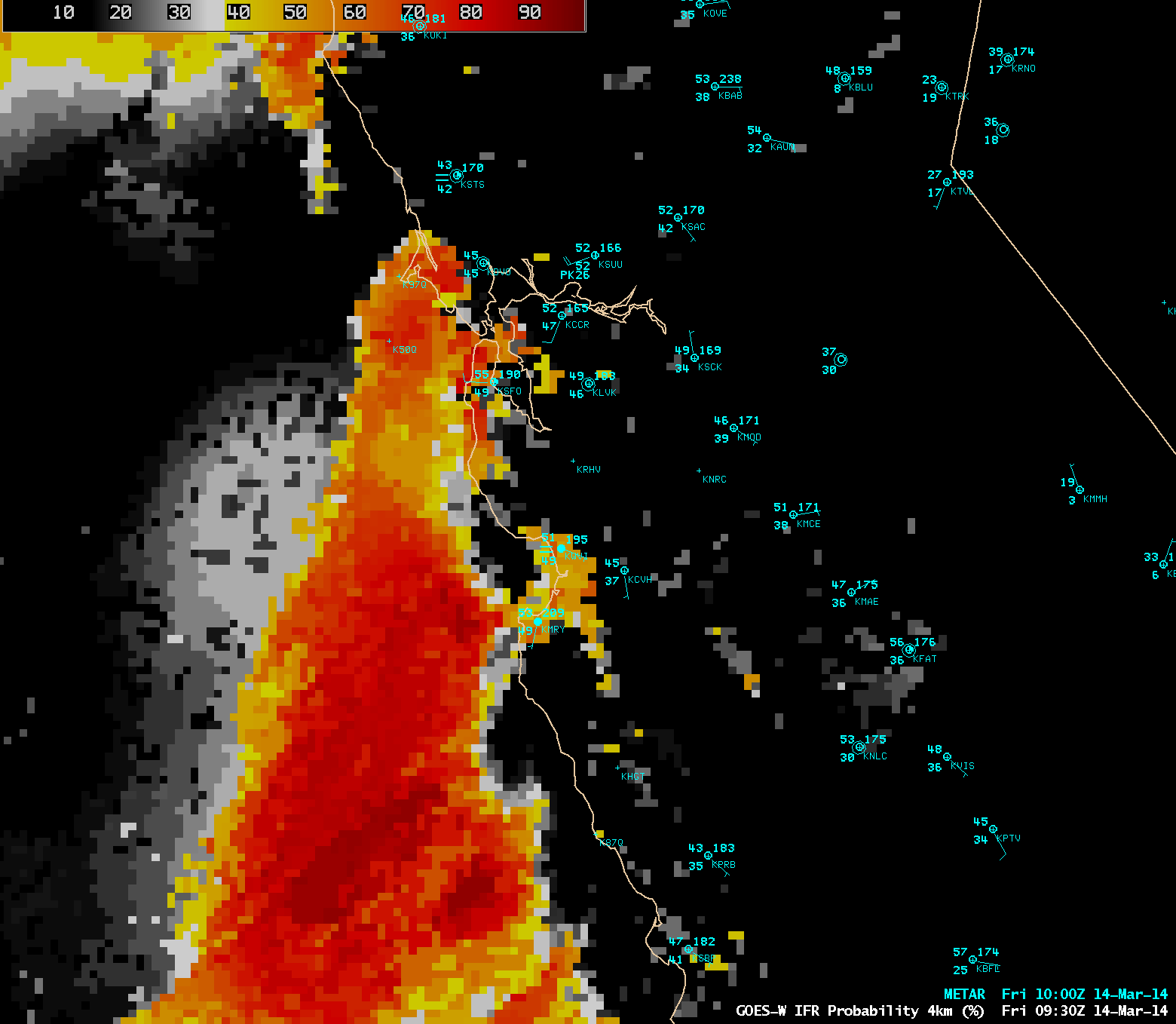
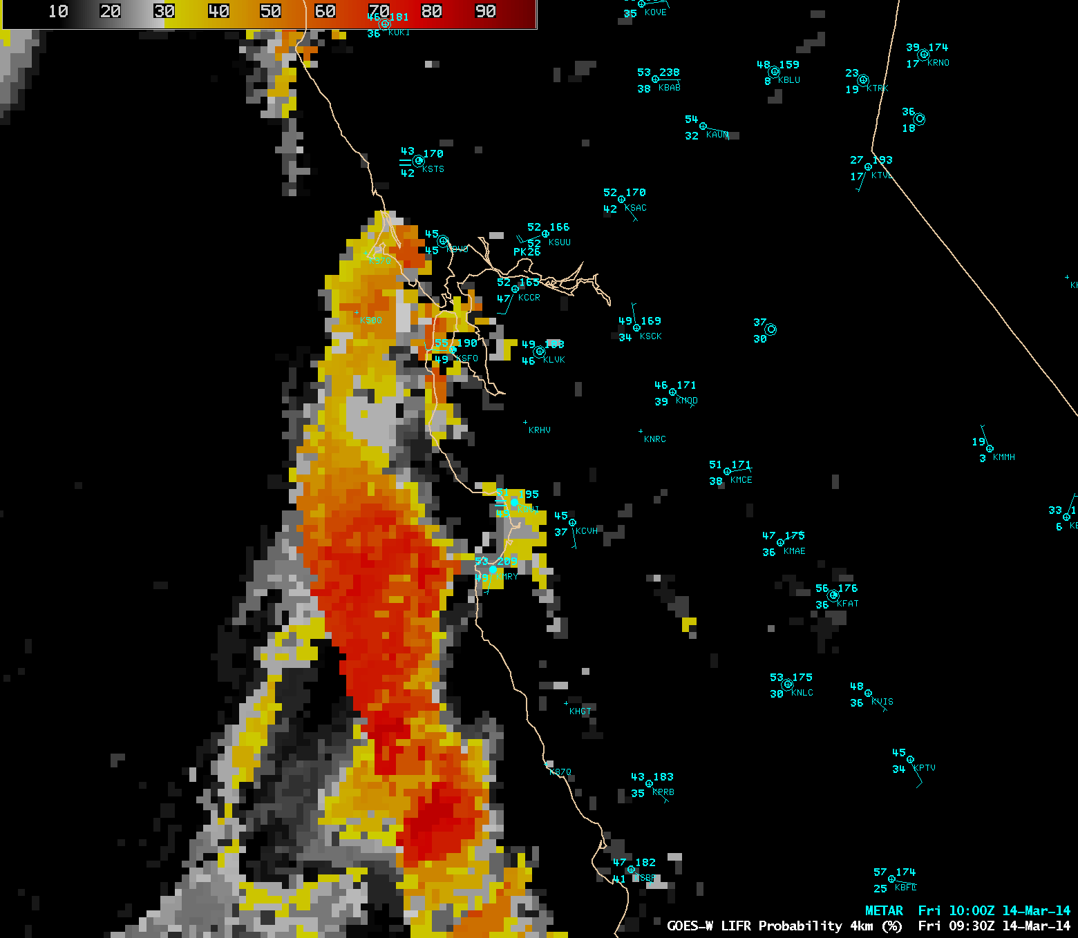
A sequence of three Infrared BTD images (below) — Terra MODIS at 06:33 UTC, Suomi NPP VIIRS at 09:39 UTC, and Aqua MODIS at 10:44 UTC — offered detailed views of the inland progression of the fog/stratus features, especially in the San Francisco Bay area and also down the Salinas Valley. The appearance of degraded resolution of the features seen on the 10:44 UTC MODIS image is due to the so-called “bow-tie effect” near the edge of a MODIS scan swath — even with a bow-tie correction algorithm applied, the MODIS images tend to look less crisp and clear along the scan edges. A GOES-R “Cloud Thickness – Highest Liquid Cloud Layer” product created using GOES-15 data (below) showed the southward advancement of the band of fog/stratus during the overnight hours. The maximum thickness displayed was in excess of 1200 ft (lighter cyan color enhancement), which agreed well with the profiler depths mentioned in the NWS forecast discussion above. Additional GOES-R products such as Marginal Visual Flight Rules (MVFR), Instrument Flight Rules (IFR), and Low Instrument Flight Rules (LIFR) Probability are shown below. These products help to better quantify the potential aviation impacts that features seen on the conventional BTD “fog/stratus product” might have. For additional information on this event, see the GOES-R Fog Product Examples blog.

