Ice coverage in Lake Michigan
According to the 04 March 2014 Great Lakes Environmental Research Laboratory ice analysis, much of Lake Michigan had over 90% median ice concentration, with a total ice coverage of around 95%. However, AWIPS images of GOES-13 0.63 µm visible channel data on 05 March (above; click image to play animation) showed the effect of northerly winds on the ice , with large leads (cracks) opening up in the northern portion of the lake.
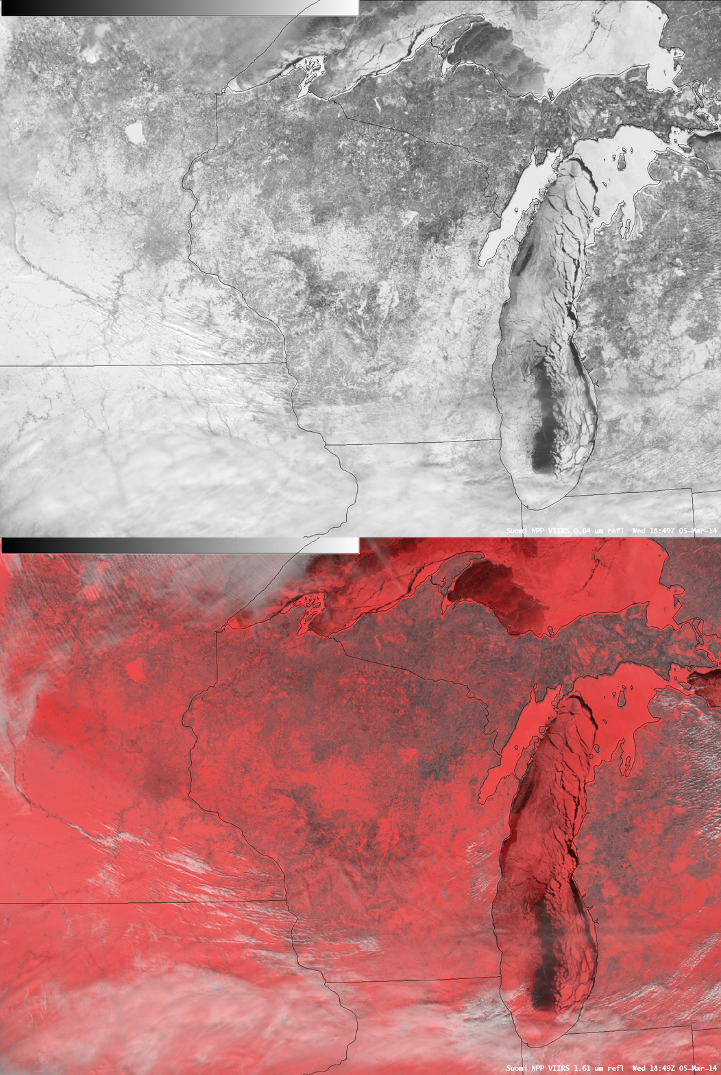
A comparison of AWIPS 0.64 µm visible channel and false-color Red/Green/Blue (RGB) images at 18:49 UTC (below) confirmed that most of Lake Michigan was cloud-free — snow and ice appear as varying shades of red on the RGB image, which supercooled water droplet clouds appear as shades of white.
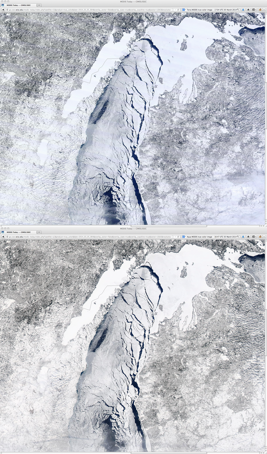
A toggle between the 17:04 UTC Terra MODIS and 18:47 UTC Aqua MODIS true-color RGB images from the SSEC MODIS Today site (below) showed the amount of ice motion within that 103 minute period of time.
===== 06 March Update =====
As winds changed to southerly and southwesterly in the wake of a retreating surface high pressure on 06 March, a corresponding change in Great Lakes ice motion was seen on GOES-13 0.63 µm visible channel images (below; click image to play animation).
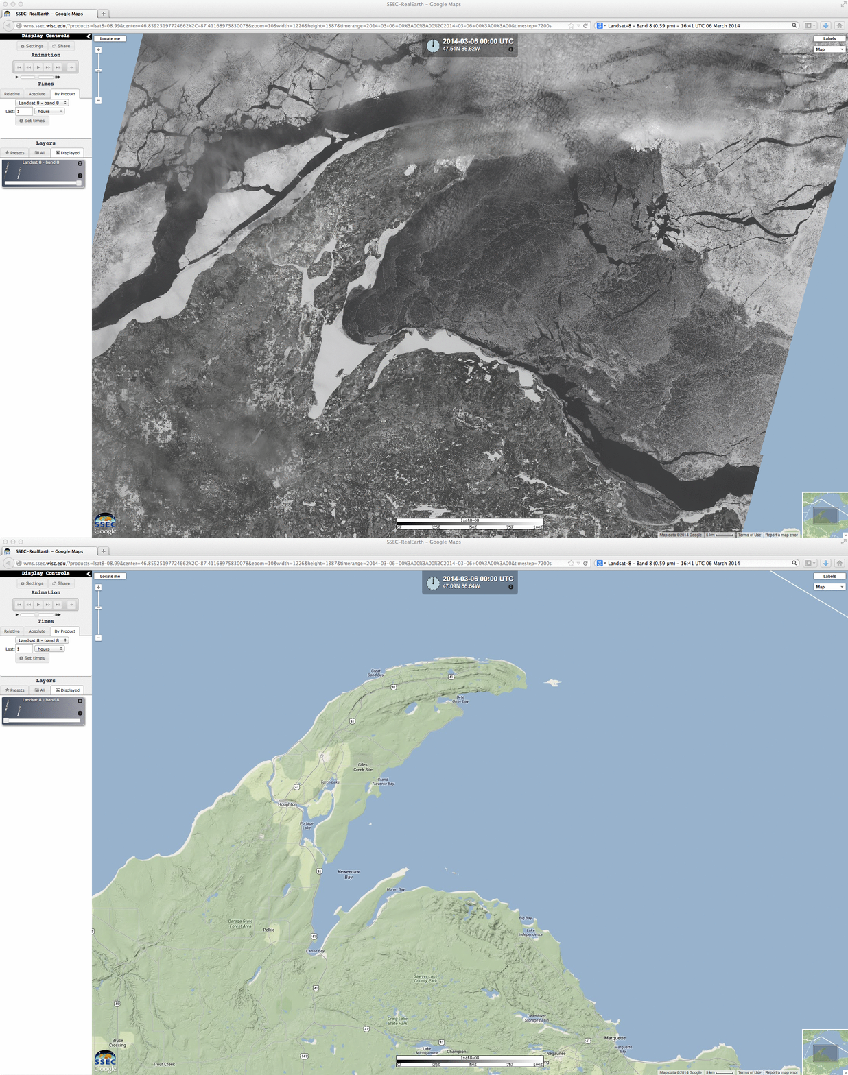
15-meter resolution Landsat-8 0.59 µm panochromatic visible imagery viewed using the SSEC RealEarth web map server (below) offered a very detailed view of the Lake Superior ice in the vicinity of the Keweenaw Peninsula and Marquette in the Upper Peninsula of Michigan.


