Lake ice, and “nuclear power plant effect” snow
McIDAS images of GOES-13 0.6 µm visible channel data (above; click image to play animation) showed the motion of ice in the nearshore waters of Lake Michigan on 06 February 2014. Along the coast of Wisconsin, westerly winds — gusting as high as 27 knots at Manitowoc (KMTW), and 23 knots at Sheboygan (KSBM) — were causing the thin ice to continue drifting eastward during the day.
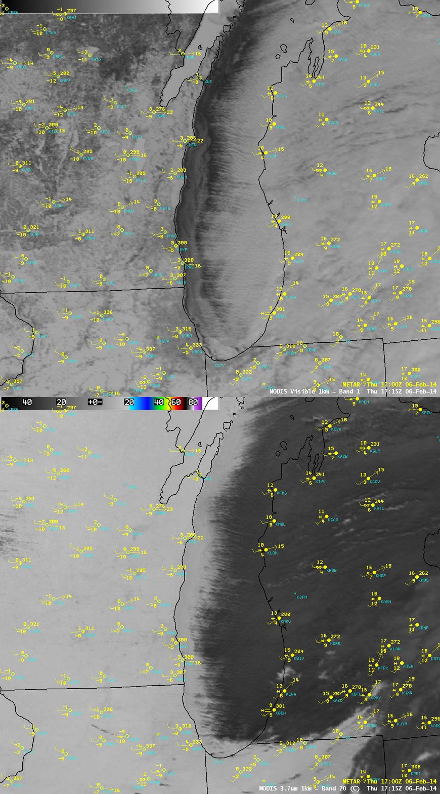
Another feature of interest seen on the GOES-13 visible imagery was a long, narrow cloud plume streaming southeastward in far northern Illinois — this cloud plume was a result of waste heat and moisture from the cooling towers at the Byron Nuclear Generating Station (located just east of the red “>” symbol on the images). Although there appeared to be no meteorological clouds over northern Illinois during the late morning and afternoon hours, light snow was reported at De Kalb from 16 – 19 UTC (animation of visible images, with surface reports). An AWIPS comparison of 1-km resolution MODIS 0.65 µm visible channel and 3.7 µm shortwave IR channel images at 17:15 UTC (below) indicated that the cloud plume from the Byron nuclear plant appeared to be drifting very near De Kalb (KDKB), which was likely causing the light snow (the surface visibility at De Kalb was reduced to 2.5 miles at 17 UTC). On the MODIS 3.7 µm shortwave IR image, the widespread supercooled water droplet clouds — as well as the nuclear power plant plume — appeared warmer (darker gray) than the surrounding snow-covered ground, due to this channel’s sensitivity to solar radiation reflected off the cloud top water droplets.
At least one other case of “nuclear power plant effect” snowfall has been documented, downwind of the Beaver Valley power plant in Pennsylvania.
Farther to the north, a significant amount of ice motion could also be seen in the western portion of Lake Superior (below; click image to play animation).


