Airborne glacial silt over the Gulf of Alaska
Hat tip to Mark Ruminski (NOAA/NESDIS) for directing our attention to a pair of airborne glacial silt plumes that were being drawn southward over the far northern Gulf of Alaska on 16 November 2013. McIDAS images of GOES-15 0.63 µm visible channel data (above; click image to play animation) showed the two distinct hazy plumes as they were being advected offshore east of the Cordova, Alaska (PACV) area. The tight cyclonic circulation of a mesoscale area of low pressure may have helped to increase the speed of the gap winds that were lofting the glacial silt particles from the Copper River Delta and Icy Bay regions.
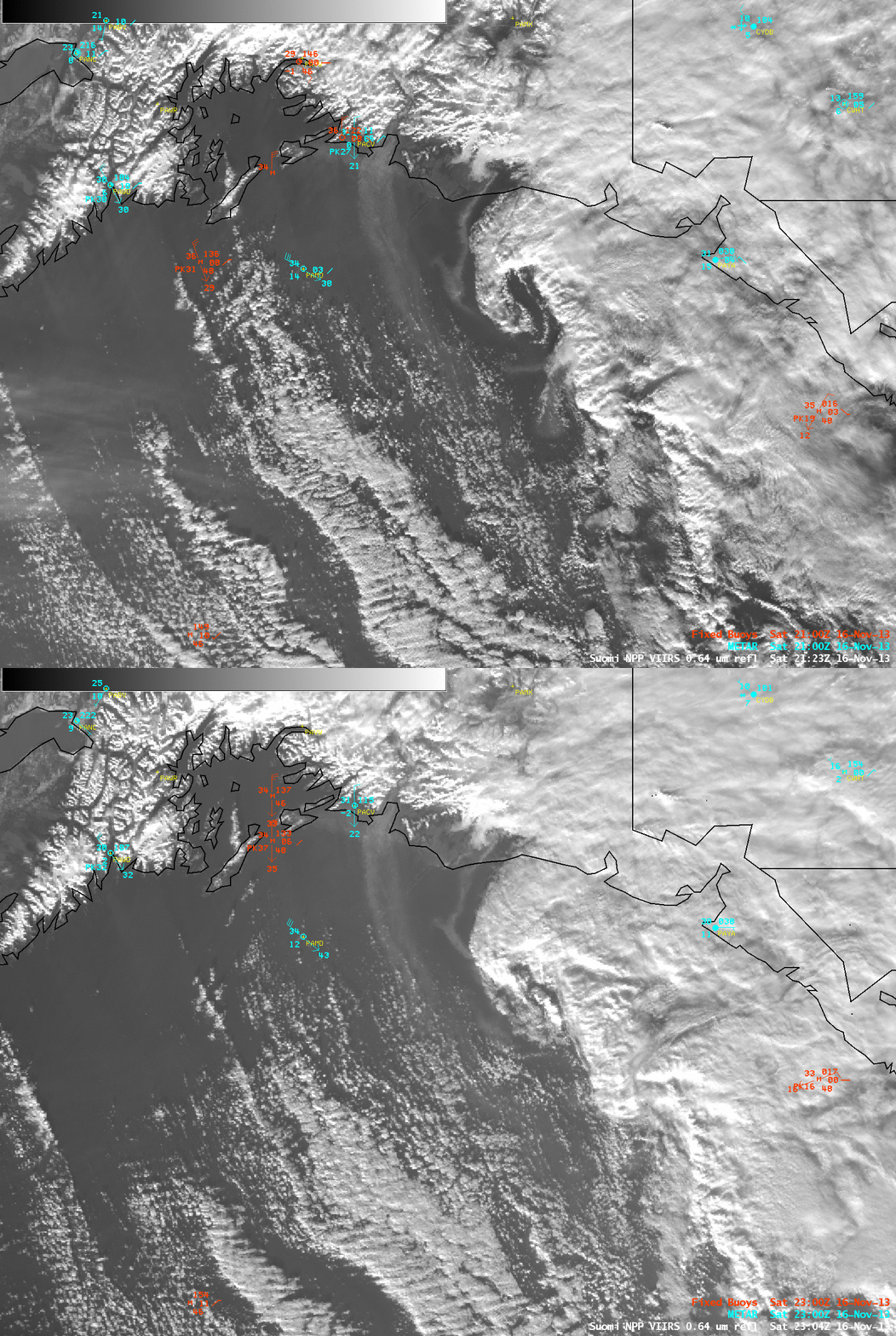
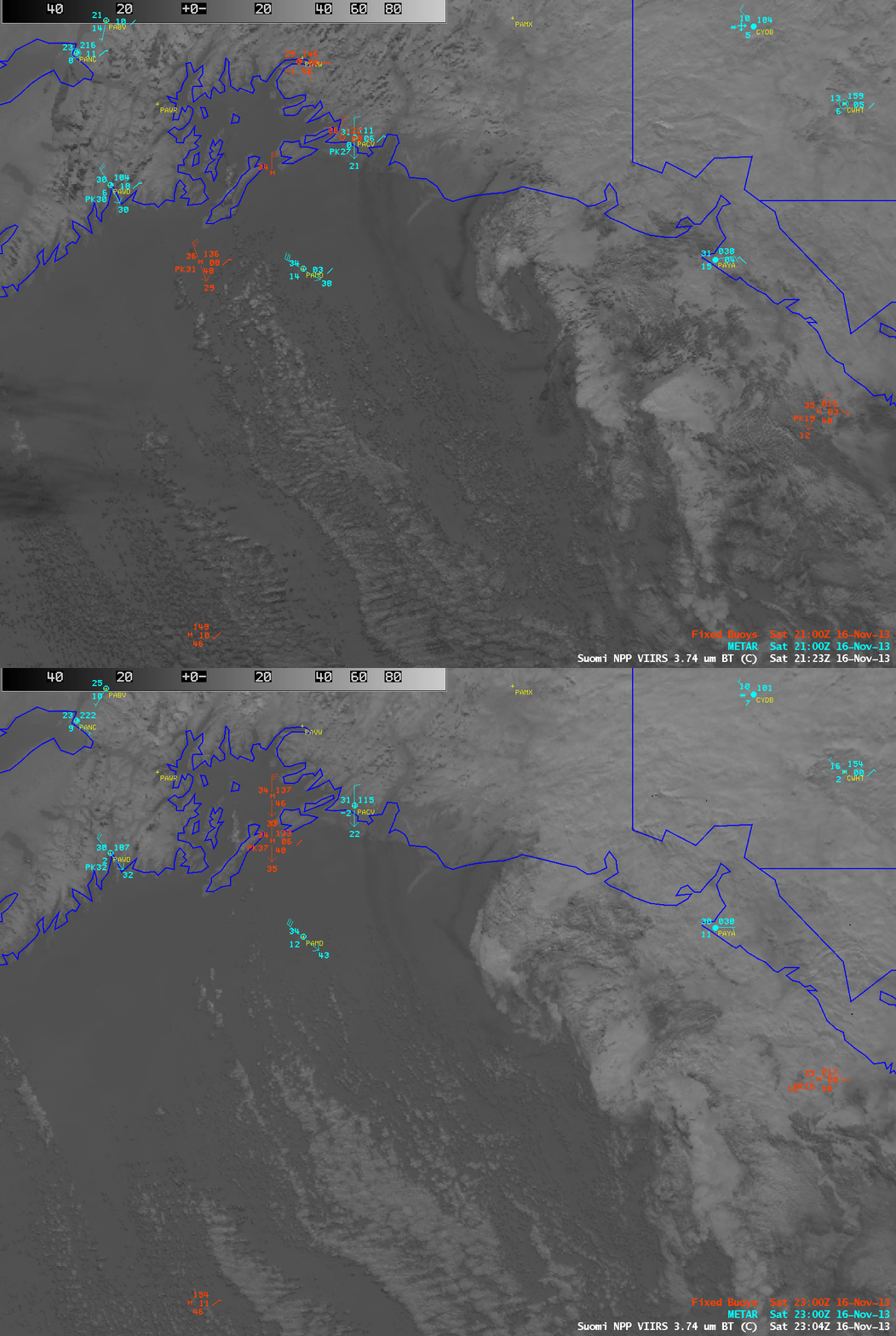
AWIPS images of Suomi NPP VIIRS 0.64 µm visible channel data (above) showed a better view of the 2 plumes at 21:23 and 23:04 UTC. The airborne glacial silt plumes appeared darker on the corresponding 3.74 µm shortwave IR images (below) due to enhanced solar reflection off the small particles.
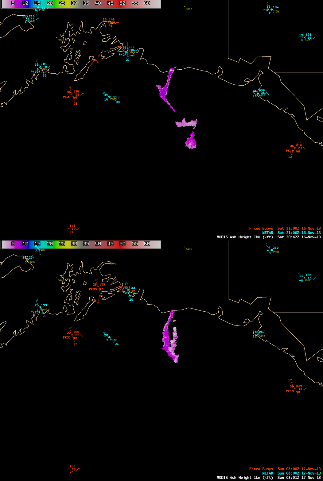
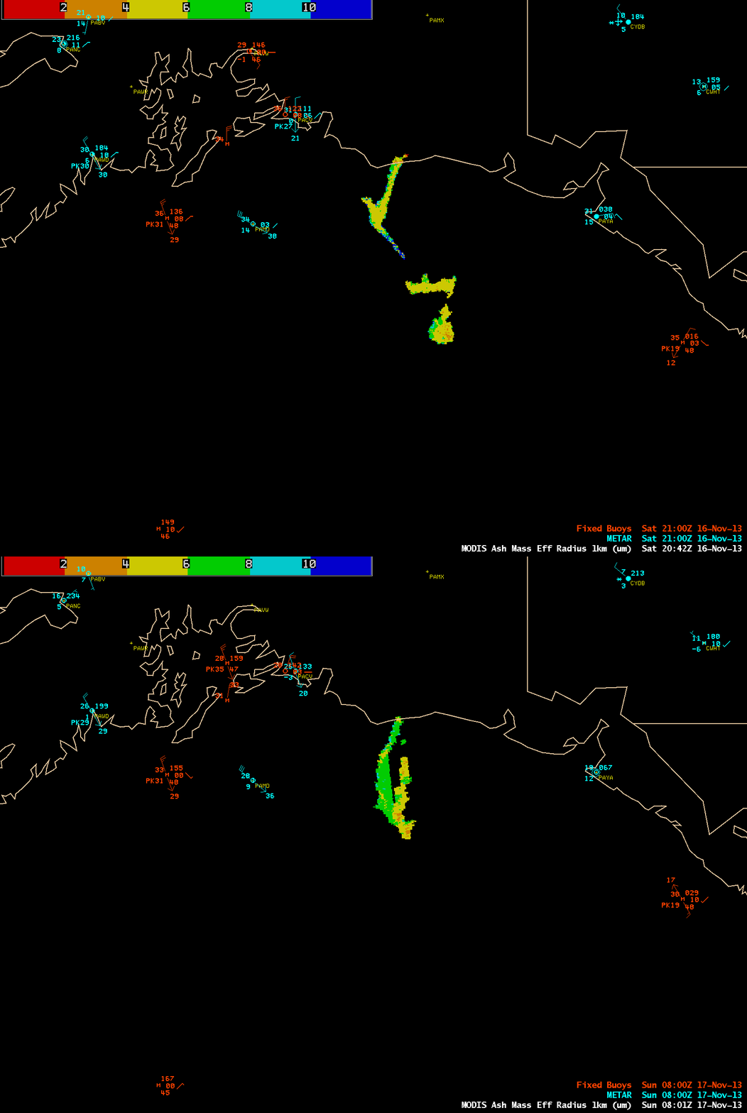
MODIS-based products designed to monitor volcanic ash plumes were also able to detect the glacial silt plumes and provide quantitative information about these features. The mean plume height (above) was around 5000 feet, with a maximum around 9000 feet at some locations. The mean particle effective radius (below) was generally in the 4-7 µm range, with a maximum size of 9-10 µm.


